Get all the comprehensive weather here:
https://www.marketforum.com/forum/topic/83844/
++++++++++++++++++++
Just issued mesoscale discussion from the Storm Predication Center:
https://www.spc.noaa.gov/products/md/md1689.html

A severe thunderstorm(possibly tornado) watch box is likely in the next couple of hours for the Evansville, IN. Any tornadoes would be weak tornadoes of 110 mph or less as opposed to the more violent, 150+ mph tornadoes that kill most people.
This threat will only be for a few hours late this afternoon before the cold front moves south of the Ohio River.
From earlier today:
Re: Grains--post breakout of July 6
By metmike - July 21, 2026, 11:30 a.m.
We have a shot for rain the next 7 hours here in southwest, IN until this cold front goes thru late afternoon. Some extremely steamy dew points ahead of the front in this air mass, a few at 80+ are pretty impressive just after 10am.
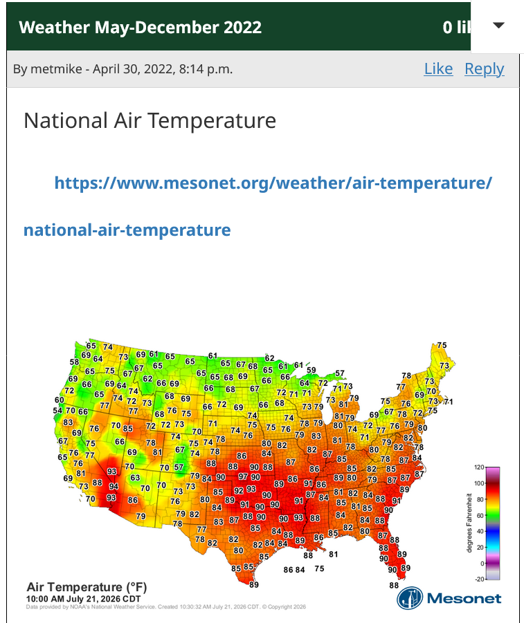
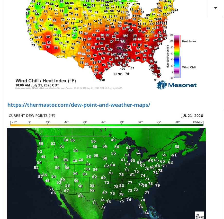
That's the feature causing the Heat Index to soar higher today. The next 3 frames are frozen images.
1. Air temp-10am Central
2. Heat Index-20 deg, higher in spots from humidity
3. Dew Point-75 Deg+ in most places ahead of front
+++++++++++=
Constant updates below:
https://www.marketforum.com/forum/topic/83844/#83845
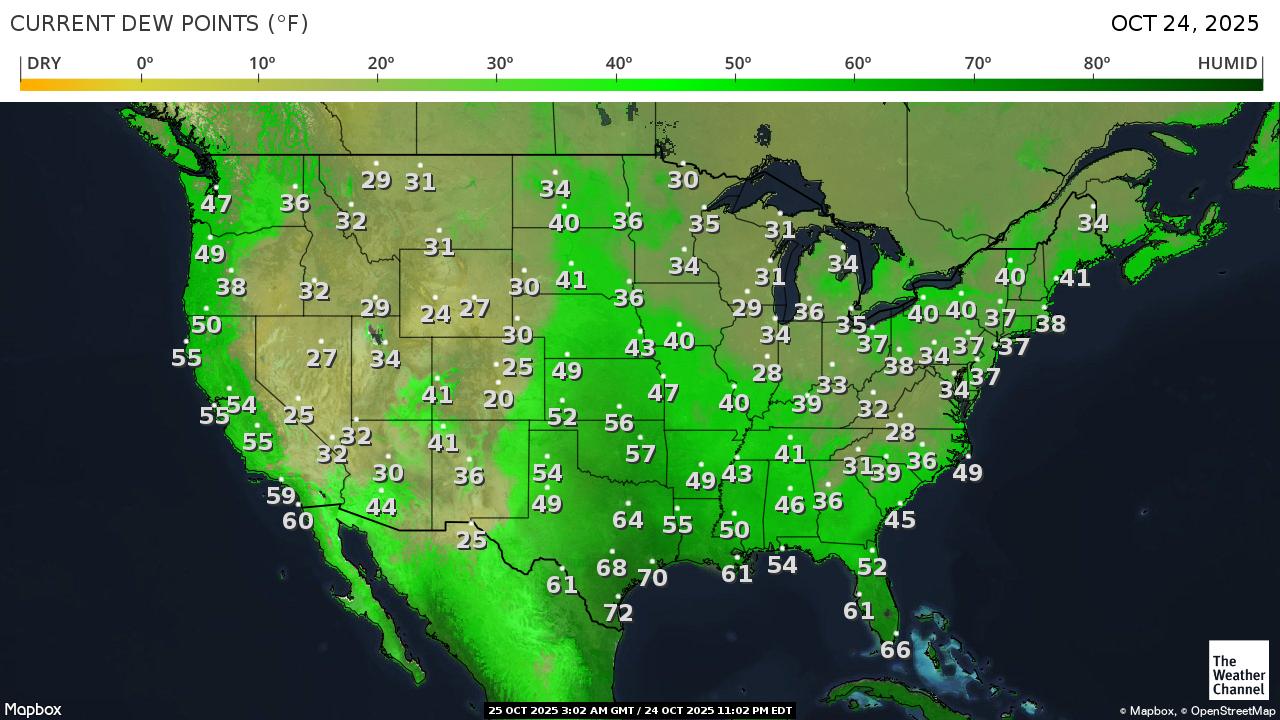
https://thermastor.com/dew-point-and-weather-maps/
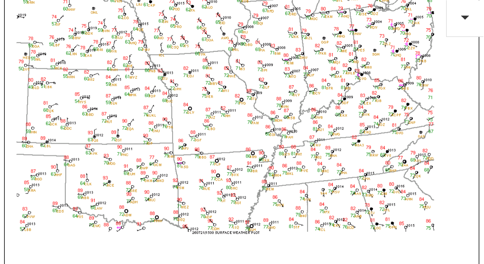
Look at the current conditions in Evansville, IN here at 1pm.
Dew point of 80 degrees! That is making 93 degrees feel like 112 degrees!!!! Feels 19 degrees hotter!!!
My wife just went outside and immediately commented on the intensity of the heat(humidity).
https://forecast.weather.gov/MapClick.php?x=282&y=84&site=pah&zmx=&zmy=&map_x=281&map_y=84
Current conditions at
Lat: 38.04°NLon: 87.52°WElev: 417ft. 
Mostly Cloudy
93°F
34°C
| Humidity | 66% |
| Wind Speed | SW 15 G 22 mph |
| Barometer | 29.79 in (1008.3 mb) |
| Dewpoint | 80°F (27°C) |
| Visibility | 10.00 mi |
| Heat Index | 112°F (44°C) |
| Last update | 21 Jul 12:54 pm CDT |
More Information:
Local Forecast OfficeMore Local Wx3 Day HistoryHourly Weather Forecast
That hot, extremely humid air is also very buoyant and unstable ahead of the lifting mechanism(cold front).
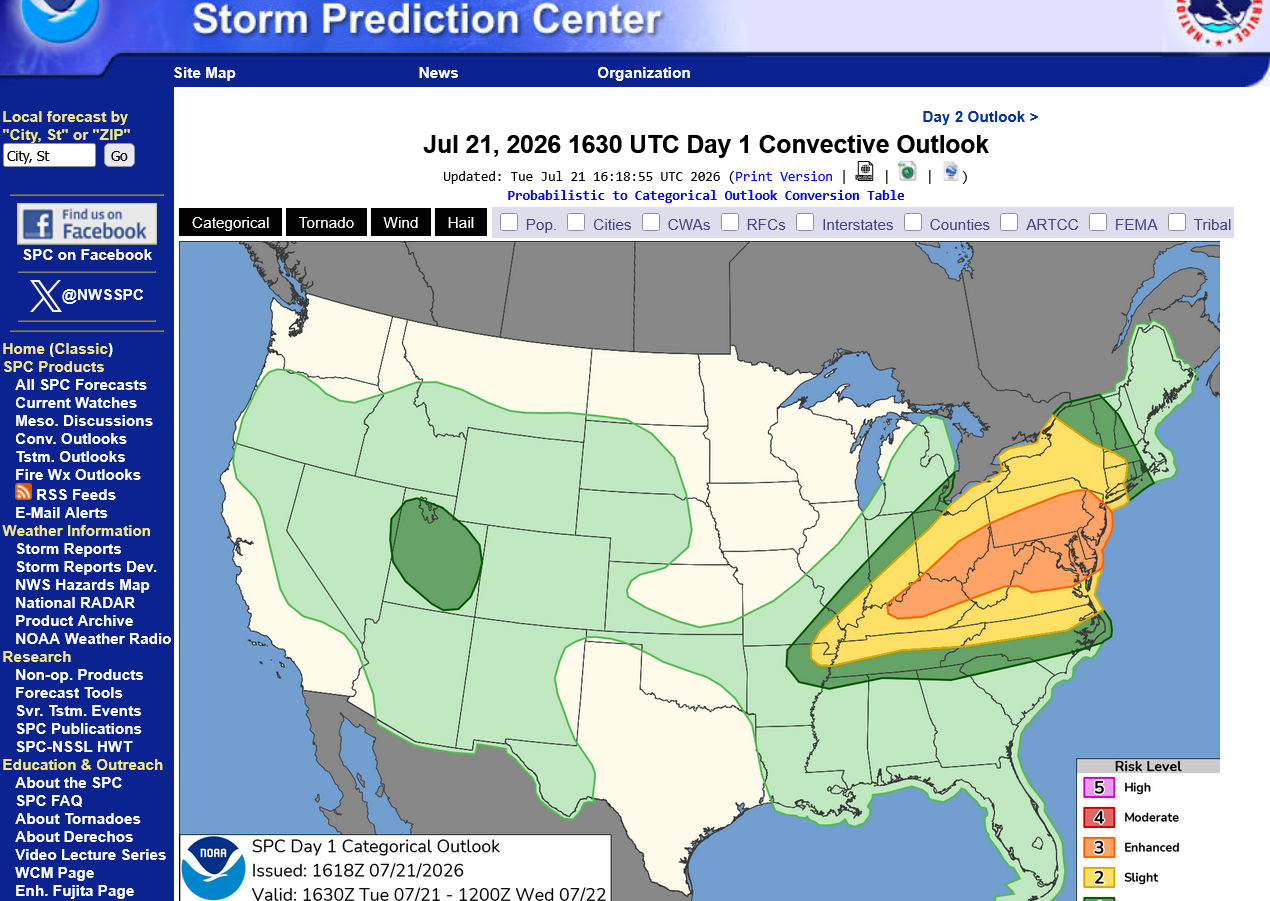
The highest risk for severe storms or a tornado is EAST of Evansville, IN. However, the yellow shade below is a level 2(slight) out of 5 risk.
https://www.spc.noaa.gov/products/outlook/day1otlk.html
The storms have in fact already developed to our north:
https://radar.weather.gov/station/kvwx/standard

We got the expected Severe Thunderstorm Watch Box:
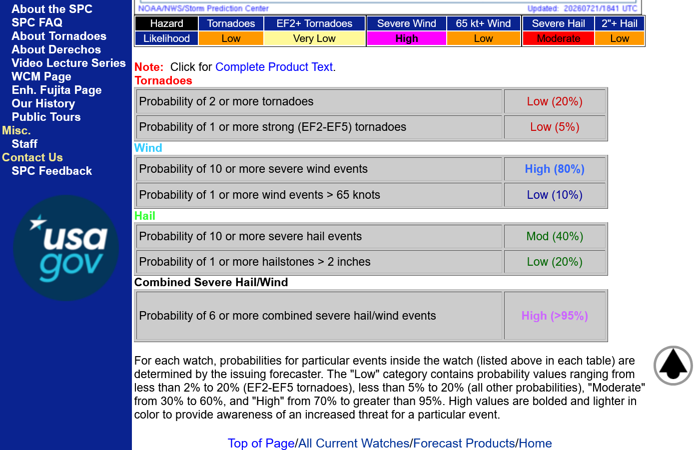
Note the risk parameters below the watch box. This is NOT a high end threat.
https://www.spc.noaa.gov/products/watch/ww0508.html

All of the stormy weather was east of Evansville and also to the south.
The cold front triggering the storms just went thru Evansville.
The Storm Prediction Center has cut back the Severe Thunderstorm Watch as a result.
Winds picked up out of the northwest and the dew point, that had been as high
Current conditions at
Lat: 38.04°NLon: 87.52°WElev: 417ft. 
Partly Cloudy
92°F
33°C
| Humidity | 47% |
| Wind Speed | NW 13 G 24 mph |
| Barometer | 29.76 in (1007.3 mb) |
| Dewpoint | 69°F (21°C) |
| Visibility | 10.00 mi |
| Heat Index | 97°F (36°C) |
| Last update | 21 Jul 4:54 pm CDT |
More Information:
Local Forecast OfficeMore Local Wx3 Day HistoryHourly Weather Forecast
We missed the rains here in southwest, IN. No surprise. Our 80 deg. dew point yesterday was only 1 deg. from the highest DP ever recorded in Evansville. 81 deg. dew point happened on 4 previous occasions.
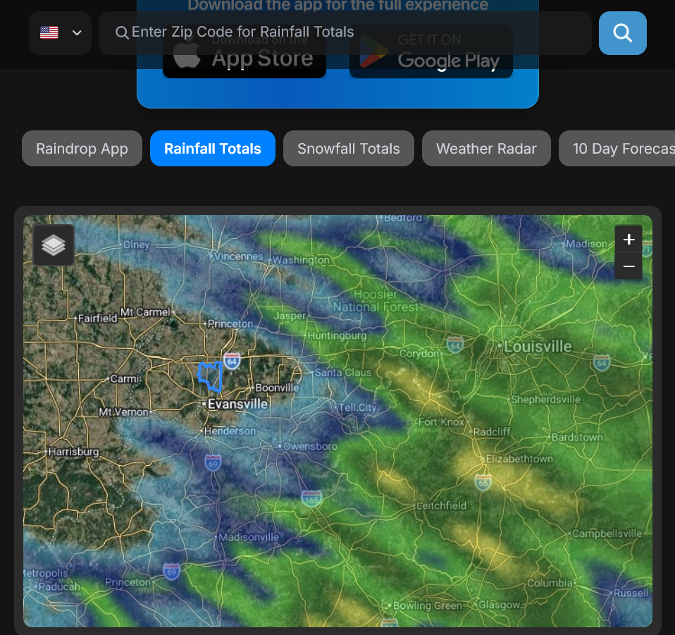
It's one thing when EVERYBODY misses rains around you. That stinks. But when this much rain falls this close to you and all around you, while you get ZILCH, it really bites!
https://www.raindrop.farm/rainfall-totals/zipcode/47725#map