This was the previous SEVERE weather thread:
Higher risk severe weather threat 3-15/16-2026
43 responses |
Started by metmike - March 13, 2026, 8:02 p.m.
https://www.marketforum.com/forum/topic/118638/
+++++++++++++++++
Ongoing heat thread:
Historic SW US March heatwave
25 responses |
Started by WxFollower - March 18, 2026, 12:24 a.m.
https://www.marketforum.com/forum/topic/118783/
++++++++++++++
Get all the comprehensive weather here:
https://www.marketforum.com/forum/topic/83844/
+++++++++++++++
https://www.spc.noaa.gov/products/watch/ww0074.html
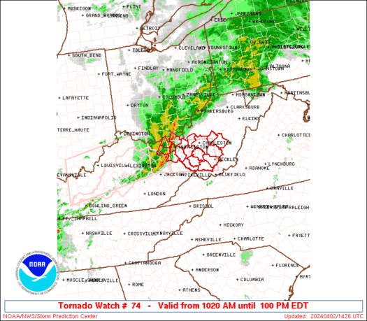
Low risk for tornadoes and extremely low risk for a strong tornado.
If a warning is issued, stay inside away from windows until the storm passes.
++++++++++++=
https://www.marketforum.com/forum/topic/118783/#118903
Look at the 60 degree contrast from south to north in the states of IL and IN right now, at 5pm!!!!
https://www.mesonet.org/weather/air-temperature/national-wind-chill-heat-index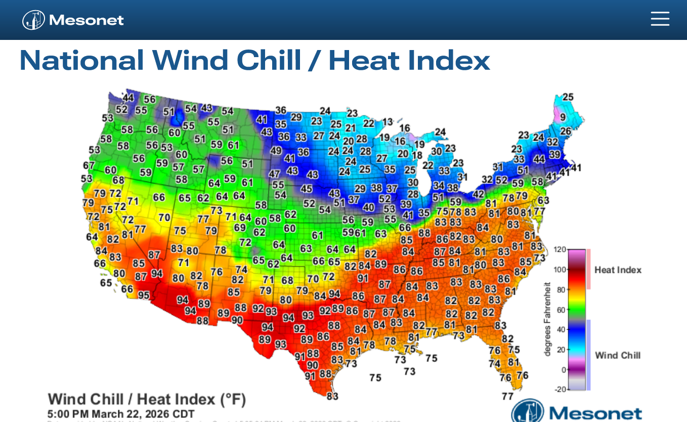
This is the THUNDERSTORM outlook not the SEVERE thunderstorm outlook.
https://www.spc.noaa.gov/products/exper/enhtstm/

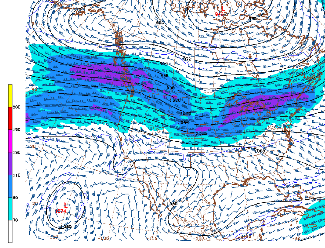
We're on the southern periphery of a moderately strong jet stream with the greatest dynamics from the more powerful, ZONAL jet streak in the center pretty far north of us.
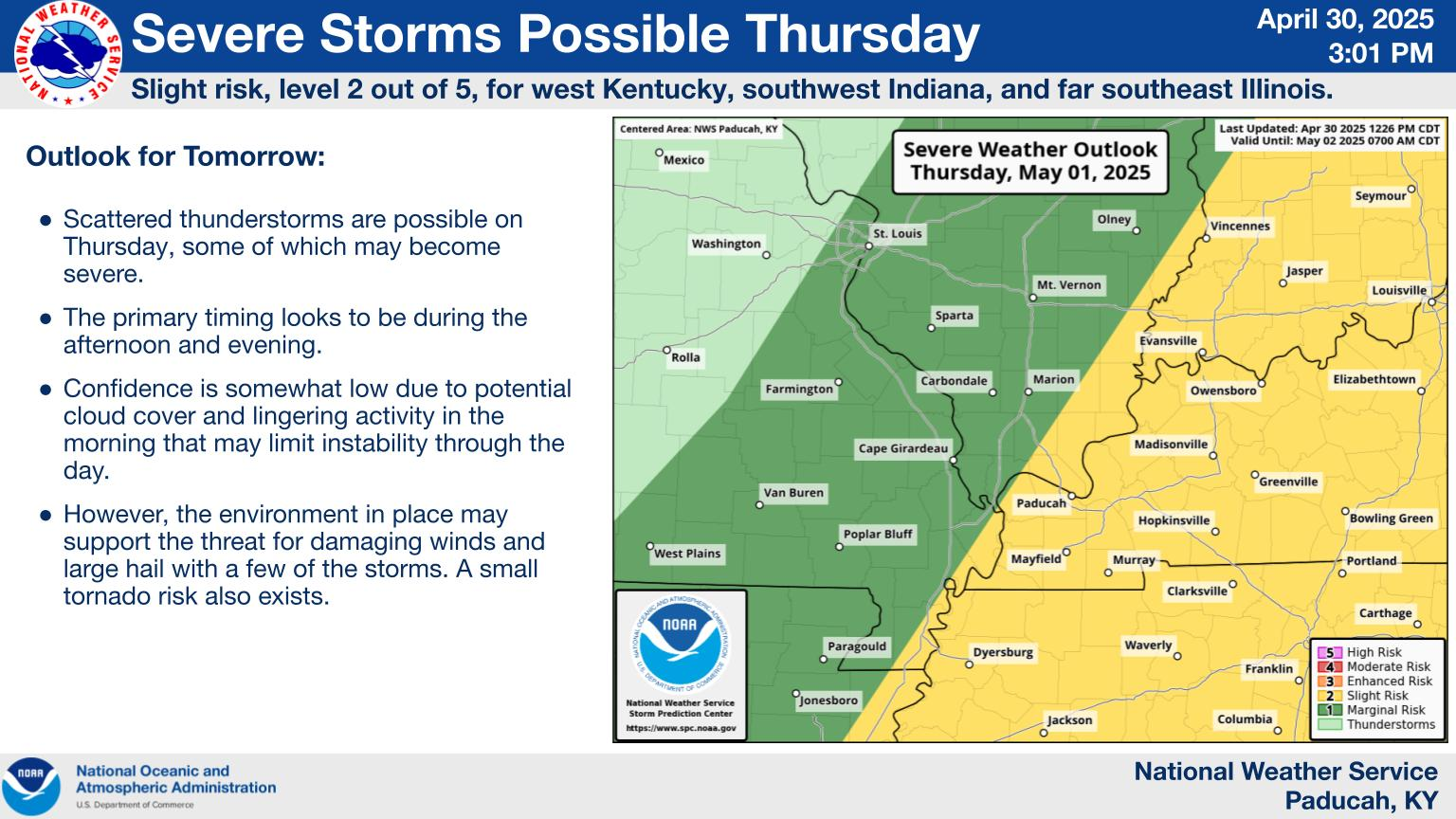
This was the last severe weather outlook from the Storm Prediction Center.
I was sort of ignoring it, sorry about that. The main risk is for large hail, then a severe thunderstorm wind with the chance of a tornado not being 0 but being below 2%.
https://www.spc.noaa.gov/products/outlook/day1otlk.html
1. All categories
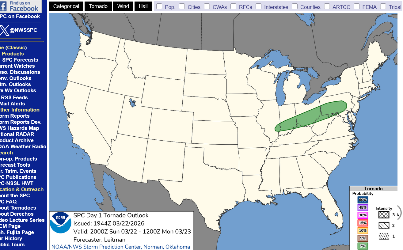
2. Risk of tornadoes-less than 2%
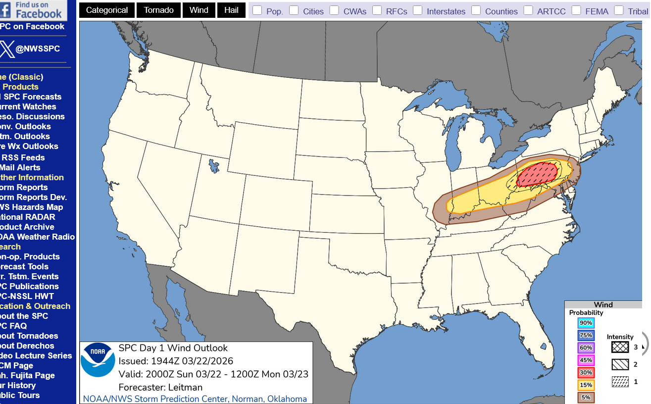
3. Risk of a wind gust of 58 mph+
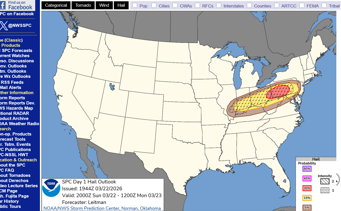
4. Risk of large hail within 25 miles of any 1 point. Hatched area represents LARGE hail.
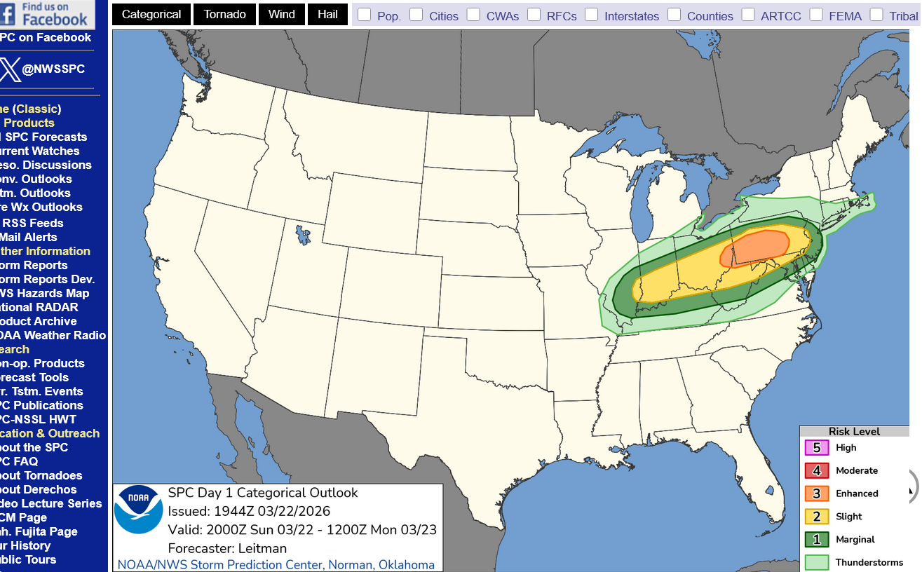
Again, the life threatening risk for this event is VERY low. What do you do when large hail is falling or winds are gusting above 58 mph during a warning for those elements?
Stay inside and away from windows.
What about in a car?
1. Try to avoid driving in an area surrounded by tall trees or objects/power lines that can be blown on to the road during the storm.
2. Lightning: A typical cloud-to-ground, actually cloud-to-vehicle, lightning strike will either strike the antenna of the vehicle or along the roofline. The lightning will then pass through the vehicle's outer metal shell, then through the tires to the ground. It can so tremendous damage to some of the components but YOU ARE SAFE.
Lightning is present in ALL thunderstorms, not just severe thunderstorms.
https://www.weather.gov/safety/lightning-cars
++++++++++++++++=
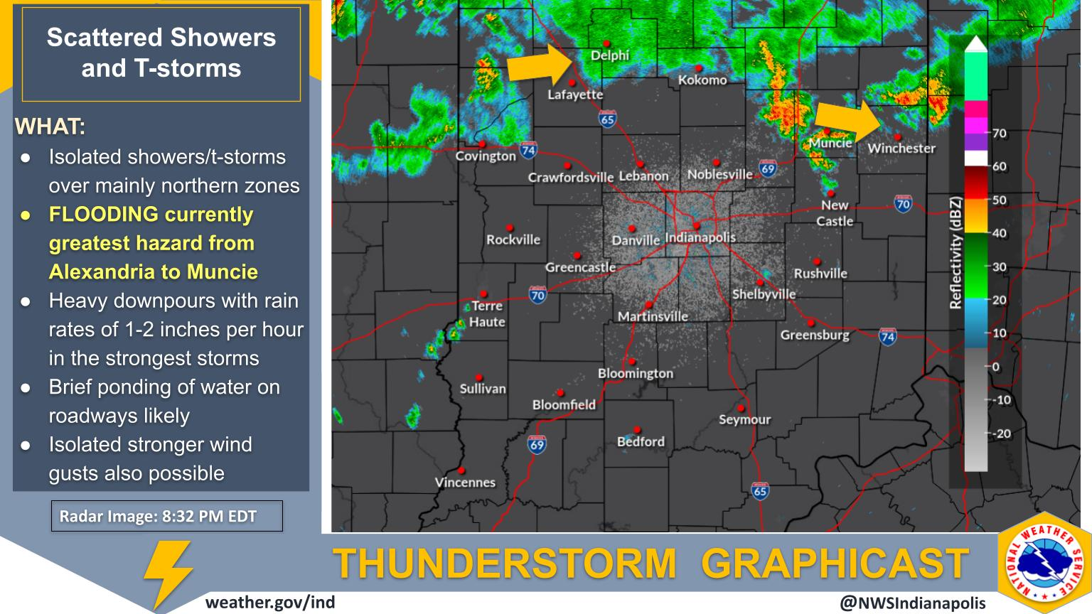
This is our local weather service in Evansville.

Tracking the storms!
Indianapolis


+++++++++++++++
Springfield IL

Scattered Showers and Storms This Evening
A few strong to severe storms may develop in parts of eastern and southeast Illinois this evening. Primary hazards with any severe storms would be large hail and damaging wind gusts. Seek shelter indoors when storms approach.
++++++++++++
Columbus Ohio

++++++++++++
Pittsburgh, PA


+++++++++++++++++
NWS Forecast Office Philadelphia/Mt Holly

| Text Product Selector (Selected product opens in new window) | |
This is extremely unusual.
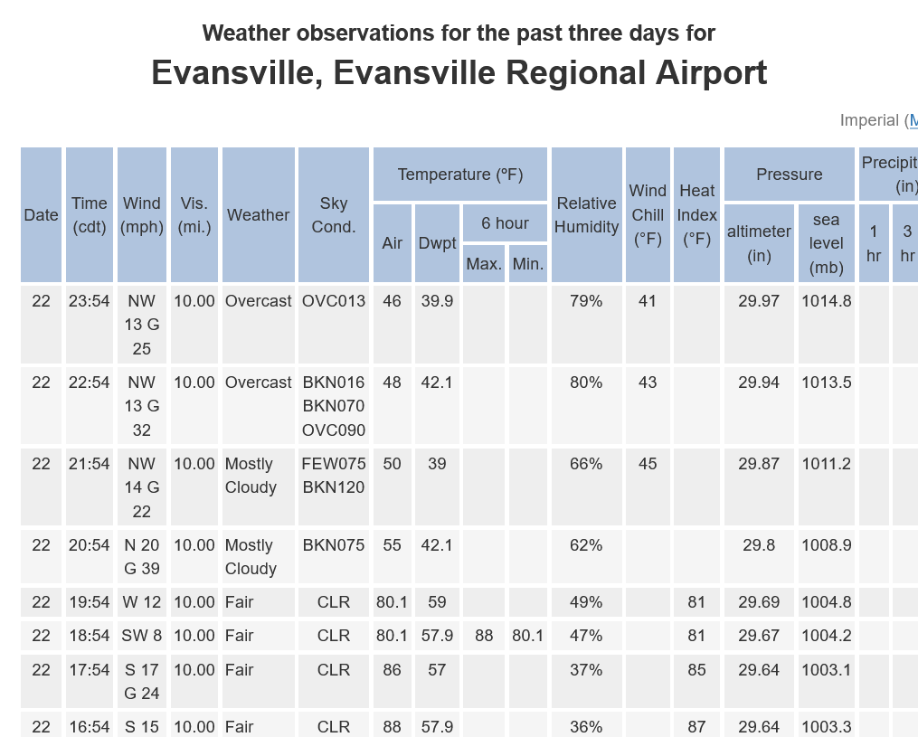
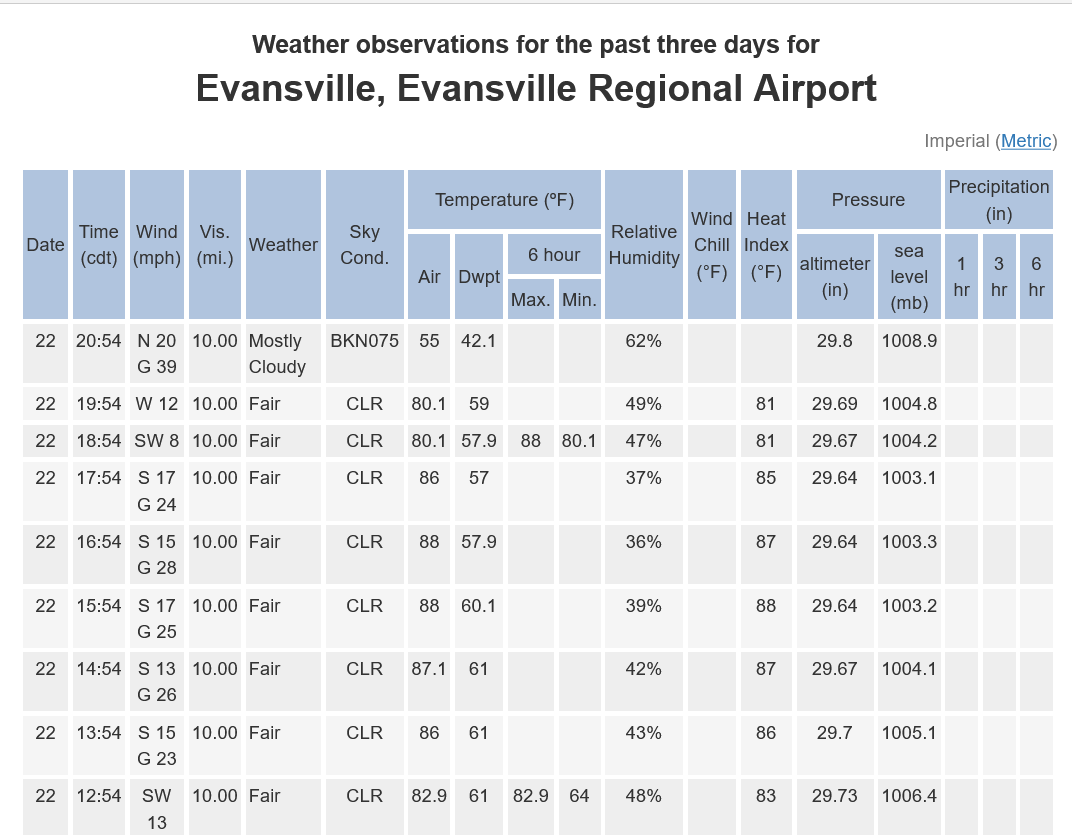
The cold front went thru Evansville almost an hour ago. Normally, that's the lifting agent that triggers the storms.
However, that much colder air hugging the ground has raced south really fast and there is still warmer air above the surface being lifted and causing storms WELL BEHIND the front.
This is our local weather service in Evansville.
The cold front is well south of the Ohio River at 9pm with scattered strong storms still 30 minutes north!
https://www.mesonet.org/weather/air-temperature/national-wind-chill-heat-index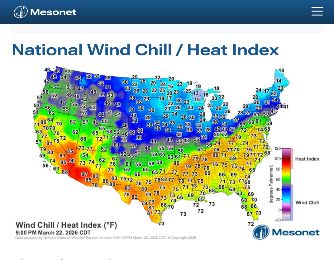
The temperature dropped 25 Deg. F in just 1 hour between 8-9pm. From 80 to 55!
https://forecast.weather.gov/data/obhistory/KEVV.html
https://www.mesonet.org/weather/air-temperature/national-wind-chill-heat-index ++++++++++++++++++++++++++
We're 42 degrees colder than that 88 degree, hottest ever in March temperature: