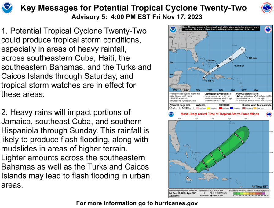
A minimal hurricane for the next few days with no threat to land.
https://www.nhc.noaa.gov/graphics_at5.shtml?start#contents
https://www.nhc.noaa.gov/text/refresh/MIATCDAT5+shtml/221435.shtml?
Several models such as the UKMET have been persistent about this after an initial 3 days of NE movement turning W and approaching Bahamas/Florida in 7+ days. However, those that do weaken her substantially. Nevertheless, it would be a highly unusual track though not unprecedented in October.
Reminder: Mike wins our contest if there are no more MHs. Jean wins if there is a MH.
Thanks much, Larry!
Jean still has a chance to win!
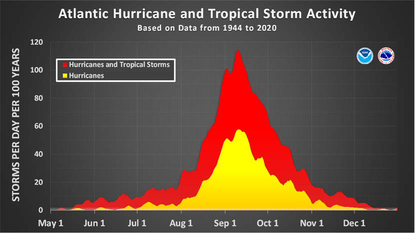
We should note that 7 out of the 12 late season major hurricanes happened BEFORE climate change kicked in, so the 1 Deg. C of the oceans has not yet resulted in a big increase for late major hurricanes.
You would think this factor could extend the hurricane season by extending the time which water temperatures are 79+ Deg. by an extra week+.
| Rank | Name | Date | Winds (mph) | Location |
|---|---|---|---|---|
| 1. | Kate | 20-21 Nov. 1985 | 120 | Florida Panhandle |
| 2. | Wrong-way Lenny | 17-18 Nov. 1999 | 155 | Northern Lesser Antilles |
| 3. | Hurricane 7 | 17-18 Nov. 1912 | 115 | South of Jamaica |
| 4. | 1932 Cuba Hurricane | 5-10 Nov. 1932 | 135 | Cuba |
| 5. | Paloma | 8 Nov. 2008 | 145 | Cuba |
| 6. | Greta | 5-6 Nov. 1956 | 140 | Mid-Atlantic |
| 7. | Michelle | 3-5 Nov. 2001 | 140 | Cuba |
| 8. | Beta | 30 Oct. 2005 | 115 | Nicaragua |
| 9. | Hattie | 28-31 Oct. 1961 | 160 | Belize |
| 10. | Mitch | 25-28 Oct. 1998 | 180 | Honduras |
| 11. | Hurricane Nine | 29 Oct. 1867 | 130 | Northern Lesser Antilles |
| 12. | Fox | 26 Oct. 1952 | 115 | Cuba |
Mktfrm 2023 Atlantic Hurricane Season Forecast Contest: deadline *6/4/23* 36 responses |
Started by WxFollower - May 31, 2023, 4:07 p.m.
https://www.marketforum.com/forum/topic/95746/
Some awesome data/graphics displayed at this link!
https://www.nhc.noaa.gov/climo/
| Number | Named systems | Hurricanes | Major Hurricanes |
|---|---|---|---|
| 1 | Jun 20 | Aug 11 | Sep 1 |
| 2 | Jul 17 | Aug 26 | Sep 19 |
| 3 | Aug 3 | Sep 7 | Oct 28 |
| 4 | Aug 15 | Sep 16 | - |
| 5 | Aug 22 | Sep 28 | - |
| 6 | Aug 29 | Oct 15 | - |
| 7 | Sep 3 | Nov 15 | - |
| 8 | Sep 9 | - | - |
| 9 | Sep 16 | - | - |
| 10 | Sep 22 | - | - |
| 11 | Oct 2 | - | - |
| 12 | Oct 11 | - | - |
| 13 | Oct 25 | - | - |
| 14 | Nov 19 | - | - |
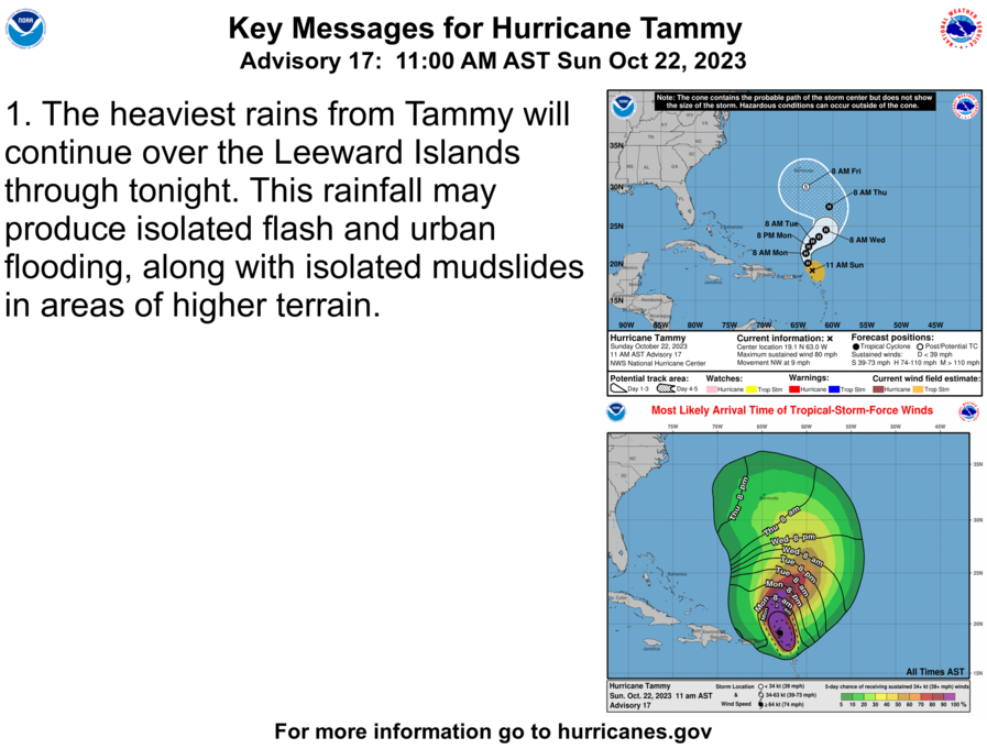
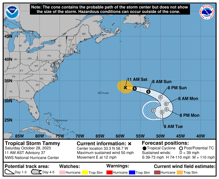
Minimal hurricane Tammy is predicted to weaken the next several days. No threats anywhere.
https://www.nhc.noaa.gov/graphics_at5.shtml?start#contents
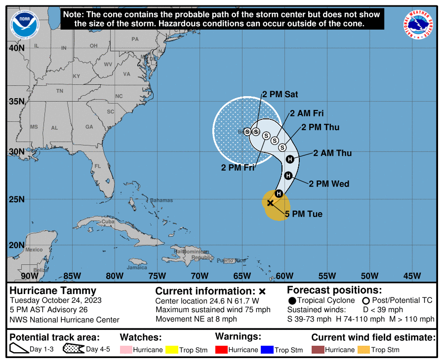
Tammy has suddenly gotten close to MH strength. We’ll see whether or not the NHC upgrades it that far.
Thanks, Larry.
Way to stay on top of things!
It's at 100 mph.
It needs only 111 mph and the NHC has it peaking at 105 mph later today.
I'm pretty sure that, for all practical purposes they need to upgrade it/measure to 115 mph because they count by (round off to) 5s when measuring the speed of tropical systems.
And it looks like we have the next 12 hours or so to do it as the peak is later today in the forecast.
https://www.nhc.noaa.gov/text/refresh/MIATCDAT5+shtml/250841.shtml?
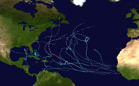
Here's a review of the 2023 hurricane season so far:
https://en.wikipedia.org/wiki/2023_Atlantic_hurricane_season
LOL WHAT A SEASON THIS'N HAS BEEN!! THANKFULLY, NOT VERY DESTRUCTIVE!!
I'LL SAY: "THERE'S GONNA BE A VERY LATE SEASON HURRICANE" WE'LL SEE.
SUPPOSEDLY, THERE'S GONNA BE SOME MIGHTY WARM DAYS IN THE SOUTH, NEXT WEEK.
WE WERE 80, YESTERDAY. TWO NIGHTS AGO, WE GOT DOWN TO 27 !
Up another 5 mph with the late morning advisory!
Now at 105 mph with a few hours left to make 115 mph.
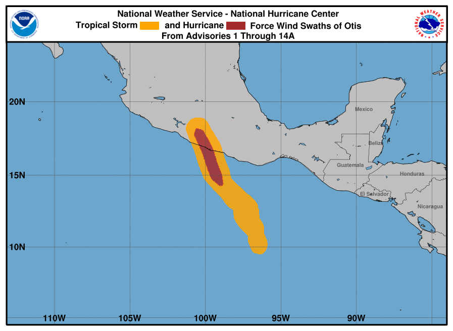
Hurricane Otis hitting Mexico.
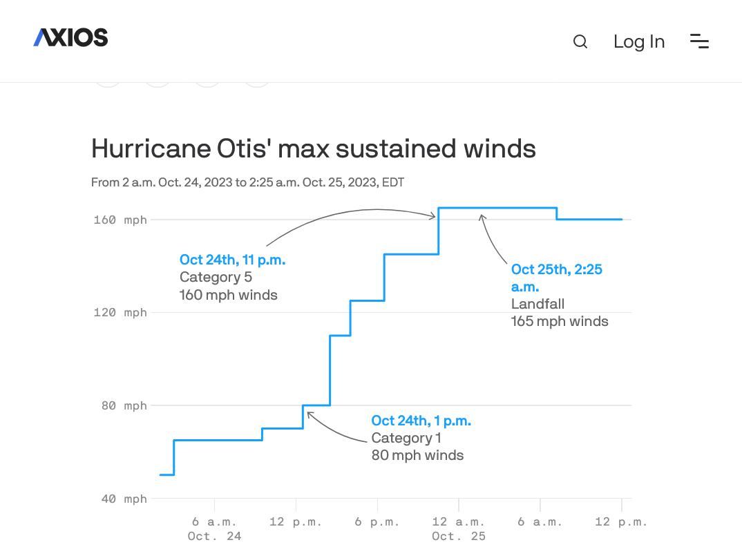
Otis went from a Tropical Storm to a major Hurricane in a record fast time frame(around 12 hours-amazing!)
https://www.nhc.noaa.gov/refresh/graphics_ep3+shtml/174939.shtml?swath#contents
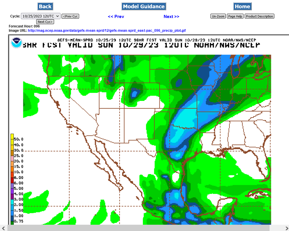
Not much rain from the remnants of Otis, all in Mexico but its all WELCOME rain.
We couldn't quite get there for your major hurricane this time, Jean.
Looks like 105 mph will be the peak from the previous report at we're weakening now and down to 100 mph.
If not for Larry, tipping us off early today, I would have missed this late gasp of strength by Tammy and the exiting drama today related to his contest.
But the waters are still warmer than usual and November has featured 7 major hurricanes in the past, so it's still not over for you, Jean!
These 2 below were incredibly impressive for so late in the season.
1. Because it was so late and so far north
2. Because it was so strong that late
https://www.marketforum.com/forum/topic/99881/#99896
| Rank | Name | Date | Winds (mph) | Location |
|---|---|---|---|---|
| 1. | Kate | 20-21 Nov. 1985 | 120 | Florida Panhandle |
| 2. | Wrong-way Lenny | 17-18 Nov. 1999 | 155 | Northern Lesser Antilles |
I wouldn't completely rule out something in December with water temperatures so warm, even though its past what we normally consider the hurricane season. That would be a first for anything stronger than a cat.1. There were several of those in December as you can see on the long list below.
97% of the tropical activity usually happens between June 1 thru the end of November.
+++++++++++
https://en.wikipedia.org/wiki/List_of_off-season_Atlantic_hurricanes
++++++++++++
An interesting fact about those stats. The decade with the most off season tropical systems listed above was the 1950's with 14 of them during global COOLING! 11 or those occurred just between 1951-1954.
That's an insanely high number for just 4 years and seems counterintuitive to what we are taught about hurricanes.
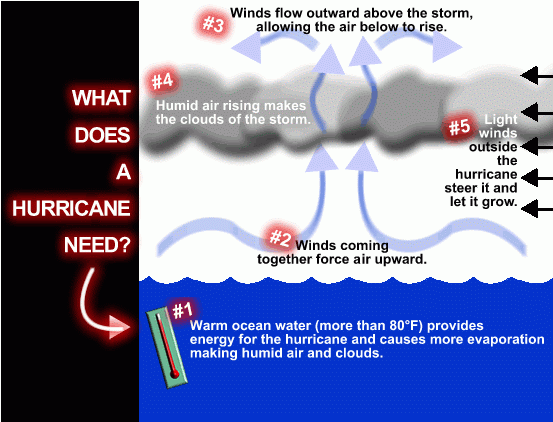
However, besides using warm water 79+ degrees for fuel, hurricanes exhaust excessive heat in the topics to balance the unequal heat distribution because of solar heating that naturally builds heat in the tropics while more heat is being lost at higher latitudes.
During greenhouse gas global warming, we accomplished that by heating the highest latitudes the most, so we don't need as many hurricanes with the weaker meridional temperature gradient!
This has offset the expected increase of hurricanes from warmer ocean temps.
WHAT FUNN, EH?
https://www.axios.com/2023/10/25/hurricane-otis-forecast-failure
LIKE THE OLD SAYING GOES: "YA CAN'T FOOL MOTHER NATURE, BUT... SHE CAN SURELY FOOL YOU!"
YA CAN'T FOOL MOTHER NATURE, BUT... SHE CAN SURELY FOOL YOU!"
That should be the title of a book about the life of an operational meteorologist(that predicts weather for a living (-:
GOOD OLD MOM NATURE, EH? LOL
I'VE NEVER SEEN THIS GUY, BEFORE. WHAT DO YA THINK?
Tropical Development Expected In The Best Conditions All Season! Who Needs To Watch? 13 MINUTES
Thanks, Jean!
Not looking very good at the moment for that one. Tammy will fizzle the next several days.
Tammy below:
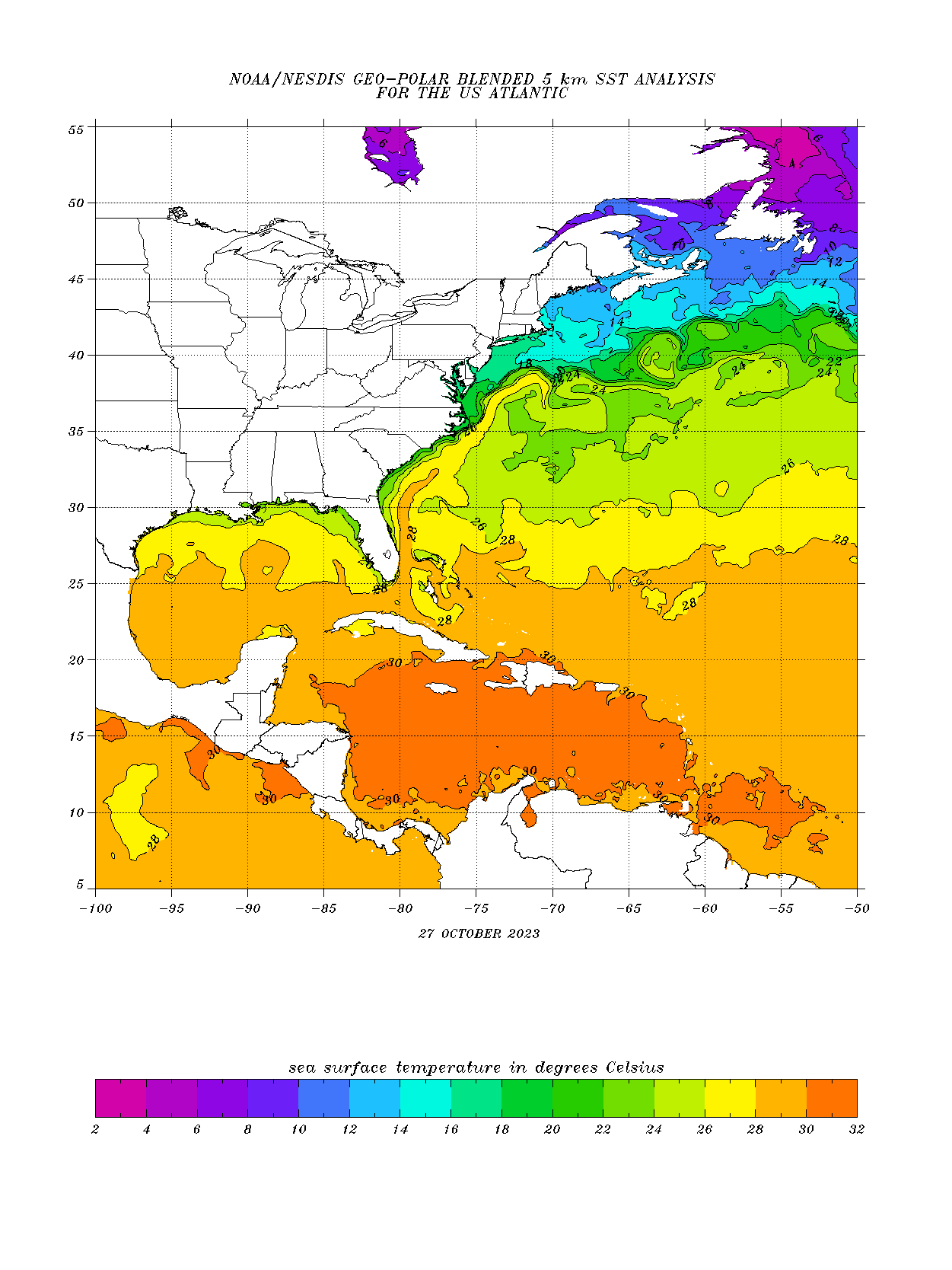
However, temps only need to be 27 Deg. C or more for a tropical storm and they will stay plenty warm enough for that thru November but gradually shift farther and farther south.
You can note Tammy's location above, close to the same latitude as the SC/NC border and compare it to the same area in the ocean below.......GREEN shade and BELOW 26 Deg. C right now but it does meander back into warmer waters in the forecast, while weakening because of strong wind sheer and dry mid level air.
https://www.ospo.noaa.gov/data/sst/contour/usatlant.fc.gif
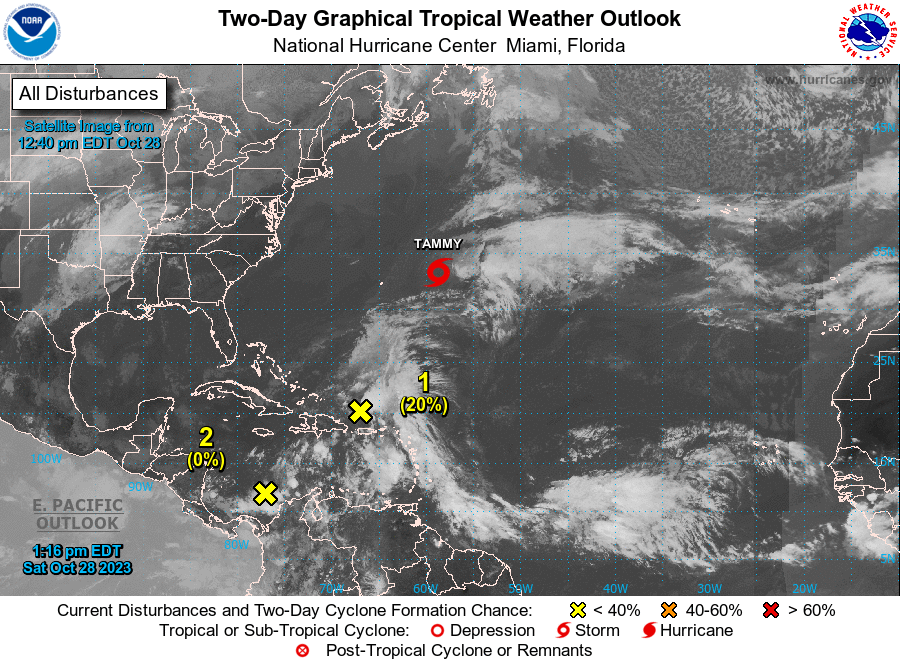
60% chance that this could develop in the next week.
20% the next 28 hours
https://www.nhc.noaa.gov/gtwo.php?basin=atlc&fdays=2

+++++++++++
I'll have to disagree with that and say that an extra 1 Deg. C to the water temperature likely did contribute a little bit.
We may have a Tropical Storm Vince coming up in the next day. However, almost no chance to strengthen.
https://www.nhc.noaa.gov/graph
https://www.nhc.noaa.gov/text/refresh/MIATCDAT2+shtml/172051.shtml?
There's never been a major hurricane in the Atlantic Basin after November 21.
https://www.marketforum.com/forum/topic/99881/#99896
++++++++++++
Here's a list of the name for Atlantic Hurricanes for the next 5 years! These names repeat every 6 years, UNLESS the storm is noteworthy. Then, that name is retired and a new name with the same letter replaces it.
If you look at the list for 2028 for instance, you will remember several of the same names from last year(2022).
I'm thinking that MAJOR hurricane Larry, in 2027 is going to be a DOOZY (-:
Then cat. 5 hurricane Julia, in 2028 will be historical (-:
Atlantic Pronunciation Guide (PDF)
| 2023 | 2024 | 2025 | 2026 | 2027 | 2028 |
|---|---|---|---|---|---|
| Arlene Bret Cindy Don Emily Franklin Gert Harold Idalia Jose Katia Lee Margot Nigel Ophelia Philippe Rina Sean Tammy Vince Whitney | Alberto Beryl Chris Debby Ernesto Francine Gordon Helene Isaac Joyce Kirk Leslie Milton Nadine Oscar Patty Rafael Sara Tony Valerie William | Andrea Barry Chantal Dexter Erin Fernand Gabrielle Humberto Imelda Jerry Karen Lorenzo Melissa Nestor Olga Pablo Rebekah Sebastien Tanya Van Wendy | Arthur Bertha Cristobal Dolly Edouard Fay Gonzalo Hanna Isaias Josephine Kyle Leah Marco Nana Omar Paulette Rene Sally Teddy Vicky Wilfred | Ana Bill Claudette Danny Elsa Fred Grace Henri Imani Julian Kate Larry Mindy Nicholas Odette Peter Rose Sam Teresa Victor Wanda | Alex Bonnie Colin Danielle Earl Farrah Gaston Hermine Idris Julia Karl Lisa Martin Nicole Owen Paula Richard Shary Tobias Virginie Walter |
Since 1953, Atlantic tropical storms had been named from lists originated by the National Hurricane Center. They are now maintained and updated through a strict procedure by an international committee of the World Meteorological Organization.
Temperatures are still warmer than average. Basically, 26 Deg. C(79 Deg. F) is needed for a hurricane and the line that defines the 26 Deg. C isotherm is slowly shifting south.
The map below only has even numbers.
https://www.ospo.noaa.gov/data/sst/contour/usatlant.fc.gif
Potential minimal TS Vince failed yesterday.
https://www.nhc.noaa.gov/text/refresh/MIATCDAT2+shtml/172051.shtml?