Wednesday Weather-top story
9 responses | 0 likes
Started by metmike - June 27, 2018, 9:22 a.m.

I started Wednesday weather: https://www.marketforum.com/forum/topic/6319/  over, realizing that upcoming heat is clearly the top story!

High Temperatures today and Thursday......cool in the Northeast. Blast furnace heat in S.Plains .........getting ready to move northeast.

Comments
By metmike - June 27, 2018, 9:25 a.m.
Like Reply

Highs days 3-7 shows  Heat from C/S Plains to Midwest.........easing a bit early next week?

http://www.wpc.ncep.noaa.gov/medr/DAY3_MAX_filled.gif

http://www.wpc.ncep.noaa.gov/medr/DAY4_MAX_filled.gifhttp://www.wpc.ncep.noaa.gov/medr/DAY5_MAX_filled.gifhttp://www.wpc.ncep.noaa.gov/medr/DAY6_MAX_filled.gifhttp://www.wpc.ncep.noaa.gov/medr/DAY7_MAX_filled.gif


How do these temperatures compare to average at this time of year:

High temperature departures:
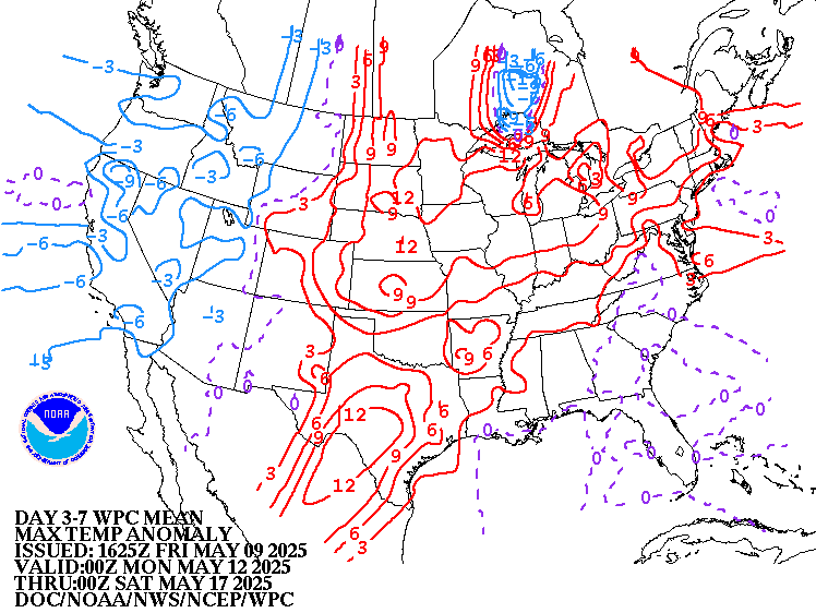
http://www.wpc.ncep.noaa.gov/medr/hpcmaxwbg.gif


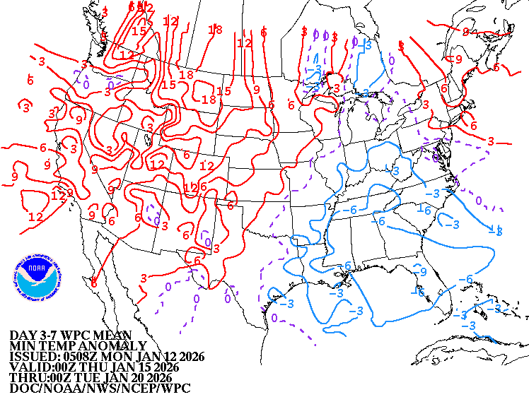
Low Temperature Departures:

http://www.wpc.ncep.noaa.gov/medr/hpcminwbg.gif


By metmike - June 27, 2018, 9:27 a.m.
Like Reply

From the GFS ensemble mean products. Temperature anomalies for this coming weekend..........record heat Northeast..............cooling N.Plains.

NCEP Ensemble t = 096 hour forecast
NCEP Ensemble t = 096 hour forecast product

By metmike - June 27, 2018, 9:28 a.m.
Like Reply

Temperature anomalies at the end of week 2.....most intense heat shifted west?  At least on the GFS ensembles but not all models.
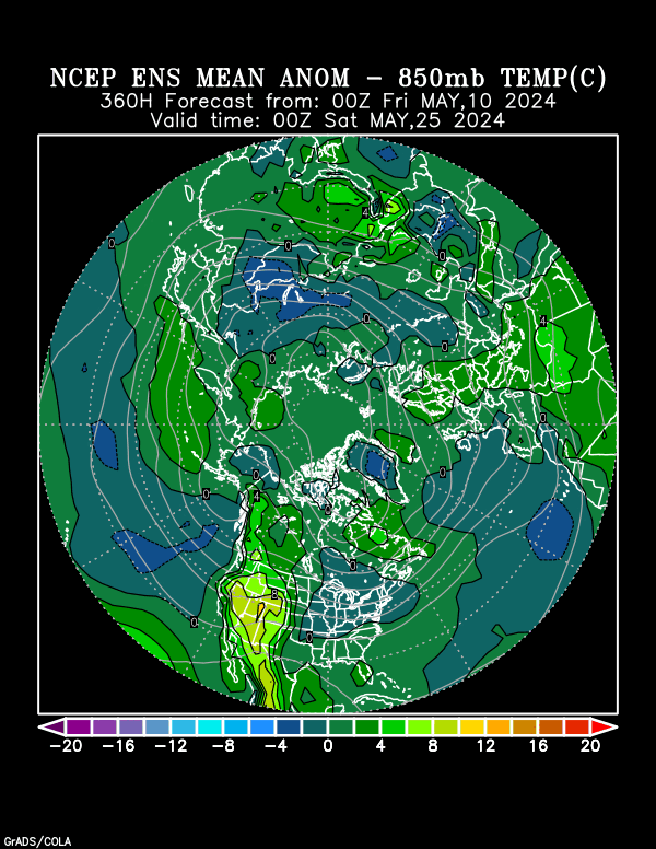
https://www.esrl.noaa.gov/psd/map/images/ens/t850anom_f360_nhbg.gif

By metmike - June 27, 2018, 9:41 a.m.
Like Reply

But the European model is MUCH different and very bullish with the "dome of death" heat ridge:


Loading Maps...


GFS ensembles at 2 weeks below.......heat ridge much farther west, cooler in the East with upper level trough. It is pretty dry though. 

Forecast Hour:  360
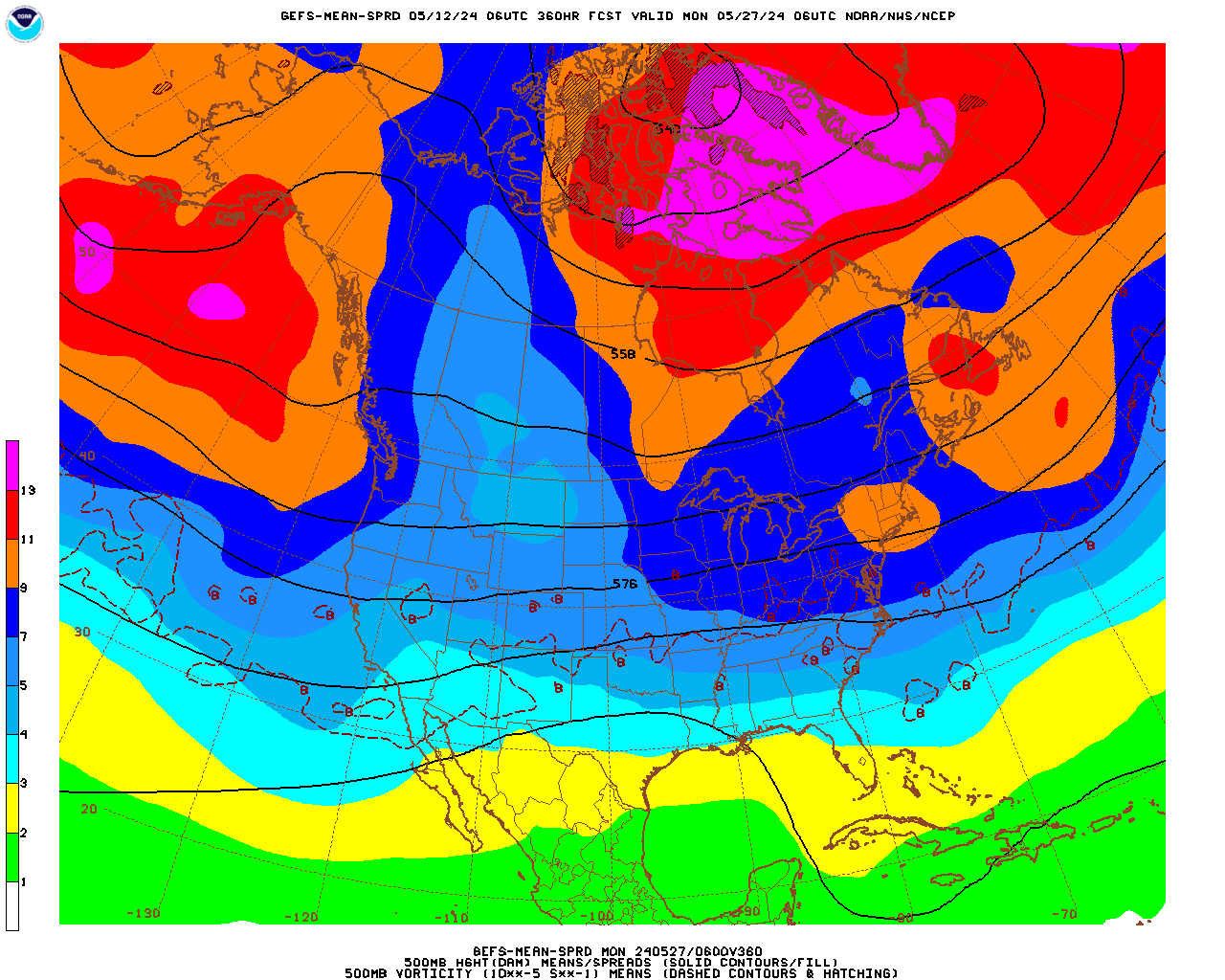
   

gefs-mean-sprd_namer_360_500_vort_ht.gif

By metmike - June 27, 2018, 9:45 a.m.
Like Reply

CFS week 3 and 4...........HOT week 3, turning cooler week 4 and drier thru the period.


http://www.cpc.ncep.noaa.gov/products/people/mchen/CFSv2FCST/weekly/images/wk3.wk4_latest.NAsfcT.gif


Precip belowhttp://www.cpc.ncep.noaa.gov/products/people/mchen/CFSv2FCST/weekly/images/wk3.wk4_latest.NAprec.gif

By metmike - June 27, 2018, 9:59 a.m.
Like Reply

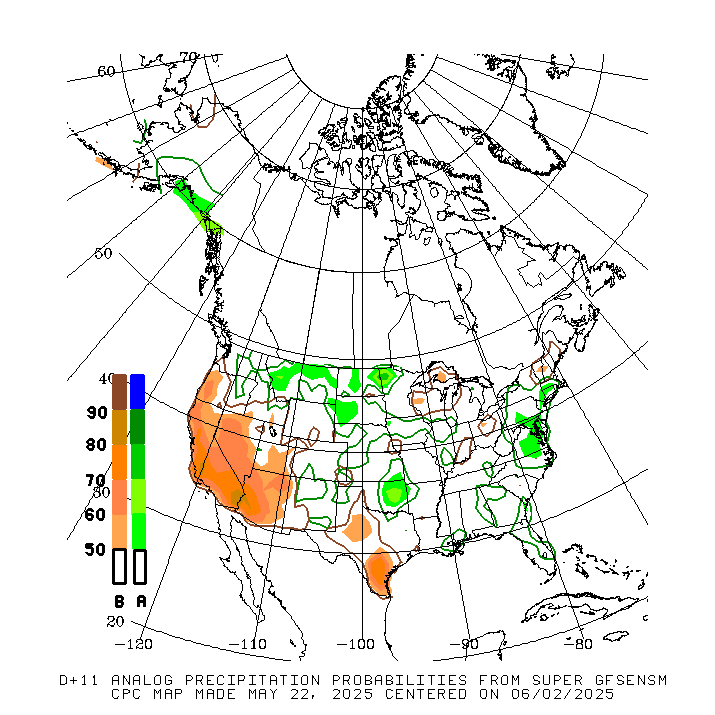
NWS guidance for 8-14 day forecast for this afternoon(sneak peak at what it will show)
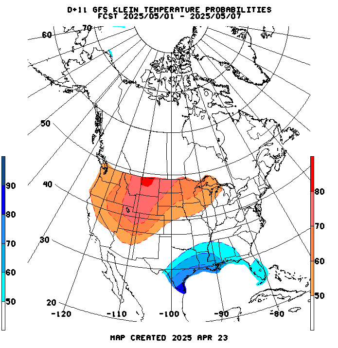
http://www.cpc.ncep.noaa.gov/products/predictions/short_range/tools/gifs/ens700_maps.d11.klnT.prb.gif

Precip below:

http://www.cpc.ncep.noaa.gov/products/predictions/short_range/tools/gifs/sfc_count_sup814_prec.gif

By metmike - June 27, 2018, 11:24 a.m.
Like Reply

Canadian control model, top and individual ensemble member solutions. They are all over the place with the heat ridge forecast.............but have gradually shifted west from previous runs.............mainly the result of several members now "seeing" a deep upper level trough digging into the Northeast(to, possibly Upper Midwest). 

Still some ensembles show the heat ridge much farther east, like the European model has it.

384h GZ 500 forecast valid on Jul 13, 2018 00 UTC

GZ 500 forecastGZ 500 forecastGZ 500 forecastGZ 500 forecast

Forecasts for the control (GEM 0) and the 20 ensemble members

By metmike - June 27, 2018, 11:30 a.m.
Like Reply

Looky here at the GFS ensembles. Many(increasing number) of them back up the upper level ridge west(retrograde) and more of them are "seeing" a prominent upper level trough in the east. 

http://mp1.met.psu.edu/~fxg1/ENSHGT_0z/f384.gif

By metmike - June 27, 2018, 1:17 p.m.
Like Reply

12z GFS was not bullish(6z GFS was)


Lastest 12z GFS at 2 weeks, below:            

      gfs_namer_360_200_wnd_ht
      gfs_namer_360_200_wnd_ht_s.gif   
      gfs_namer_360_500_vort_ht
      gfs_namer_360_500_vort_ht_s.gif   
      gfs_namer_360_1000_500_thick
      gfs_namer_360_1000_500_thick_s.gif   
      gfs_namer_360_850_temp_ht
      gfs_namer_360_850_temp_ht_s.gif