
Welcome to another day, September 15th. Make it a great day! Do something special for somebody to remember today! Seriously, don't just think about it for a moment......do it.
The story continues along the East Coast from Hurricane Florence, with torrential rain that are shifting southwest.
https://www.marketforum.com/forum/topic/12841/
Drying thru the weekend in the Cornbelt has been great but unwelcome rains from Central Plains to Upper Midwest next week.
The latest rain forecasts are below. Not as extreme in NC/SC because much of the rain has already fallen.
Scroll down and enjoy the latest comprehensive weather to the max!!
Day 1 below:
http://www.wpc.ncep.noaa.gov/qpf/fill_94qwbg.gif?1526306199054

Day 2 below:
http://www.wpc.ncep.noaa.gov/qpf/fill_98qwbg.gif?1528293750112

Day 3 below:
http://www.wpc.ncep.noaa.gov/qpf/fill_99qwbg.gif?1528293842764

Days 4-5 below:
http://www.wpc.ncep.noaa.gov/qpf/95ep48iwbg_fill.gif?1526306162

Days 6-7 below:
http://www.wpc.ncep.noaa.gov/qpf/97ep48iwbg_fill.gif?1526306162

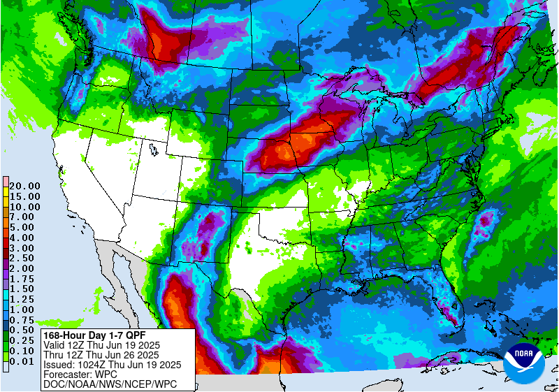
7 Day Total precipitation below:
http://www.wpc.ncep.noaa.govcdx /qpf/p168i.gif?1530796126
Excessive rain threat...............off the charts in NC/SC.
Day 1 Threat Area in Text Format
Current Day 2 Forecast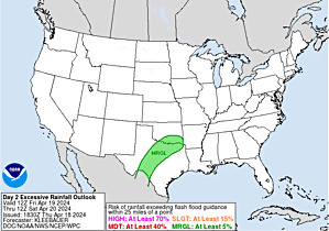 |
Day 3 forecast below
Severe Storm Risk. Maybe a tornado with Florence. Hit the map for full screen.
https://www.spc.noaa.gov/products/outlook/
Current Day 1 Outlook | |
Current Day 2 Outlook | |
Current Day 3 Outlook | |
Current Day 4-8 Outlook |
High Temperatures today and Sunday. Widespread warmth..........even hot in a few spots. Cool Northwest.


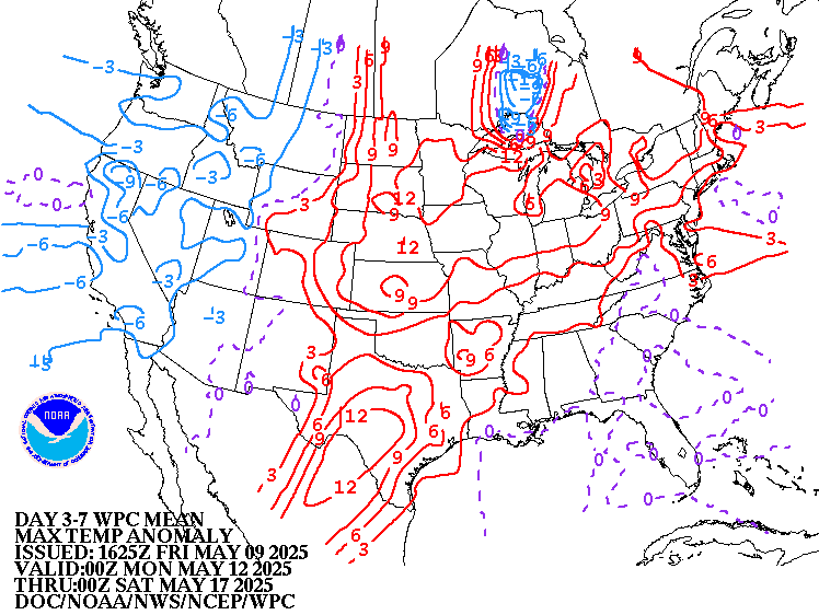
Highs days 3-7. Widespread warmth, then chilly air invades the north while it stays very warm deep south.
New cold surge Northwest, then Northern Plains/Upper Midwest, then Northeast.


How do these days 3-7 temperatures compare to average at this time of year? We are now 8 weeks past the climatological time of year when temperatures are the hottest.
Well above average.............but average in mid September is not that hot anymore.
Very cool Northwest to N.Plains.
High temperature departures:
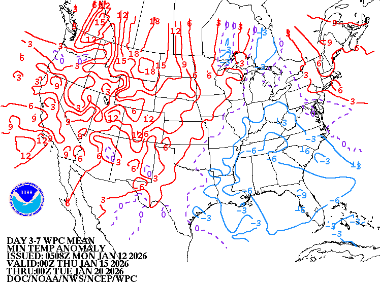
Low Temperature Departures:
Dew points. 70+ on this scale makes it feel uncomfortable(sticky air)!
More humid air has been returning.

Heat and high humidity COMBINED. Feels like temperature.

Florence is in South Carolina. Cold front N.Plains. High pressure in between.
https://weather.com/maps/currentusweather

Here is the latest radar image. Florence will continue to steal the show. Radars still show the well defined counterclockwise circulation.............inching slowly westward.
http://www.nws.noaa.gov/radar_tab.php


Satellite picture.
Very well defined Florence in the Carolinas!

Rains the past 24 hours. Not much................except over a foot along the coast in North Carolina.
![]()
You can go to this link to see rain totals from recent time periods:
https://water.weather.gov/precip/
Go to precipitation, then scroll down to pick a time frame. Hit states to get the borders to see locations better. Under products, you can hit "observed" or "Percent of normal"
Too wet in a huge area from massive September rains!
Drier this week, which is minimizing problems to the crops but wet again next week from C.Plains to Upper Midwest. Flooding from Florence is happening and getting worse.

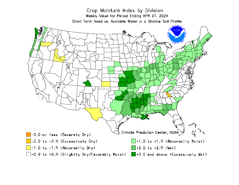
Below are rains compared to average of the last 7, 14, 30 and 60 days. Usually not updated for previous day until late the next day.
Bountiful rains for most of the Cornbelt..............and points eastward and westward. This increased yields in August!!!
But September brought too much rain! Drying out now.
https://www.atmos.illinois.edu/~snodgrss/Ag_Wx.html


Drought Monitor. This product is updated every Thursday. Drought has been shrinking but still persists in Texas.........this measure takes into account the long term precip/sub soil moisture and goes back over MANY months.
Top map is this week. Map below it was last week.
http://droughtmonitor.unl.edu/Maps/CompareTwoWeeks.aspx


The amazingly warm Sep continues in the SE US, where Atlanta has a high of 95 for the 2nd day in a row. What’s amazing about this is that these 95s are the hottest of the summer so far!
That is amazing Larry!