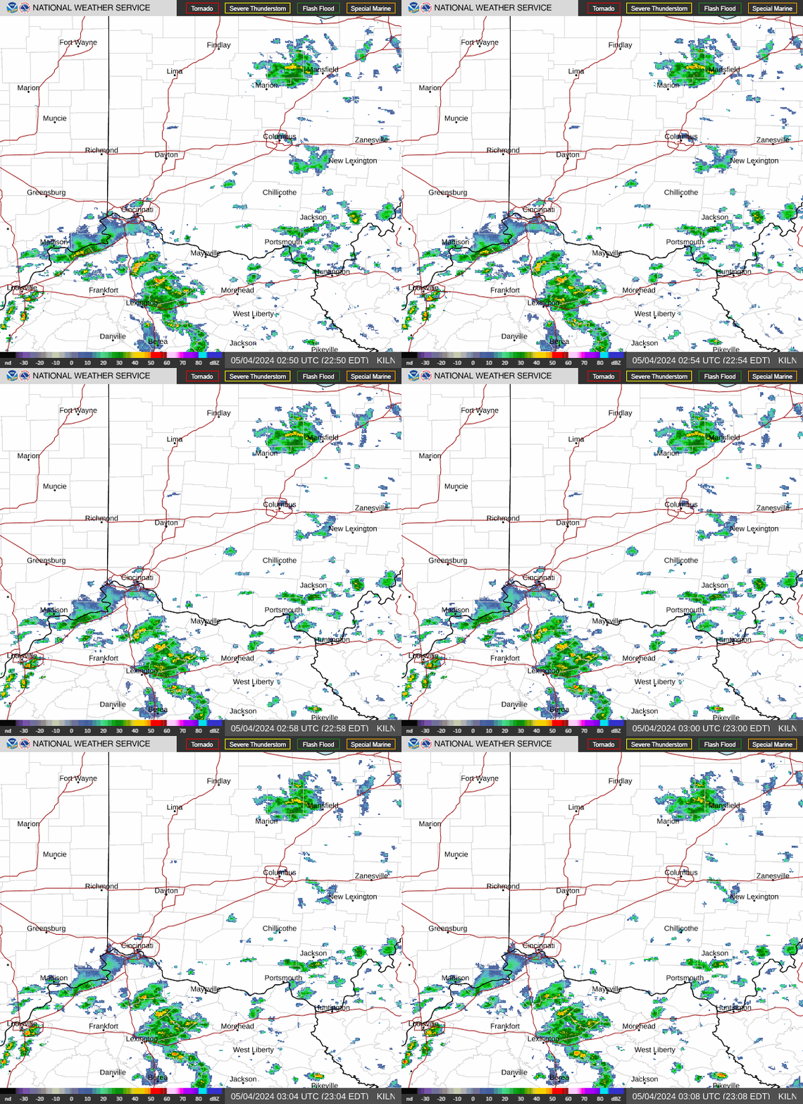
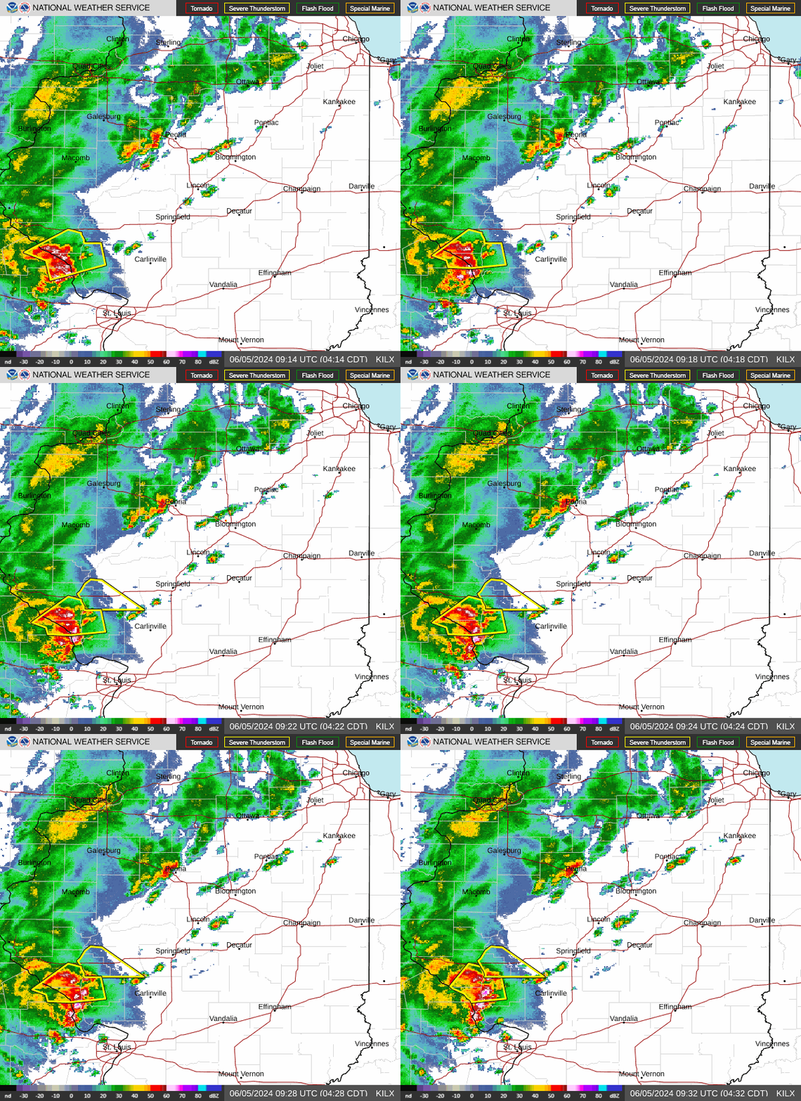
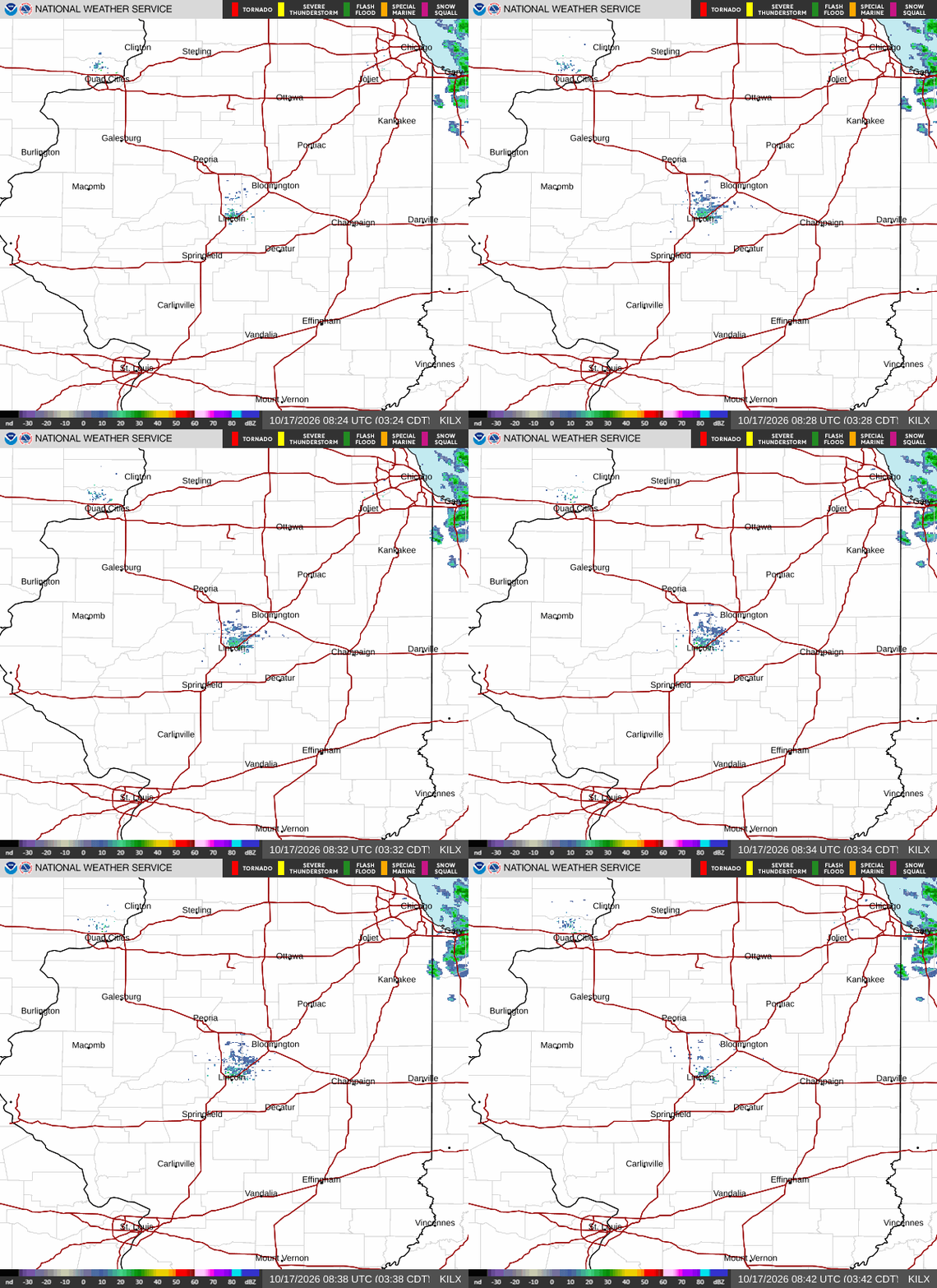
Very severe storm along I80 in LaSalle County. Sirens and weather warnings on phone. Very dark. Heavy rain. "White" on radar 920 ct
"ALL CLEAR" issued at 937ct
Wonderful technology!
One heck of a way to start high school!
Get all the comprehensive weather here:
https://www.marketforum.com/forum/topic/83844/
Thanks, tjc!
I'm watching that cluster of storms with hopes that the same perturbation, tracking along the periphery of the heat dome will dive south and bring rain to far southwest IN later today.
We've really dried out in my backyard part of the Cornbelt the past 3 weeks(missing rains all around us). I put down .10 of irrigation water last night on select sections of the lawn because it was deteriorating fast, to keep help it until potential rains this evening.
If we miss, it could be dry for awhile after that.
++++++++++++++
Current Hazards at the link below.
For your NWS and county, go to the link below.
Then you can hit any spot on the map, including where you live and it will go to that NWS with all the comprehensive local weather information for that/your county.

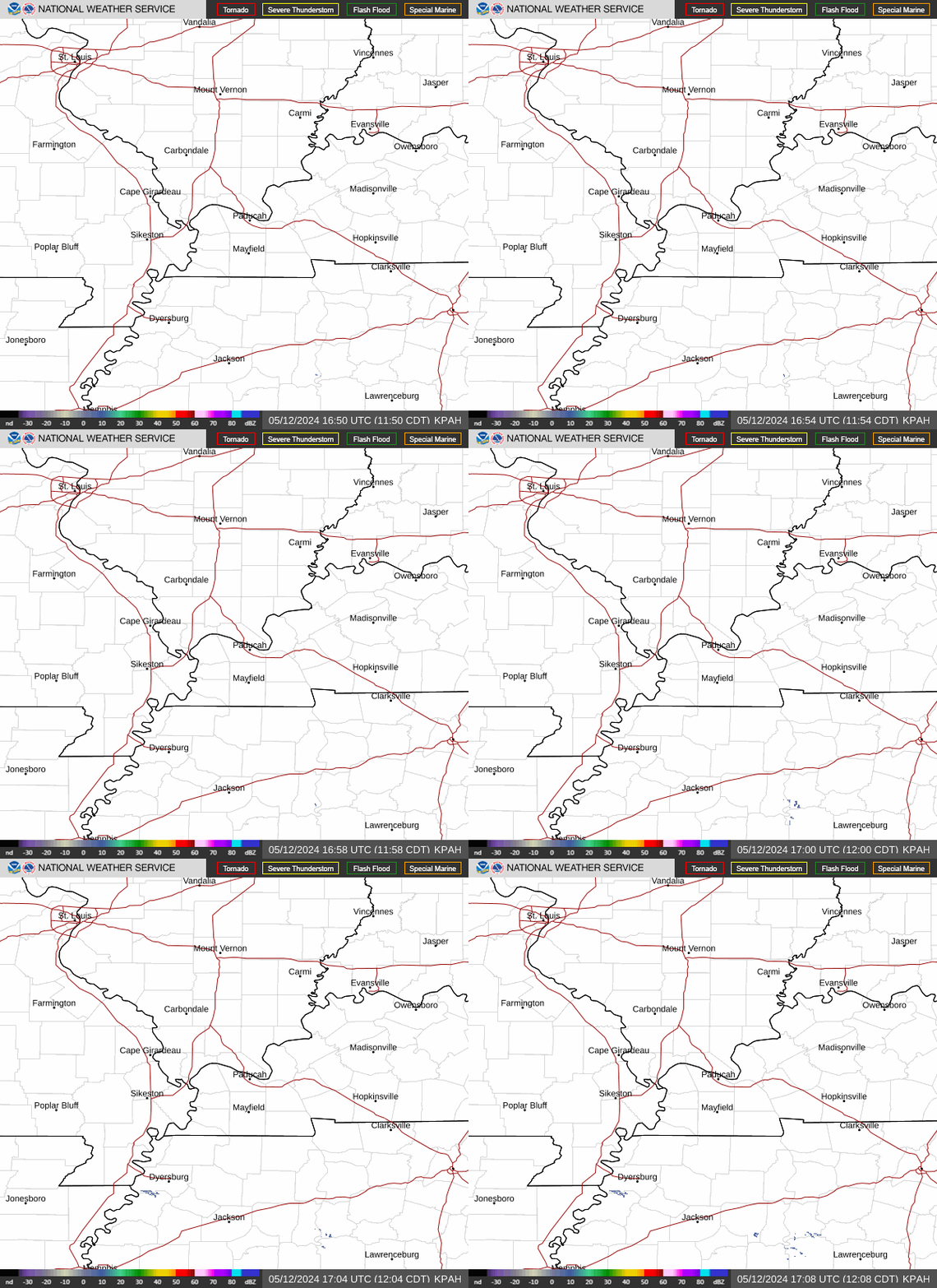
New radar product below
Go to: "Select View" then "Local Radar"
Hit the purple circle to see that local radar site
+++++++++++++++++++++++
This link below provides some great data. After going to the link, hit "Mesoanalysis" then, the center of any box for the area that you want, then go to observation on the far left, then surface observations to get constantly updated surface observations or hit another of the dozens of choices.

This weather is impacting cutworm in Southeast, IN(below).
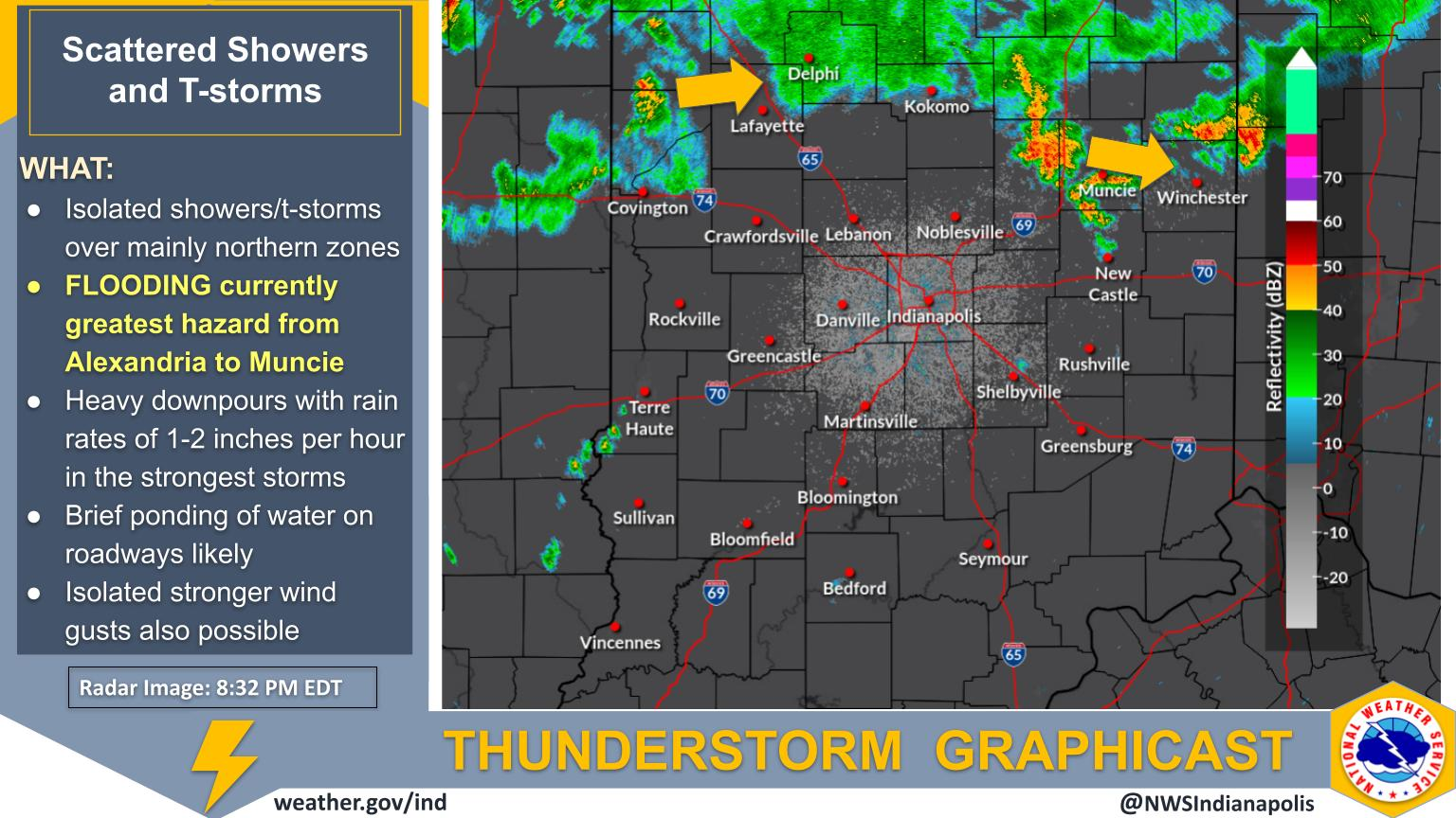
Flash flooding can develop quickly, and water levels can change in the blink of an eye. Keep these three simple steps in mind to stay safe when heavy rain threatens your area: 1. GET TO HIGHER GROUND: Move out of low-lying areas subject to flooding immediately. 2. DO NOT DRIVE OR WALK INTO WATER: It takes only 6 inches of moving water to...Read more
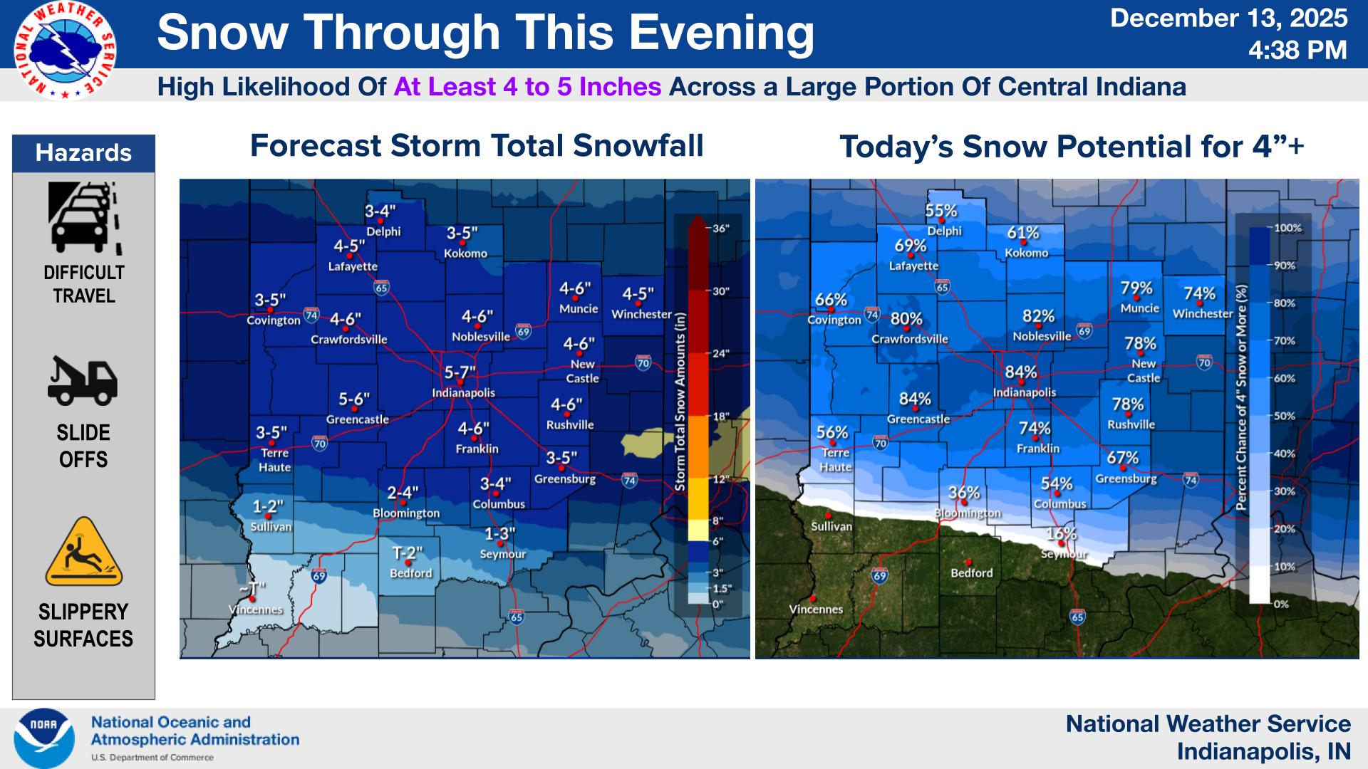

Yesterday in Evansville, IN(southwest corner), the storms stayed 50 miles northeast of us.
However we had a strong outflow boundary pushing way far southwest from the storms that came flying thru in the evening that acted like a cold front would.
It was incredible to be outside and suddenly have this big wind shift and have the temp and dewpoint (Heat Index) immediately more comfortable.
Note the bottom line below is 7pm in Evansville, IN.
7pm: Temp 91, Dewpoint 74, Heat Index 101, and Winds SW-6 mph.
8pm: Temp 80, Dewpoint 68, Heat Index 83, and Winds E-13 gusting to 29 mph!
Most of this drop was within minutes.
My wife(who doesn't spend that much time outside like me) was in the parking lot of her exercise class and noticed the same thing.
https://forecast.weather.gov/data/obhistory/KEVV.html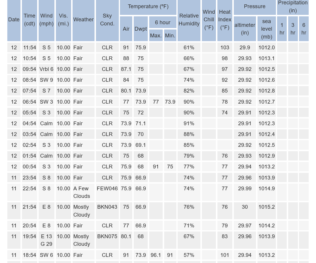
Here we go!
https://www.spc.noaa.gov/products/watch/ww0577.html

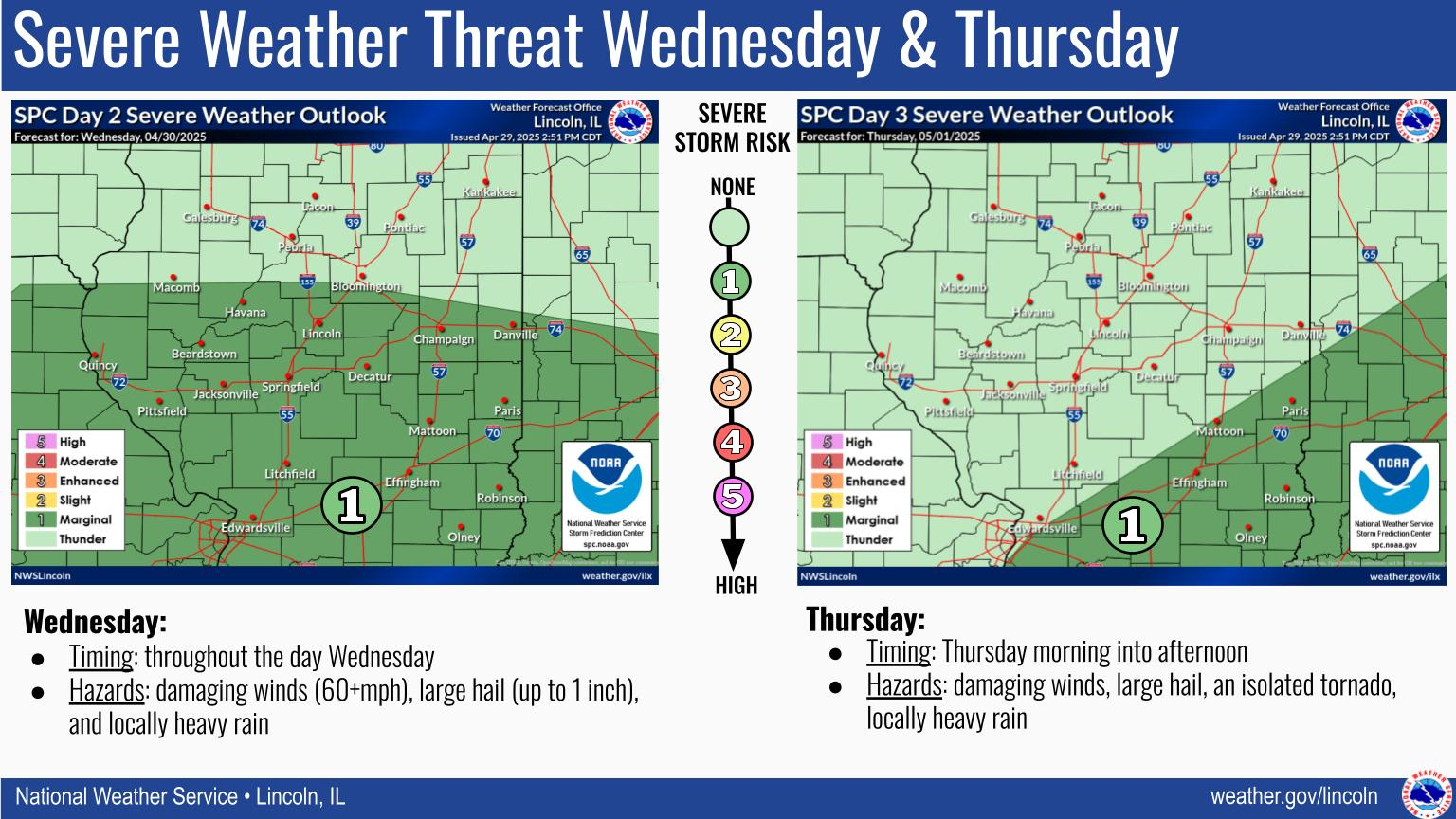
Scattered severe thunderstorms are possible this afternoon across portions of the Wabash Valley and Evansville Tri-state. Elsewhere across our area, some isolated storms are possible but the overall severe threat is lower.
Click a location below for detailed forecast.
Evansville IN
https://radar.weather.gov/station/kvwx/standard

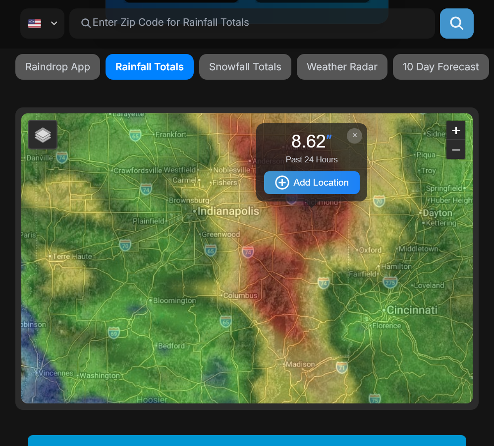
Great site for getting rainfall data. Just put in your zip code!
https://www.raindrop.farm/rainfall-totals/zipcode
With extremely heavy rains it might be off by as much as 50% to the downside but its constantly updated.
Up to 1.7" of wonderful rain. I keep going outside in the pouring rain to check the last reading in the rain gauge in the backyard.
We've had some back building to the west that has resulted in the rains continuing.
We're on hill with a steep slope so much of this was runoff in some places.
I have 4 inches since yesterday morning.
The West Fork of the Whitewater River that I farm around received more than 6 inchesup streem of me. The noaa gage upstream from me is at 17 feet, according to noaa the highest recorded, and predicted to reach 23 feet. If it does it will wipe out 75 acres of my crops. As of 3:pm here not flooding my field yet.
West Fork Whitewater River near Alpine
Edit; Looks like maybe rain has stopped. Maybe the flood will spread out and not be as bad as predicted here. Hopefully!!
OH NO, cutworm!!!
Will crop insurance cover much of this if it did happen?
I noticed that you were in the red zone this morning.
Added: Since they are updating the graphics at this site, the "red zone" from earlier no longer exists.
Producers have one of the riskiest jobs on the planet and this is an example of how an extreme weather event can take out their crop, even when it looks most of the way to being made.
We got 2.1 inches of rain in less than an hour that stopped the damage.
I "only" ended up with 3.7" over tues/wed storms here in wc ohio.
Saw you guys south and west of me really getting hit hard; the Whitewater River area esp.
Stay safe and best of luck.
Thanks, buck!
Most of this fell in less than an hour along with some quarter sized hail!
https://forecast.weather.gov/data/obhistory/KEVV.html
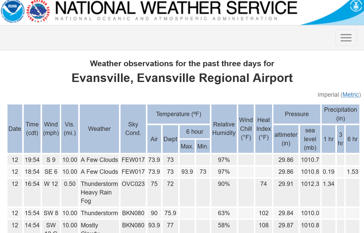
This site below is pretty good with steady rains but it thinks the site above only got 1.14" instead of the 1.53" reported above.
https://www.raindrop.farm/rainfall-totals/zipcode/47725#map
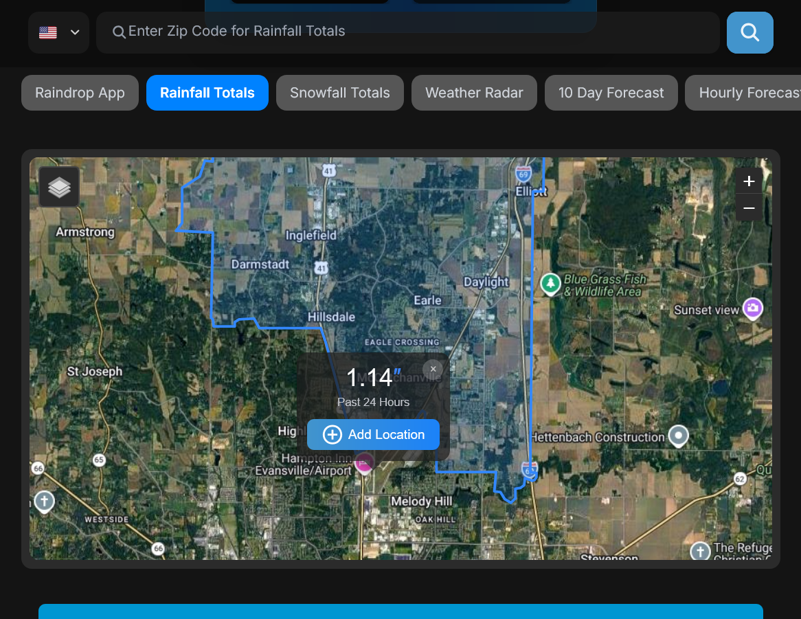
We got 2.1 with that site above showing just 1.23".
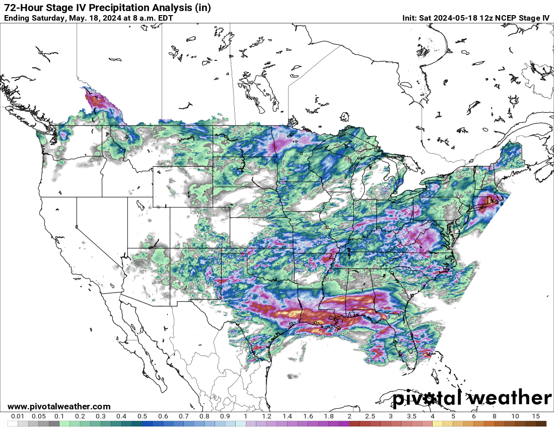
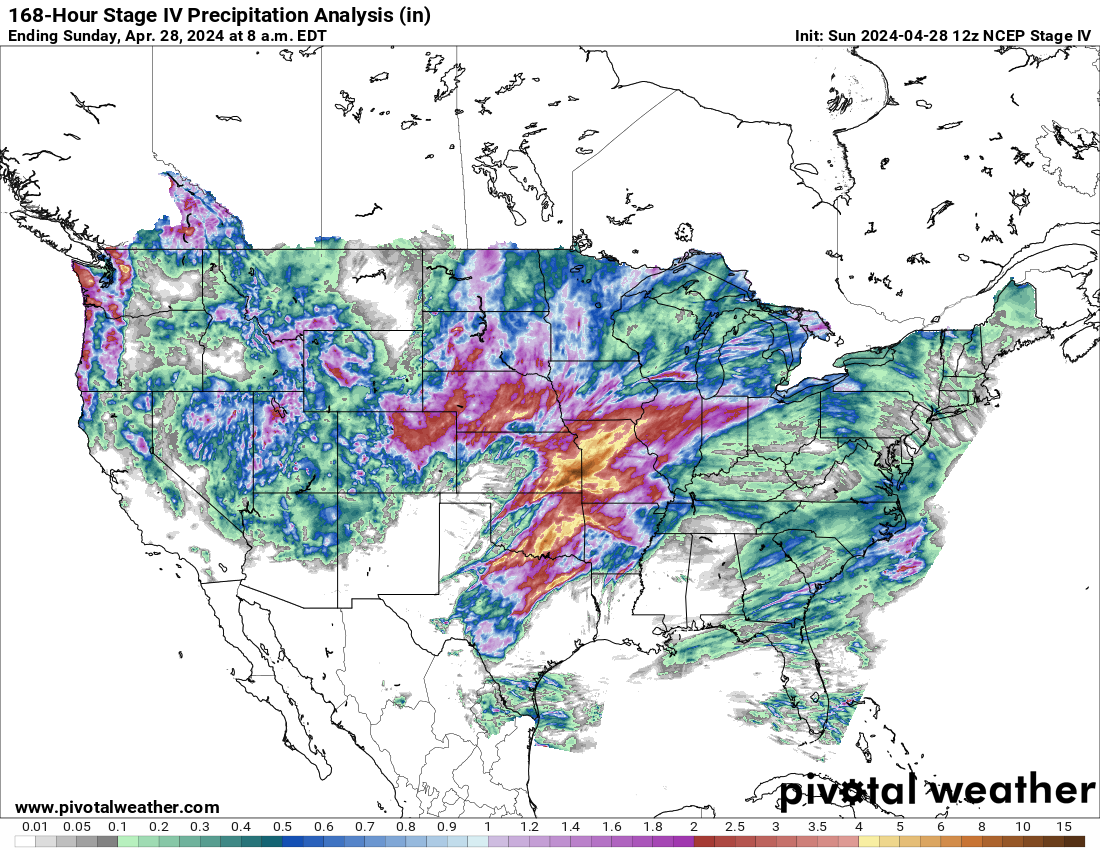
The time frame to gather data below ended early Wednesday morning.
It will be updated early Thursday morning.
https://www.pivotalweather.com/maps.php?ds=stageiv&p=stageiv_qpe_168h_p&r=conus
Last 24 hours
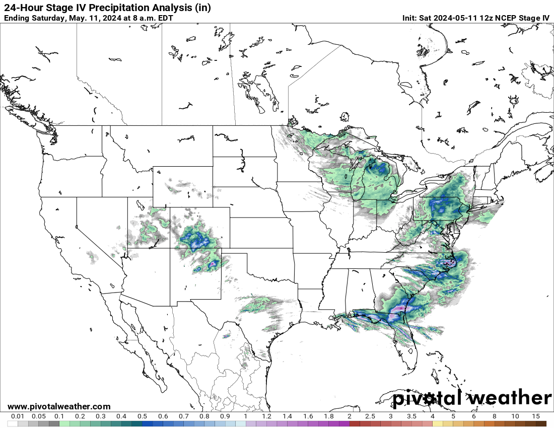
Last 72 hours
Last 7 days:
thanks buck
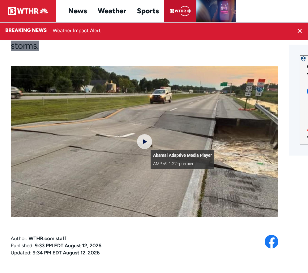
My son a, truck driver, said that they closed I70 at the whitewater river as it was going over the road.
ADDED: This source UNDER estimates extremely heavy rains. Local amounts could have been MUCH higher!!!
This was the highest reading for the past 24 hours ending 9pm CDT Wednesday(not counting Tuesday before 9pm)
I'm glad that the most extreme rains did not dump on top of you 2 days in a row, cutworm!
https://en.wikipedia.org/wiki/White_River_(Indiana)

Just saw that too. From pics looks like deck collapsed
State officials said a busy highway in eastern Indiana was closed to repair a road surface that became damaged during Wednesday's storms.
+++++
Great to read cutworm's update that some of his crops will NOT get taken out by flooding!
We should all appreciate how producers can lose their crops for all sorts of weather reasons.
AI Overview
Ottawa, Il area is forecasted to have another inch plus starting 5pm. Another inch on Friday. Had 1.7 Wednesday morning. Flood warnings issued for Fox and Illinois Rivers after 7pm
I asked our tenant and he was NOT wanting anymore rain. Corn this year.
Cutworm, what is his reasoning? (He would rather the rest of August to dry out so as to have 'normal' approach to harvest? Or too wet affects stand?)
Get all the comprehensive weather here:
https://www.marketforum.com/forum/topic/83844/
++++++++++++++++++
Much less risk for severe storms today:
Current Hazards at the link below.
For your NWS and county, go to the link below.
Then you can hit any spot on the map, including where you live and it will go to that NWS with all the comprehensive local weather information for that/your county.
New radar product below
Go to: "Select View" then "Local Radar"
Hit the purple circle to see that local radar site
+++++++++++++++++++++++
This link below provides some great data. After going to the link, hit "Mesoanalysis" then, the center of any box for the area that you want, then go to observation on the far left, then surface observations to get constantly updated surface observations or hit another of the dozens of choices.
I was wrong hoping the flood would be less than predicted. It turned out to be the 2 nd or 3 highest on record. It easily was over the top of 9 foot tall corn. And covered everything in the valley. I lost about 225 acres
That's very sad news to read, cutworm! I'm so sorry this happened to you.
How much does crop insurance cover and how will they calculate the compensation?
I know that you probably have the answer but am just sharing this below for basic information for readers. Much of it applies to flooding that impacts planting in the Spring, which I'm guessing were the other times you had flooding to this area(but maybe not).
AI Overview
++++++++++++++++++++++
AI Overview
++++++++++++++++++
No doubt there are a dozen nuances that make it very complicated but at least it won't be a total loss. You probably wasted a bunch of money on nitrogen if it's corn or other chemicals spraying if that was done.
More unwelcome heavy rains today, focused more westward.
Scroll down from the top to see the latest!
By metmike - Aug. 12, 2026, 12:06 p.m.
Let's add an additional site to the west:
L

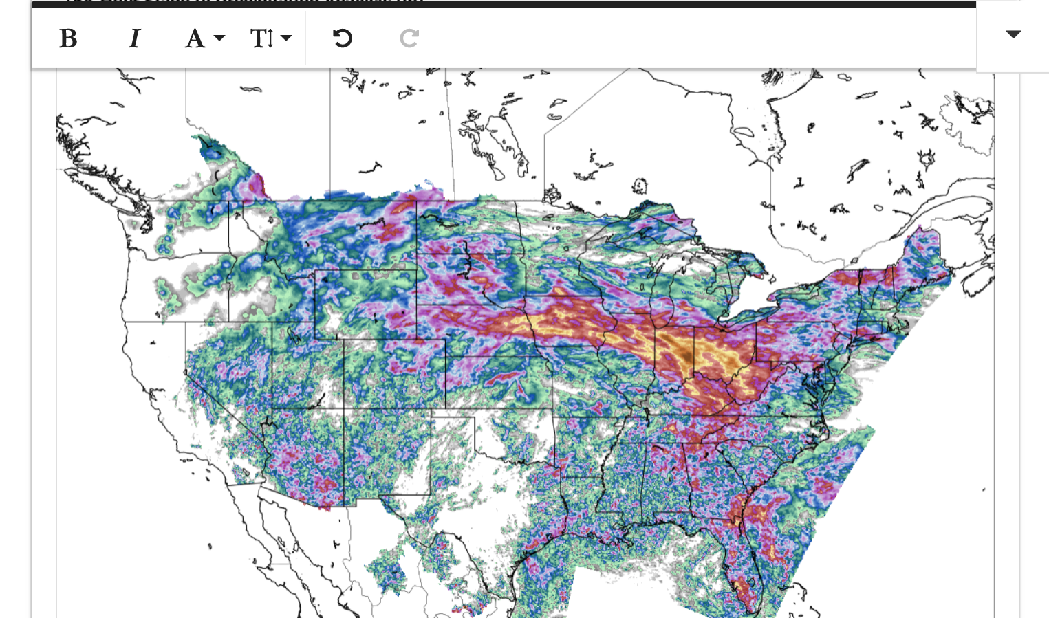
Here is a map that shows total rains the past. Top map is a snap shot. 2nd one is constantly updated. Cutworm lives just south of the epicenter in southcentral/southeast Indiana.
I'm having a tough time discerning the value of the darkest brown epicenter but will check other data sources. It's at least 10 inches but could be much more.
https://www.pivotalweather.com/maps.php?ds=stageiv&p=stageiv_qpe_168h_p&r=conus
The NWS in Indianapolis helped with this:
https://www.weather.gov/ind/aug122026floodsevere


+++++++++++++
The destruction began Tuesday when a powerful line of thunderstorms raced across the Midwest, producing widespread damaging winds from Illinois into Indiana and Ohio.

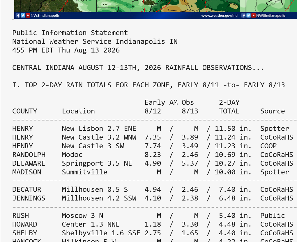
An amateur rain gauge in New Castle, Indiana, measured 11.23 inches of rain from 9 a.m. Aug. 11 to 4:30 p.m. Aug. 12. Another gauge in Modoc measured more than a foot of rain this week. At one location, the rainfall was considered intense enough to be a 1-in-1,000-year amount.
Seven flash flood emergencies were issued by the National Weather Service on Wednesday. Such emergency warnings are rare, with only 50 issued nationwide this year.
https://www.cnn.com/2026/08/14/weather/midwest-storms-flooding-indiana-ohio-hnk
After a 1-in-1,000-year rainfall in parts of Indiana Wednesday, officials conducted water rescues and ordered evacuations as rivers burst their banks and floodwater rushed into homes and left roads impassable. Gov. Mike Braun on Thursday declared a statewide disaster emergency and mobilized the Indiana National Guard.
++++++++++++++++
I have a big problem with them abusing the term "1 in 100 or even more crazy, 1 in 1,000 year rainfall events"
AI Overview
At the very least, if you want to call a rain event 1 in 100 year event, it should be close to the record for that state. That was the case here. 8.23 inches of rain at 1 place in 24 hours was close to the record of 10.5 inches.
To be a 1 in 1,000 year event, it should completely blow away the previous state record. CNN and others are extremely abusing that term here.
Isolated extreme rains in 1 spot like this happen every year in different locations. THEY ARE AN EXPECTED PART OF CLIMATE but happen in different places each year from natural variation. Expected, almost annual ISOLATED extreme rain events that happen in different locations each year are NOT all 1 in 1,000 year events. They are part of natural weather variations/climate.
https://cliffmass.blogspot.com/2016/03/the-golden-rule-of-climate-extremes.html
The GoldenRule
Considering the substantial confusion in the media about this critical issue, let me provide the GOLDENRULE OF CLIMATE EXTREMES. Here it is:
The more extreme a climate or weather record is, the greater the contribution of natural variability.
Or to put it a different way, the larger or more unusual an extreme, the higher proportion of the extreme is due to natural variability.
The NWS in Indianapolis helped with this:
https://www.weather.gov/ind/aug122026floodsevere

https://www.weather.gov/owp/hdsc_world_record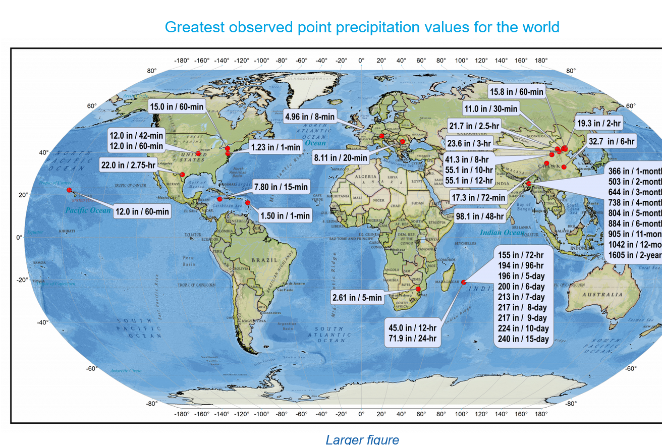
https://weather.com/storms/severe/news/2024-07-17-united-states-record-rainfall-24-hours-50-states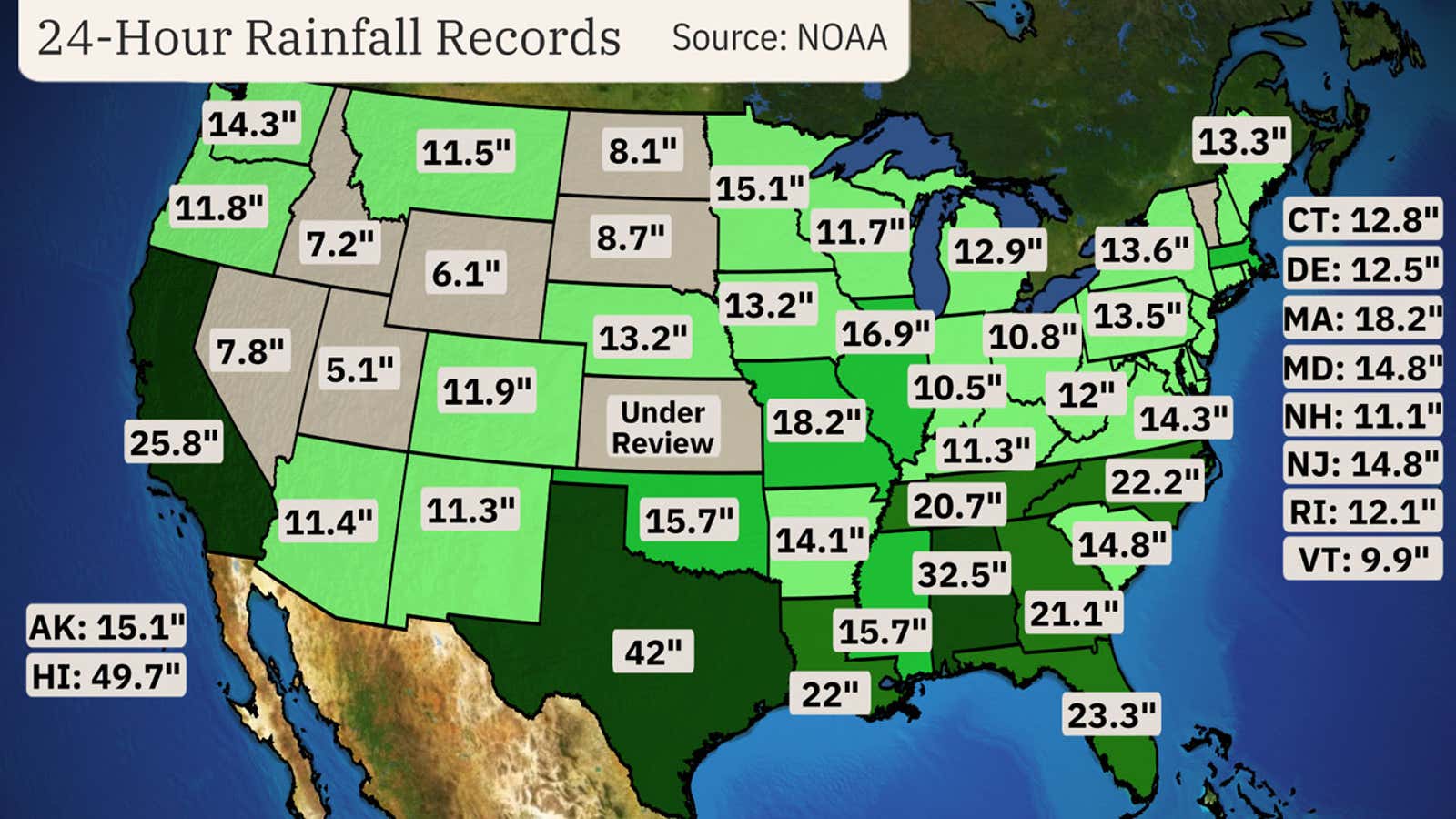
The highest 1 day total from this event was close to 8 inches. That's an incredible amount of rain in just 24 hours from 1 spot but still not a record for the state of Indiana.
The 2 day total close to 12 inches in 1 spot might be a record but I can't find that one right now.
Here's another source:
%202-DAY%20OFFICIAL%20RAIN%20NUMBERS%20are%20in%20for...%20-%20Meteorologist%20Ryan%20Morse%20Facebook.png)
We got 2.1 inches in our rain gauge in the southwest corner in an hour on the 12th even though this map shows 1.3 inches, so its possible that there were spots with even more rain than this.
Another round of heavy rain where it’s not welcome. Might as well keep the same thread going since it already has the links to cover the same areas.
Sorry for the excessive length.
We got another 2.1 inches overnight. Last week's heat accumulated alot of GDD's and caused heat fill for the corn which doesn't need any more rain this year in this neck of the woods.
The beans might benefit slightly from 1 more rain but they are basically made too.
Eric shows 15-17 inches had fallen at the head waters of the Whitewater River on Aug 12.
Aug 19, 2026: Excessive Heat South | Flooding IL/IN | Smoke Northwest | Models Hinting...
at 1;29
Highest on record flood
West Fork Whitewater River near Alpine
3rd highest at Brookville and highest since they built the flood control dam at Brookville
Thanks a ton, cutworm!
We're having another heavy rain event tonight in some of the same places but more PROGRESSIVE.
The ground is saturated so it's not taking much additional rains to cause excessive running and flash flooding.
This should be the last big rain event for the next 10+ days.
You can use the same links above to track tonight's event!
Excessive rain threat.
https://www.wpc.ncep.noaa.gov/qpf/excess_rain.shtml
Current Day 1 Forecast
%20Interactive%20Display.png)


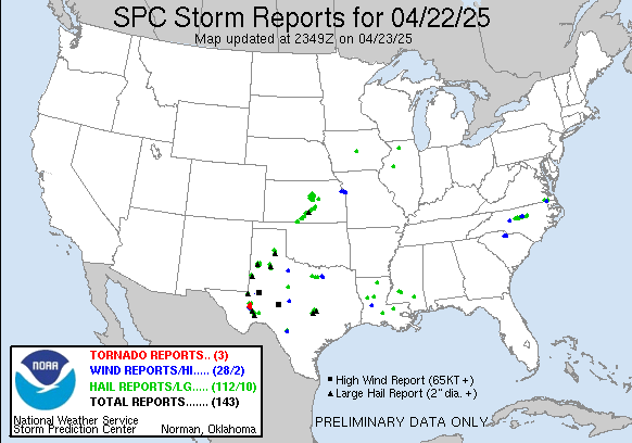
 Weather Map