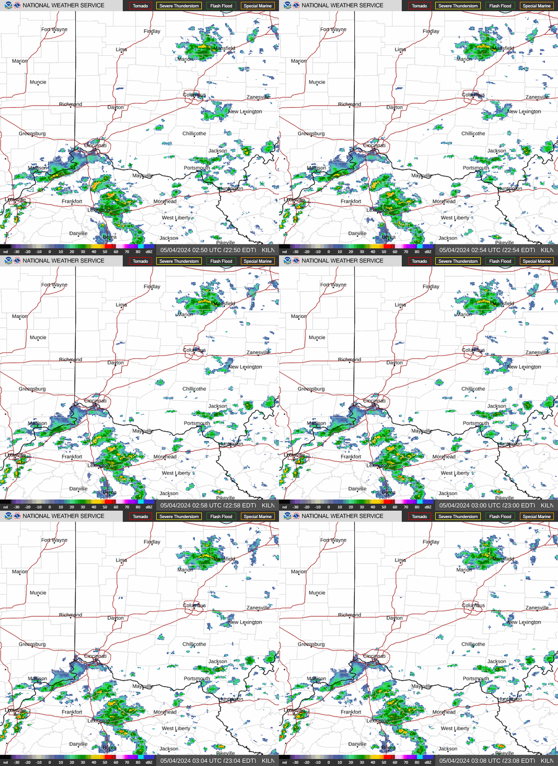
Initially, I was going to just add this to the previous thread;
Severe storm risk 7-26-2026
13 responses
https://www.marketforum.com/forum/topic/121857/
Since both days are sort of the same pattern(a heat ridge with perturbations/waves around the periphery that get coupled with lower level inflows and convergence that generate huge clusters of storms.
Instead, readers don't have to scroll 5 miles down, thru yesterdays stuff to get to today's coverage.
Get all the comprehensive weather here:
https://www.marketforum.com/forum/topic/83844/
Current Hazards at the link below.
For your NWS and county, go to the link below.
Then you can hit any spot on the map, including where you live and it will go to that NWS with all the comprehensive local weather information for that/your county.


Indianapolis NWS:
Indianapolis, IN
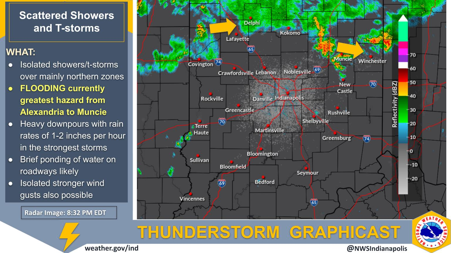
Severe thunderstorms are developing and moving SSE into central Indiana. All hazards are possible, but storms are expected to trend toward a widespread damaging wind event. Remain weather aware this afternoon!
Use this link to get a heads up from the Storm Forecast Center on potential areas that will have a watch issued, in addition to updates during current watches on the progress of storm activity.
https://www.spc.noaa.gov/products/md/

https://www.spc.noaa.gov/products/md/md1769.html

https://www.spc.noaa.gov/products/md/md1770.html

This was the last severe thunderstorm watch issued earlier this afternoon, valid until 9pm. There's a decent chance that a NEW watch will be issued outside this box, depending on where the storms are tracking.
Good chance that area will be south of this watch box and include Evansville again because these storms are moving with such a dominant north to south component.
We got 1.4 inches of wonderful rain yesterday and are good for the next week and got lucky to miss out on the 100+ reports of damage, mainly to our south in KY.
https://www.spc.noaa.gov/products/watch/ww0521.html

The Storm Prediction Center has extended the enhanced, level 3 of 5 risk down to southern IN. Mainly for high winds NOT tornadoes.
https://www.spc.noaa.gov/products/outlook/day1otlk.html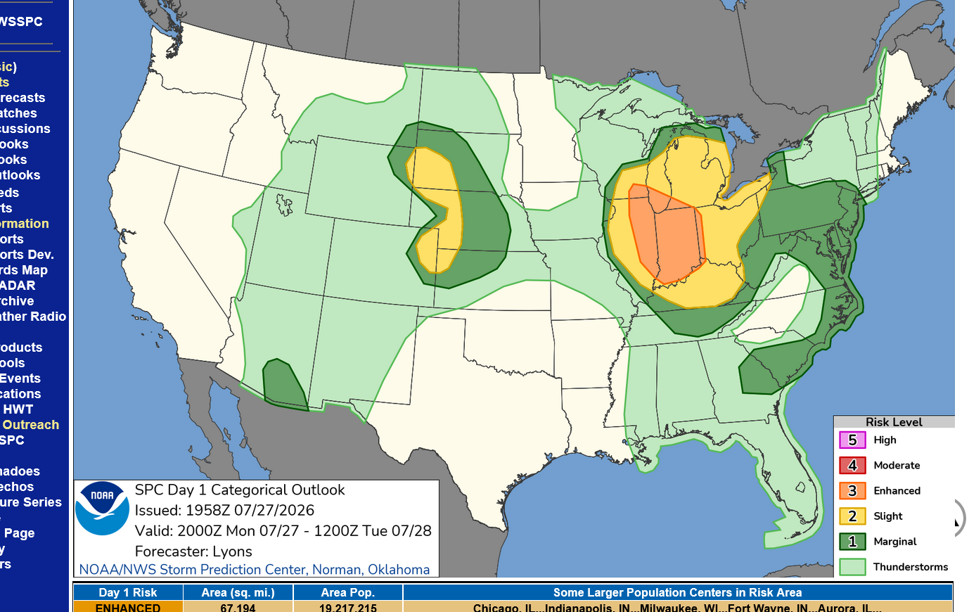
If a warning is issued with these kind of storms, stay inside of a building with a foundation, away from windows until the storms pass. You'll be OK.
Being in a mobile home during a severe thunderstorm is a risky venture. Most people will be ok but this is NOT a safe place to be like it is in a permanent structures.
Lightning kills as many people as tornadoes so don't be outside unless necessary! You are safe inside of a car which is grounded if struck by lightning.
Try to avoid driving on roads with tall trees on either side during a strong thunderstorm if you must be out.
If you are driving at XX mph on the road, a tree can suddenly fall in front of you or on top of you before you can stop.
If anything, like we got here yesterday, this will mostly result in a great rain for cutworm in southeast, IN as well as many producers in IN.
https://www.spc.noaa.gov/products/watch/ww0522.html

I watched ABC Nightly News tonight.
They led with this weather and made it out to be an apocalypse.
Let me tell you something as a meteorologist. There is nothing that unusual about this weather.
We've had this much severe weather in a day 1,000 time since I started forecasting weather over 4 decades ago.
It's excellent to cover it, even better to prepare people for it using our mind boggling technology.
It's best of all to teach people about it, enlightening them by sharing science. Most importantly, in doing so, stay tethered to realities that don't use it for ratings or self serving agenda(like a fake climate crisis)!!!
Even though I watch and enjoy ABC News most nights, they and most of the media GREATLY exaggerate weather when its just typical weather to boost their ratings. And they distort it to promote a fake climate crisis.
As a meteorologist, of course I will lead with weather on MarketForum. It's what I do. While I appreciate ABC News giving so much time to weather coverage as their top story, they aren't warning people or educating people. They are sometimes taking weather events THAT ALREADY HAPPENED and sensationalizing them to the max on slow news days for ratings.
There are very legit times to make the weather a top news story. Lots of them, in fact.
But to the average viewer, it's tough to tell the difference in how they cover those justified top/lead weather stories and how they depict a bunch of strong storms or minor flooding.
The reason this is especially bad is that it's creating additional fear/anxiety in people that have severe weather phobias(there are millions).
When those people are bombarded with news on many nights of trees falling on cars or houses damaged by a tornado or flash flooding or mud slides........events that appear as life threatening in our world, it conditions minds viewing that to think it represents 100 times more of the frequency of what it really does.
In July, their favorite coverage is heat waves. It's all major life threatening. We all need to stay inside and cancel activities. I get that some of this heat really is life threatening but they completely lack the ability to accurately communicate to viewers, the difference between legit, life threatening heat/humidity from sensationalized heat/humidity for ratings.
If 99.99% of the country has non life threatening weather, they will intentionally seek out and find the .01% and make it the top story.
And sometimes, it's not even life threatening but tv stations know that sensationalized weather helps boost ratings because its so visual.
++++++++++
I was chief meteorologist at WEHT in Evansville from 1982-1993.
We were constantly reminded(news, weather and sports and reporters) that our jobs were to get as many people to watch our news as possible.
TV stations are for profit companies that generate revenue by selling commercials/ads. The amount of money you make selling commercials has a lot to do with how much money you can charge. The more people you have watching, the more money you can make on every commercial compared to less people watching.
As an employee at Gilmore Broadcasting for 11 years, our job was to make money for the owner, Jim Gilmore by getting more people to watch our news.
There are many dozens of ways to do this. Thankfully, most of them involve broadcasting credible, comprehensive and relevant information for viewers that would cause them to watch us on a regular basis.
Being a likeable personality is the best way.
However, as an independent scientist in July 2026 concerned with sensationalism and using weather/climate to scare people for ratings and climate crisis agenda, I'll just speak out with this message to point it out!
Now back to the severe weather event
Been waiting for some sort of signal from the Storm Prediction Center on what their plans are for additional watches later this evening and just got a signal for a likely watch EAST of Evansville.
https://www.spc.noaa.gov/products/md/md1774.html

No indication if they are considering a watch west of this targeted, higher risk area. I would assume that our risk is LESS but they may be just monitoring.
Just a reminder that the main threat is wind gusts above 60 mph and NOT tornadoes. Any isolated tornadoes that managed to spin up in this environment would be LESS THAN 100 mph. Those rarely cause deaths and never if you are inside a sturdy building away from windows(not even in your safe spot-just inside).
Mobile homes are not safe. Almost everybody that rides out a severe thunderstorm in a mobile home will still be ok. But not always.
In a building with a foundation you will ALWAYS be safe in a severe thunderstorm, even with weak tornadoes.
Violent tornadoes with 150+ mph winds are the events to get in the basement for. In the current situation, that type of tornado IS IMPOSSIBLE. The jet stream isn't strong enough to physically cause that.
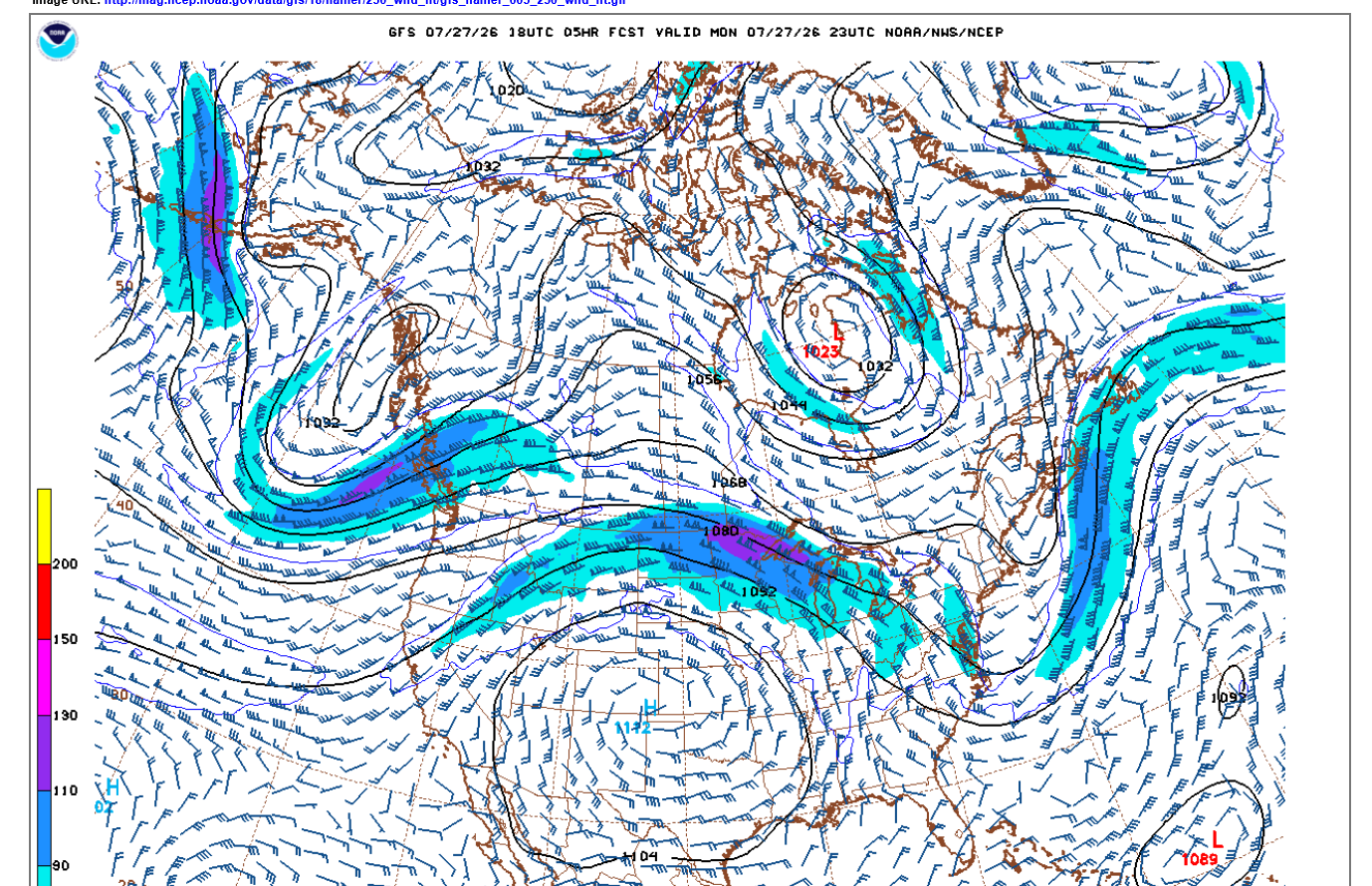
This is the current jet stream, winds at 250 mb at over 36,000 feet. Much higher in the Summer because the warmer air (less dense) greatly expands the atmosphere.
The jet streak/core is pretty strong by Summer standards and that area, with horizontal winds close to 130 mph(110 knots). That area is denoted by the color scheme on the left.
That jet stream is capable of generating a strong tornado. It usually takes a much stronger jet stream but its not impossible for a fairly strong tornado to happen closer to the Canadian border.
When we have violent tornado outbreaks, the jet streams will often be approaching 200 mph or stronger.
Farther south, in Indiana the upper level jet stream is LESS THAN 90 mph. Any isolated tornadoes are not likely to exceed that speed/strength.
Note the winds barbs that this level in the STEERING currents. On the east side of the upper level heat ridge in the Plains, they are almost due south...........and that's exactly the direction these storms are taking.
This is an odd development. Instead of the SPC issuing another watch farther south or ADDING us to the current watch, they've decided to include us in the watch box update.
The problem with that is that almost NOBODY reads the mesoscale updates. Almost everybody follows the formal watch boxes. Whether from the local NWS or the media/internet.
Almost nobody realizes that for all practical purposes. the SPC now thinks that we have the same risk as those to our north in the formal watch box.
https://www.spc.noaa.gov/products/md/md1775.html

As mentioned earlier, the risk of an isolated tornado would be for a tornado of 90 mph or less. Severe thunderstorm winds are the main threat.
If you live in Evansville, consider yourself in the severe thunderstorm watch!!
There are numerous severe thunderstorm warnings in the Vincennes area and a tornado warning for a radar signature not an actual tornado on the ground.
These storms are moving almost due south and will be approaching the Ohio River by 10 pm. Good chance for a couple of them (isolated?) to still be severe then.

OK the Storm Prediction Center must be reading MarketForum
15 minutes after that last post scolding them they did actually issue a new watch box to include Evansville!
The time stamps on MarketForum are EDT and the the SPC is on CDT with their watch box.
https://www.spc.noaa.gov/products/watch/ww0524.html
Basically nothing new to add to previous thoughts, just passing along the formal watch box. These storms will be thru Evansville before 10pm.
For those that fret about going to bed when severe weather threatens, fear not unless you live in a mobile home.
Being in a permanent structure means you'll be safe in a severe thunderstorm. Even in your bedroom sleeping!

The storms completely died out much faster than expected!
 Weather Map
 Local Radar