10pm: Fresh update by the SPC to pinpoint the high risk areas and reduce the risk in Evansville
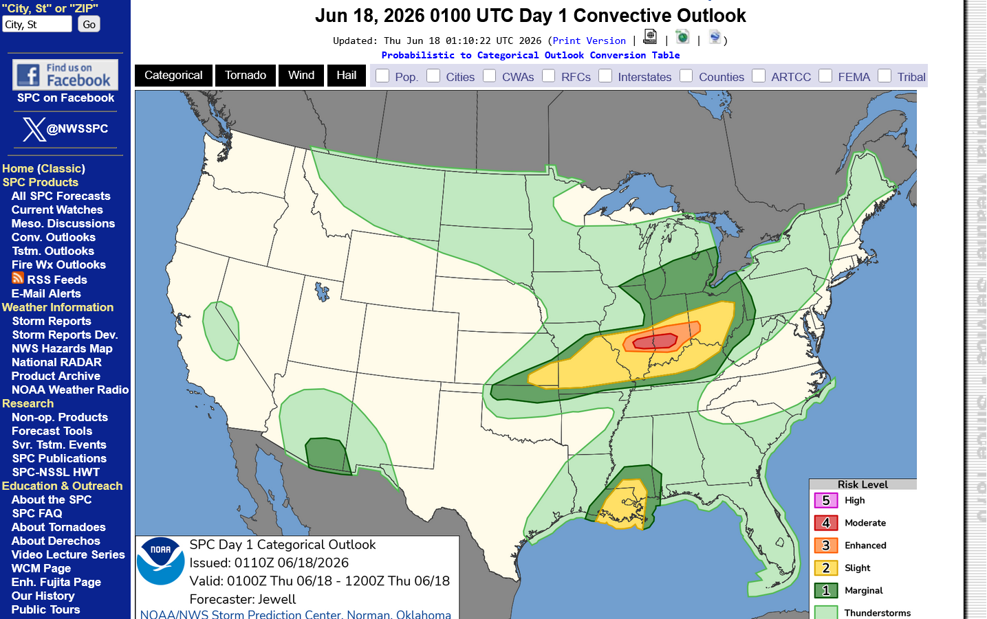
The Storm Prediction Center has shifted this zone of risk much farther south this afternoon. Evansville is now in the enhanced risk for strong storms and tornadoes that should arrive here around midnight or so.
The main risk for a strong tornado is north of Evansville but that can't be ruled out this far south.
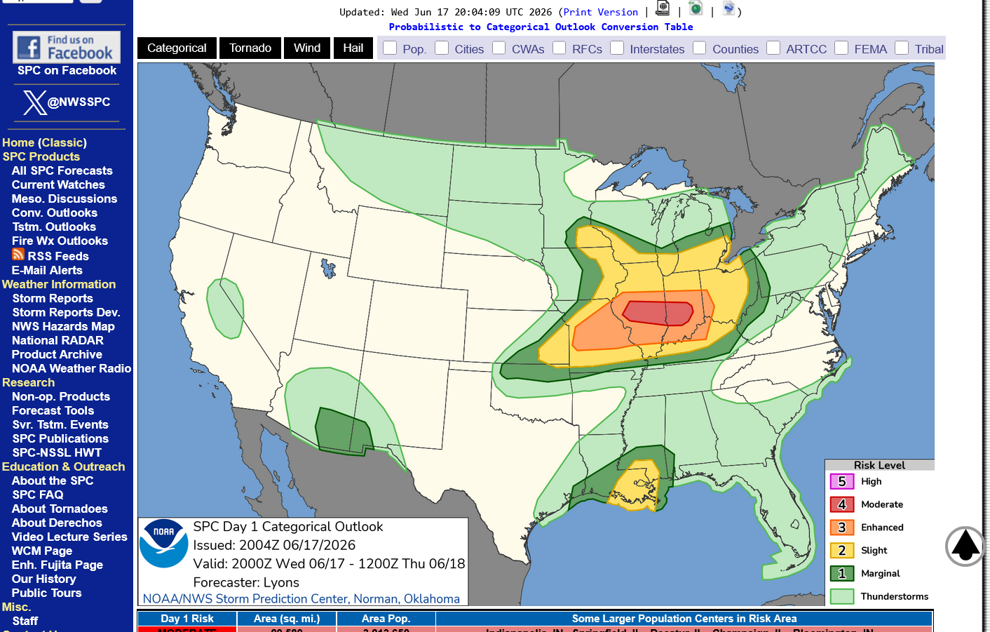
Violent tornadoes are possible on Wednesday, mainly in the red/moderate risk zone but also in the orange, enhanced color!
https://www.spc.noaa.gov/products/outlook/
https://www.weather.gov/media/ewx/iwt/SPC_WPC_Differences.pdf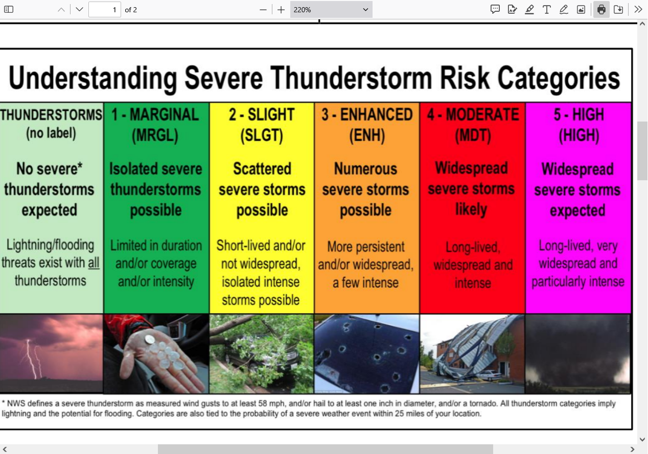
UPDATED RISKS BELOW:
Wind threat below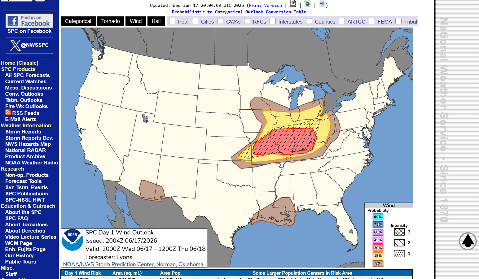
Tornado threat below
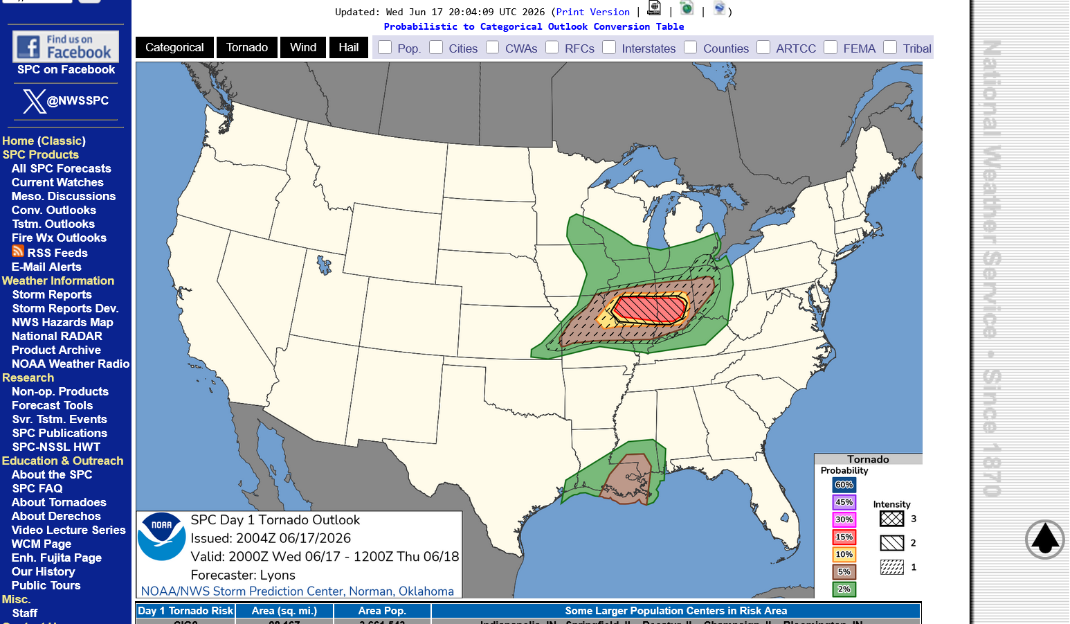
The type of tornado possible in the moderate risk zone is an EF3+. This means 165 mph+.
Enhanced Fuita scale.
https://en.wikipedia.org/wiki/Enhanced_Fujita_scale
| EFU | Unknown | No surveyable damage |
|---|---|---|
| EF0 | 65–85 mph | Light damage |
| EF1 | 86–110 mph | Moderate damage |
| EF2 | 111–135 mph | Considerable damage |
| EF3 | 136–165 mph | Severe damage |
| EF4 | 166–200 mph | Devastating damage |
| EF5 | >200 mph | Incredible damage |
Here's the deal on wind and damage.
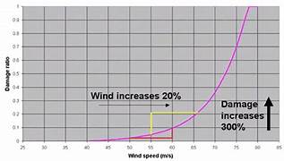
As wind increases the damage massively increases on an exponential scale. This applies to ALL wind.
Severe storms, hurricanes and especially tornadoes that have the strongest winds of all, which means the tornadoes with winds over 150 mph have incredible damage.
+++++++++++
+++++++++++++++++++++
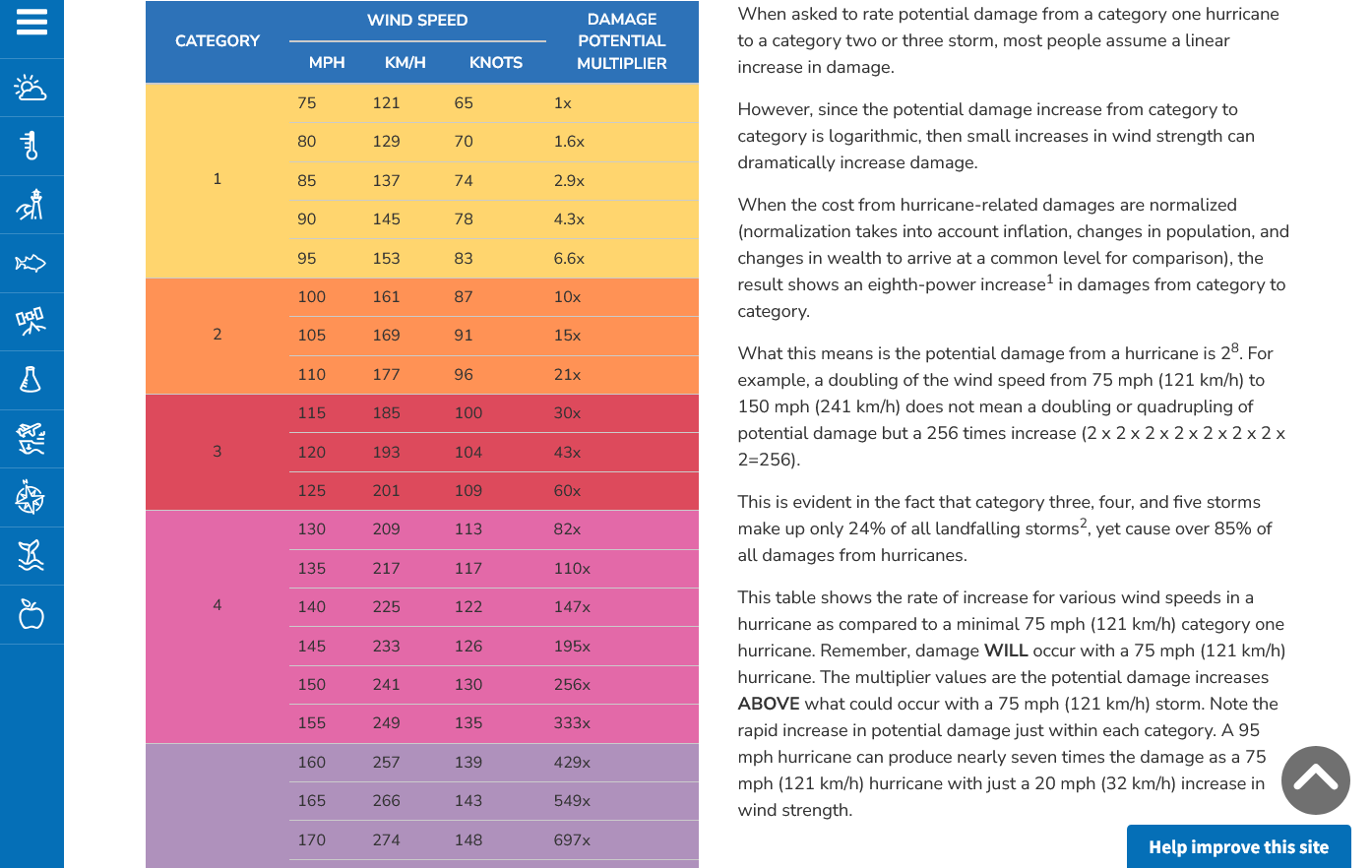
A 150 mph wind does 256X more damage than a 75 mph wind. Let's repeat that. A 150 mph wind does 256x more damage than a 75 mph wind!
Hurricane Damage Potential
https://www.noaa.gov/jetstream/tc-potential
++++++++++++
Less than 1% of tornadoes are F4 or F5 but they kill 67% of the people!
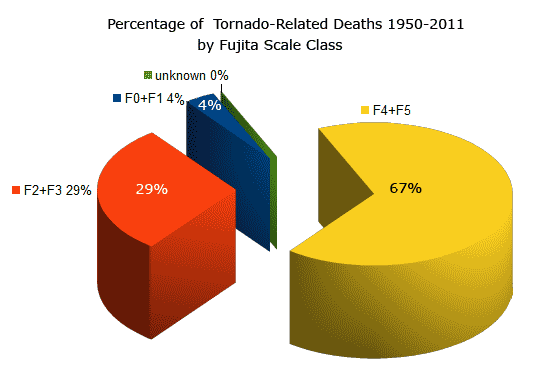
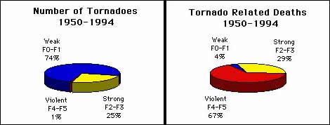
Note that the majority of tornadoes, F0 and F1= 74%(on the old scale) only killed 4% of people and they were probably outside or in a mobile home.
The F4 and F5's were just 1% but caused 67% of deaths.
+++++++++++++++++++
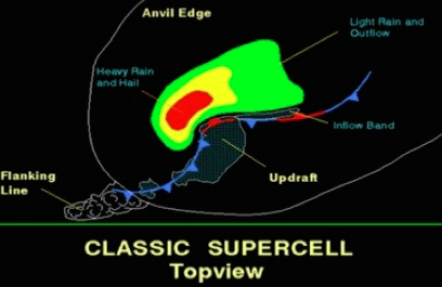
https://www.weather.gov/ama/supercell
++++++++++++
Excellent presentation at this link below that describes the different types of tornadoes and the damage they cause. Keep in mind that the EF4 and EF5 tornadoes are extremely rare. Less than 1% of tornadoes are this strong.
The EF4 and EF5 tornadoes will usually have the HIGH, level 5 risk earlier that day.
Mike Simon Tornado Damage Intensity; Enhanced Fujita Scale
Powerful jet stream aimed at this area to lift the air with gusto and also cause wind sheer and spin for tornadoes.
Jet streak of 130+ Knots(pink) which is ~150 mph.
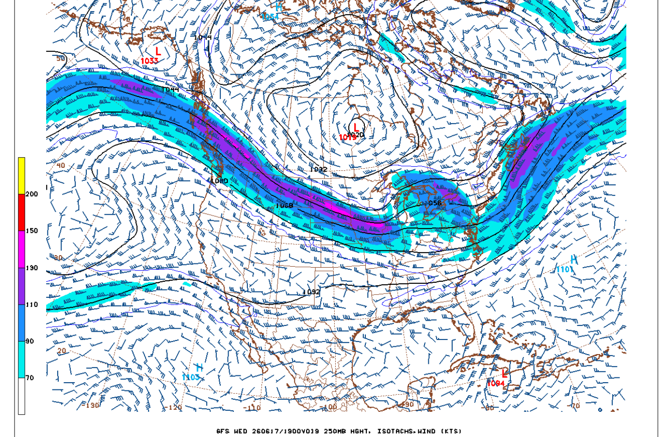
When will those highest risk times be? We will know and identify them WELL BEFORE it happens.
1. When the Storm Prediction Center has at least a moderate, level 4 out of 5 risk. When they have a 5 out of 5 high risk, it's imperative to stay tuned during that type of severe weather outbreak and be ready to act, while still keeping in mind that even during the worst tornado outbreaks, what we are doing is REDUCING the risk of being killed by a tornado from a very small number to a MUCH SMALLER number by taking actions.
2. The Storm Prediction Center will use this verbiage: "This is a particularly dangerous situation".
We know what conditions cause those type of tornadoes with high confidence days in advance but will NEVER be able to predict them with pinpoint accuracy until the storms causing them are in progress,
All tornadoes are absolutely NOT CREATED EQUAL!!!
The total lives lost from 1,000 EF0 tornadoes might not add up to the lives lost from just 1 really bad EF5 tornado!
A 150 mph EF3 wind has 256 times more damaging power than a 75 mph EFO wind!
A 225 mph EF5 wind has 256 X 256 times more damaging power than a 75 mph EFO wind!!!!
65,000 times more damaging power in a strong EF5 tornado compared to an EF0 tornado!!!. That's not a mistake or typo in the math.
That's based on physical laws and tens of thousands of surveys of tornado damage which were used to contruct the Enhanced Fujita tornado scale.
Mike Simon Tornado Damage Intensity; Enhanced Fujita Scale
https://www.youtube.com/watch?v=p-653tSCB68
++++++++++++
Understanding this in 2026 and having the technology to warn people long before the life threatening weather makes it a much, MUCH safer world compared to 100 years ago. People in that age found out about the strong tornadoes or other extreme weather events...............when they were actually getting clobbered by them!
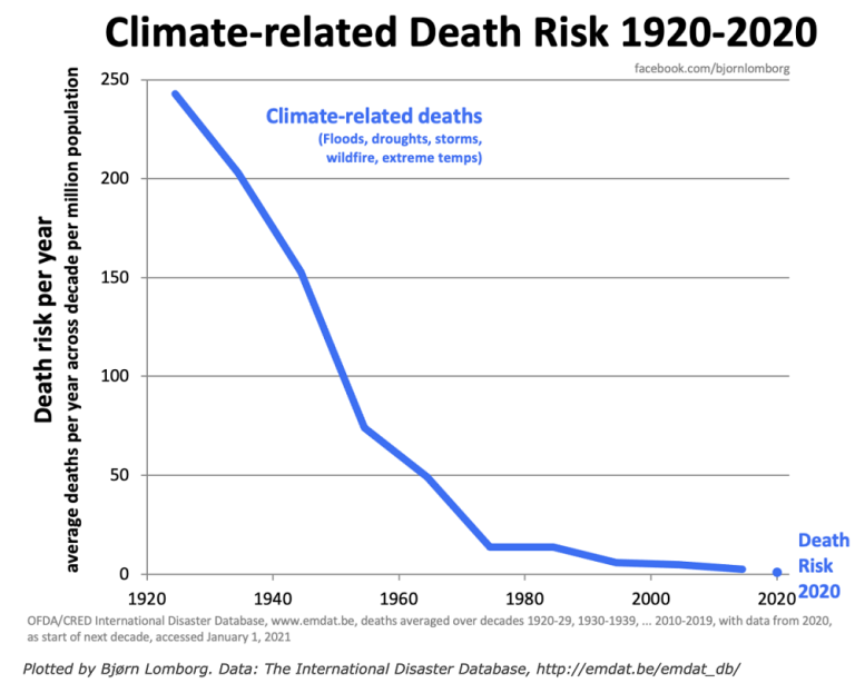
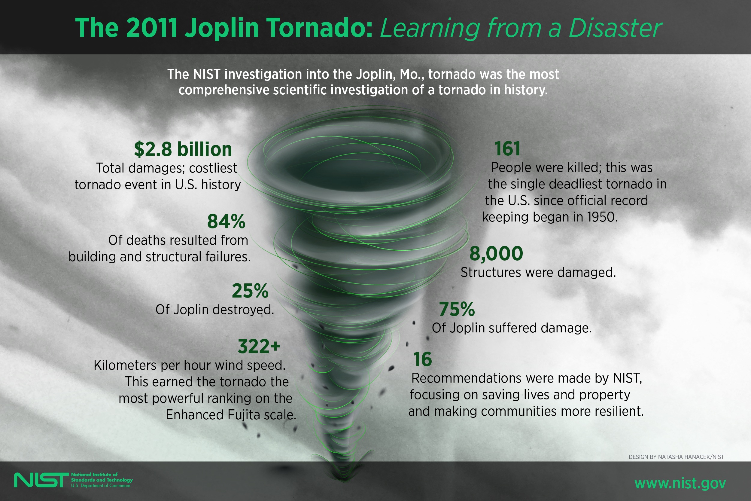
Despite this, there are still limitations based on the worst EF5 tornadoes like the one that struck Joplin, MO in May 2011!
https://en.wikipedia.org/wiki/Joplin_tornado
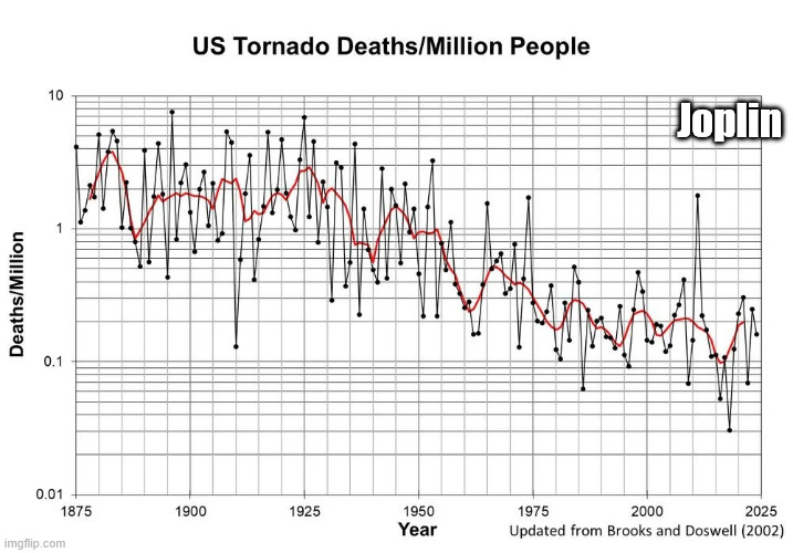
We should note that the scale below is LOGARITHMIC in order to keep the data manageable because of the tremendous drop in values.
The highest numbers on the left top/left that are approaching 10 deaths/million are actually 100+ times greater than the lowest numbers on the right that are LESS THAN .1 deaths/million!
The Joplin tornado in May 2011 caused the huge spike higher and 1 outlying year since the 1970's.
++++++++++++++++++=
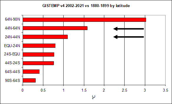
Climate change has been helping too by warming the highest latitudes the most and weakening cold fronts and jet streams! This has reduced the number of the strongest tornadoes by around 50%!
This thread is about TORNADOES not about other impacts from climate change.
May 29th, 2019 by Roy W. Spencer, Ph. D.
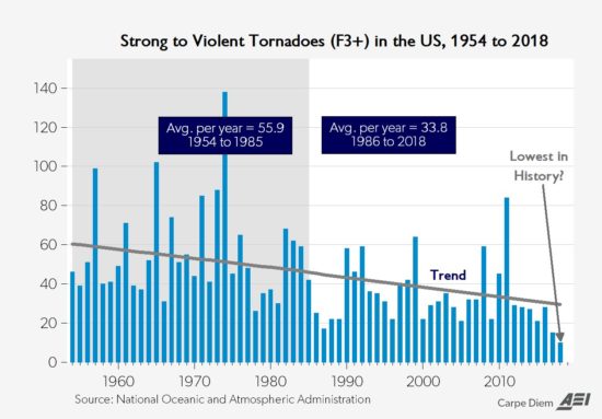
Weather becomes LESS extreme in several realms when you reduce the planets temperature contrast with latitude!
Showtime!
Get all the comprehensive weather here:
https://www.marketforum.com/forum/topic/83844/
+++++++++
Current Hazards at the link below.
For your NWS and county, go to the link below.
Then you can hit any spot on the map, including where you live and it will go to that NWS with all the comprehensive local weather information for that/your county.

This link below provides some great data. After going to the link, hit "Mesoanalysis" then, the center of any box for the area that you want, then go to observation on the far left, then surface observations to get constantly updated surface observations or hit another of the dozens of choices.

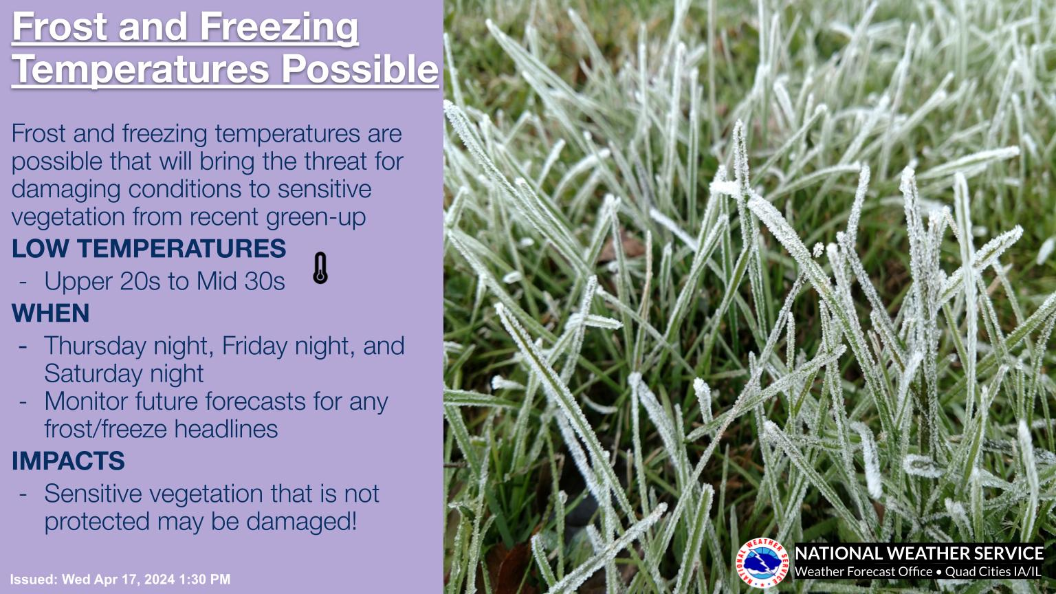
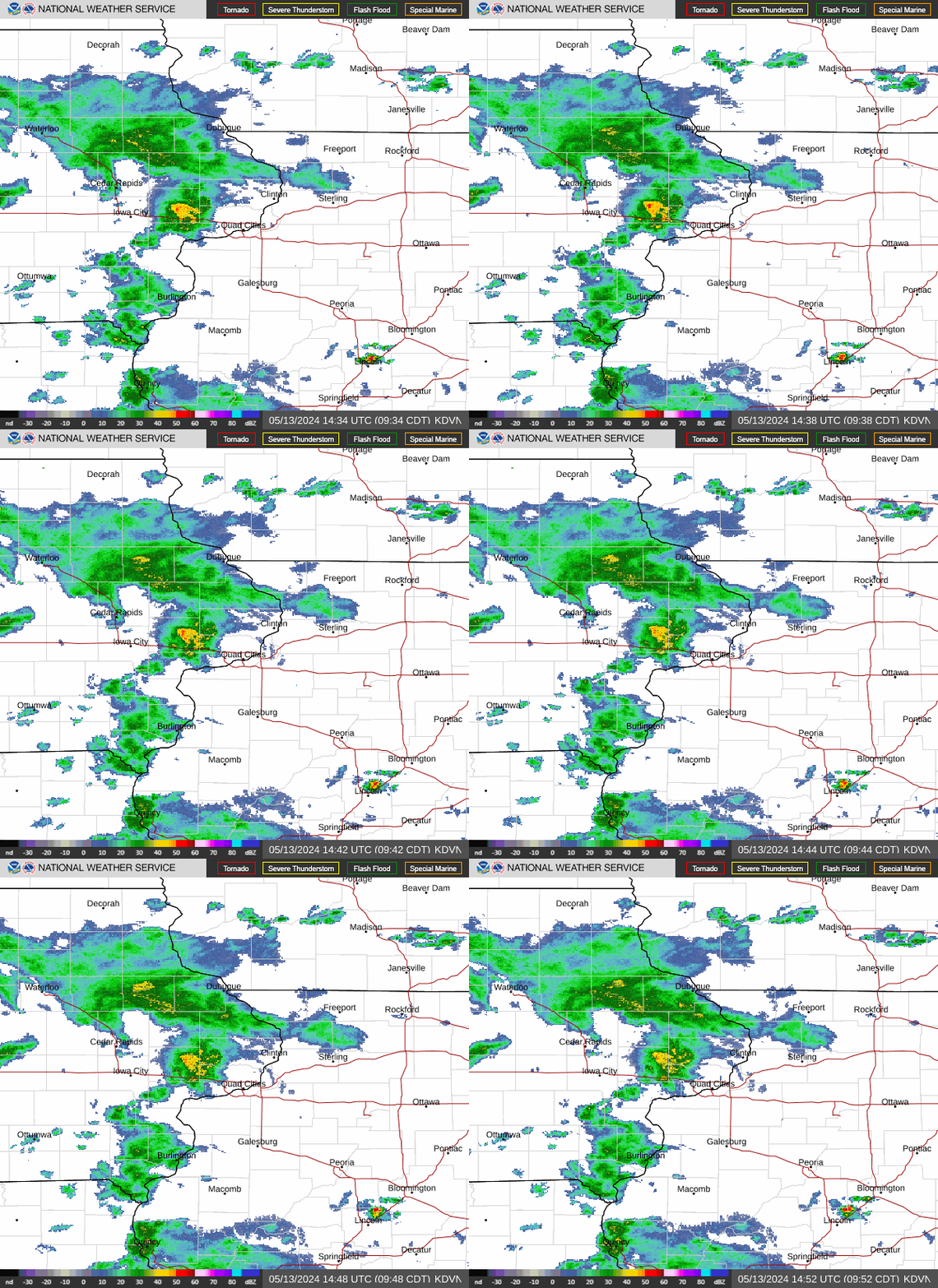
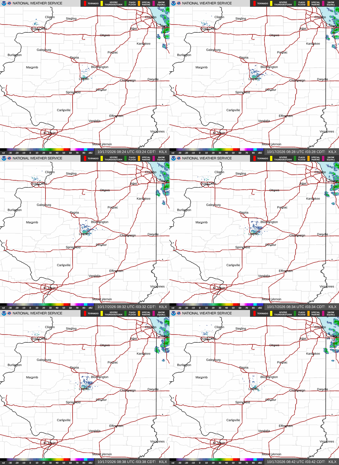
Heavy Rain in Many Areas; Severe Storms SE of QCA
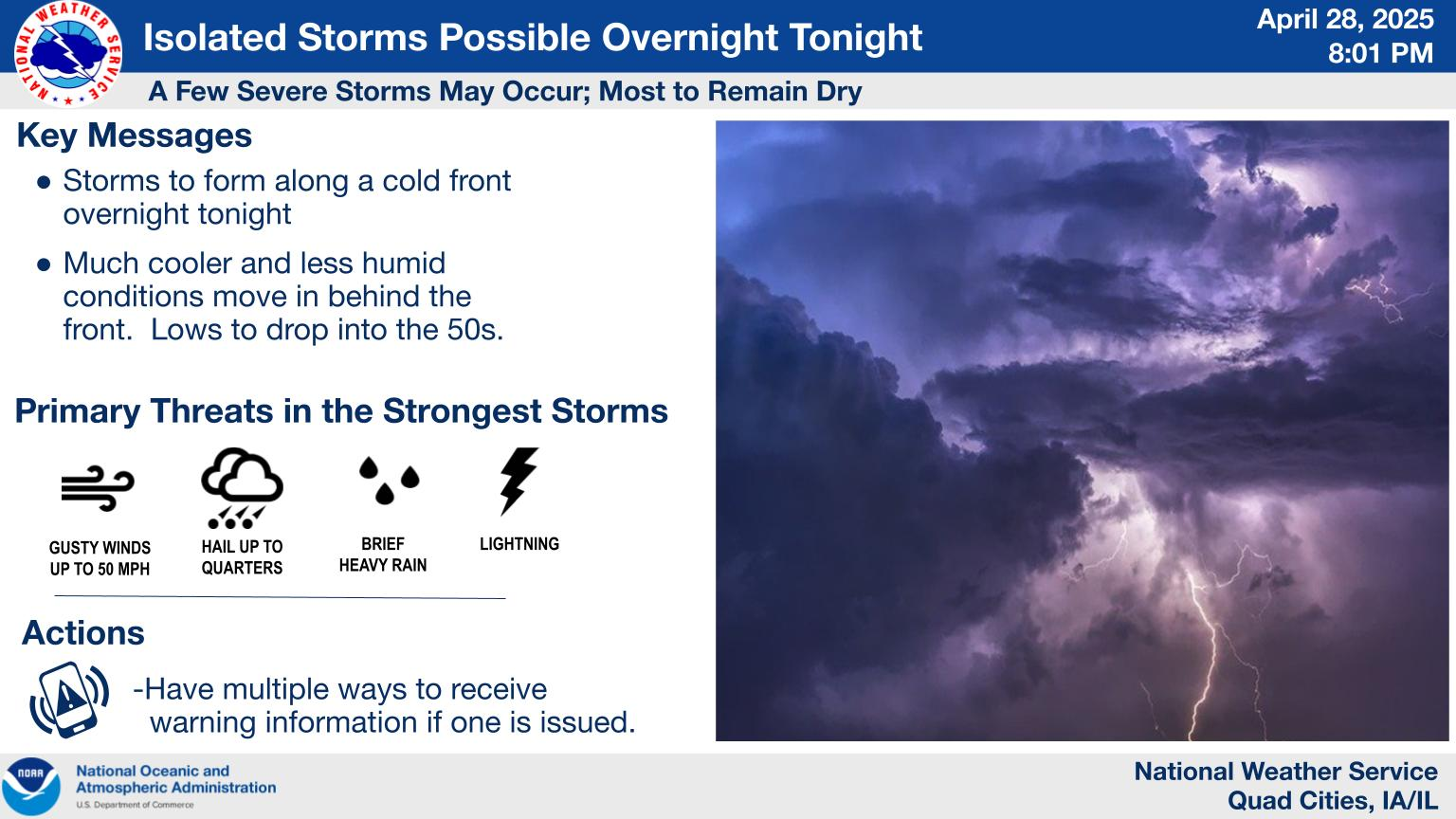
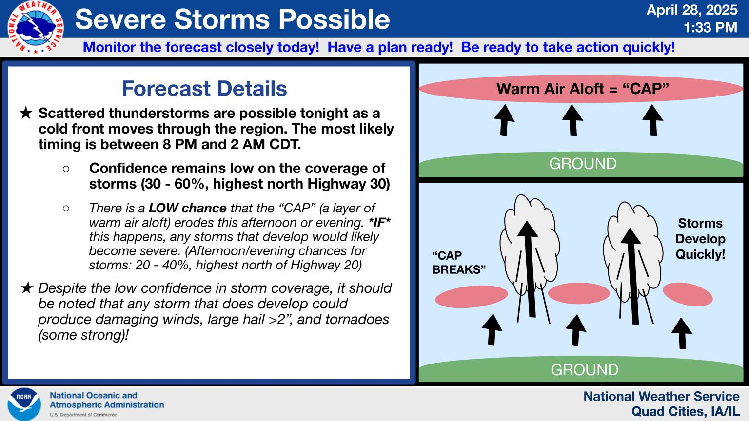
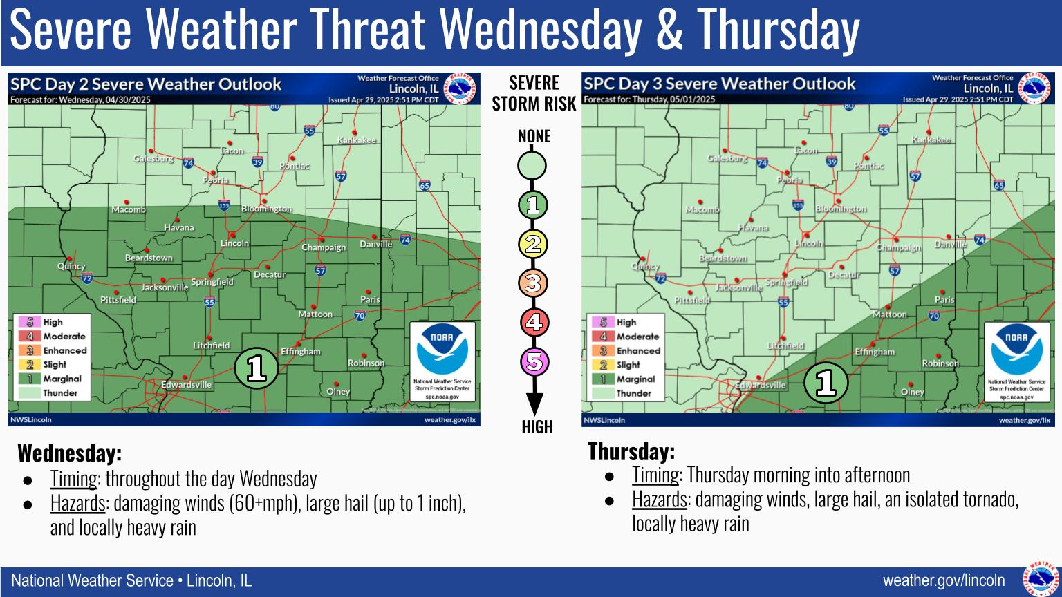
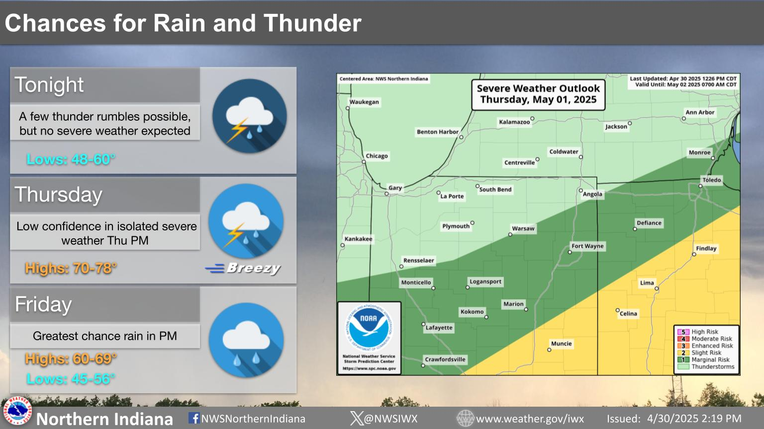
Our expectations for storms through the morning. Remember, when thunder roars head indoors, and keep awareness of issued warnings and heed them!
+++++++++++++++
Click a location below for detailed forecast.


+++++++++++
++++++++++++++++
Click a location below for detailed forecast.
Click a location below for detailed forecast.
Last Map Update: Wed, Jun 17, 202

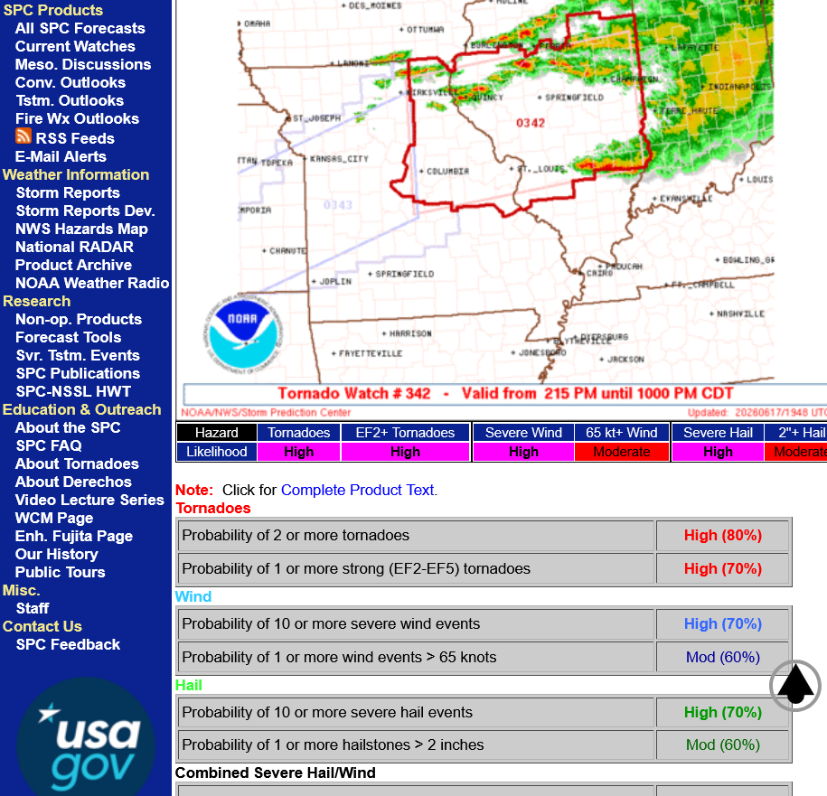
Latest tornado watch below:
https://www.spc.noaa.gov/products/watch/ww0342.html
To get mesoscale discussions that come out, sometimes hours before actual watch boxes are issued, go here:
https://www.spc.noaa.gov/products/md/
+++++++++
Storm reports are here:
https://www.spc.noaa.gov/climo/online/
https://www.spc.noaa.gov/climo/reports/today.html
| < 260616 Reports 260617 Reports > |
| Note: All Reports Are Considered Preliminary | |||||||
| |||||||
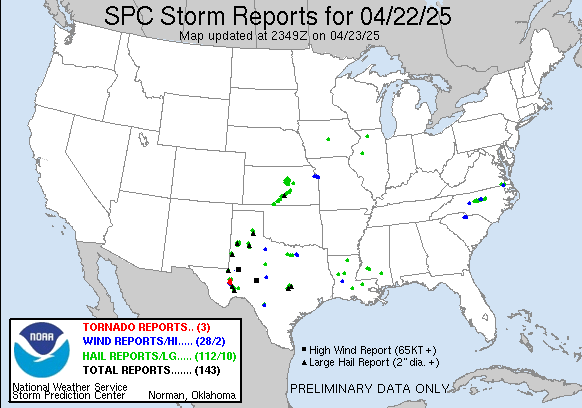 | |||||||
11pm: This map is NOT being updated!!! Missing all the tornadoes in IN and elsewhere
The Storm Prediction Center shifted their severe weather risks farther south late this afternoon:
https://www.marketforum.com/forum/topic/120887/
North Central Illinois 'mere', unneeded light rain. Little wind. Backyard = I80/Ill71
Thanks for that report, tjc! Glad the unwelcome rain was light this time.
Severe storms now in central IL, in the tornado watch box tracking east/southeast. The best news is that so far, we've only had 3 verified tornadoes!
When they do a damage survey, they will likely rule that some of the damage was caused by weak tornadoes based on the damage pattern, so the tornado count will often be revised upwards in the days after a big severe weather event.
Strong tornadoes, however usually get reported when they are happening.
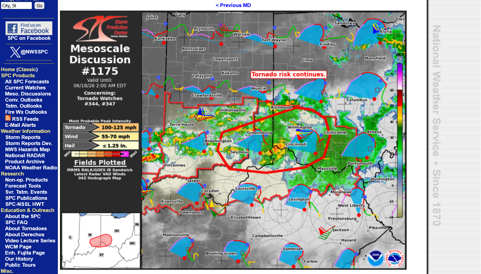
https://www.spc.noaa.gov/products/md/md1171.html

80% chance of a tornado watch for the Evansville area in the next few hours.
https://www.spc.noaa.gov/products/md/md1173.html

Peak tornado intensity to 120-145 mph, which is a strong EF2 rating and even EF3. Bad time for this risk, when everybody is in bed. I would say that in the absence of any actual strong tornadoes or widespread severe weather when the storms approach the Ohio River in 3+ hours, odds will be low for an isolated strong tornado......but not zero.
However, 3 tornadoes were just reported in the past hour(after 8 pm) in the Effingham, IL area which is just over 100 miles northwest of Evansville, so we should be prepared to go to our safe place if these storms are still producing tornadoes around midnight.
https://www.spc.noaa.gov/climo/reports/today.html
++++++++++++++++++
https://en.wikipedia.org/wiki/Enhanced_Fujita_scale
| EFU | Unknown | No surveyable damage |
|---|---|---|
| EF0 | 65–85 mph | Light damage |
| EF1 | 86–110 mph | Moderate damage |
| EF2 | 111–135 mph | Considerable damage |
| EF3 | 136–165 mph | Severe damage |
| EF4 | 166–200 mph | Devastating damage |
| EF5 | >200 mph | Incredible damage |
Martinsville In tornado with heavy debree signal now 10:09
Thanks, cutworm! And for passing on the link with Ryan Hall.
I need to add another NWS farther east to cover areas east of you into Ohio.
We got the expected tornado watch a few minutes ago that covers all the Indiana counties along the Ohio River and extends into southwest OH, including cutworm.
The expiration time is 4am CDT.
https://www.spc.noaa.gov/products/watch/ww0347.html

Ryan Hall Y'all:
https://www.youtube.com/watch?v=60vJuzlaC2g
Max Velocity
Ryan is talking about debris in the air above me 50? miles from where the tornado was. Do you know anything about this?
10pm: Fresh update by the SPC to pinpoint the high risk areas to a narrow corridor and reduce the risk in Evansville down a category to slight.
Storms aimed at cutworm!!! They have been moving more west to east and not so much south so the arrival time in Evansville may be a couple hours after midnight. ....but in WEAKENED FORM.
https://www.spc.noaa.gov/products/outlook/day1otlk.html
cutworm,
Sorry for the delayed response, I was typing the last post when you were sending that. I don't know anything about that.
I think that your source, Ryan Hall has tons of contacts and storm chasers/spotters, along with radar images that I don't and watching/listening to him is exactly the best way to be on top of it. In addition to getting the NWS warnings.
Storms have been moving mostly west to east with only a crawl to their south bound component in movement.
Maybe AFTER 2am now?
The storms along the line that will push into this area are not producing tornadoes so I'm retiring for the night with a post that shows our NWS on the last page.
Still the risk for severe storms and an isolated tornado.

1 more update: looks like this came oit an hour ago.
Note that the magnitude of the potential tornadoes they are predicting has dropped a category to 100-125 mph.
The stability of night time cooling is having a negative impact on the potential strength.
Back up.
The western part of the line of storms has continued to weaken all night to the point of being below severe levels. However, we are seeing new development BELOW severe levels.
Evansville is just now seeing the first rain here at 4:50 am, even with a new line of non severe storms developing farther south in southern IL to northwest KY.
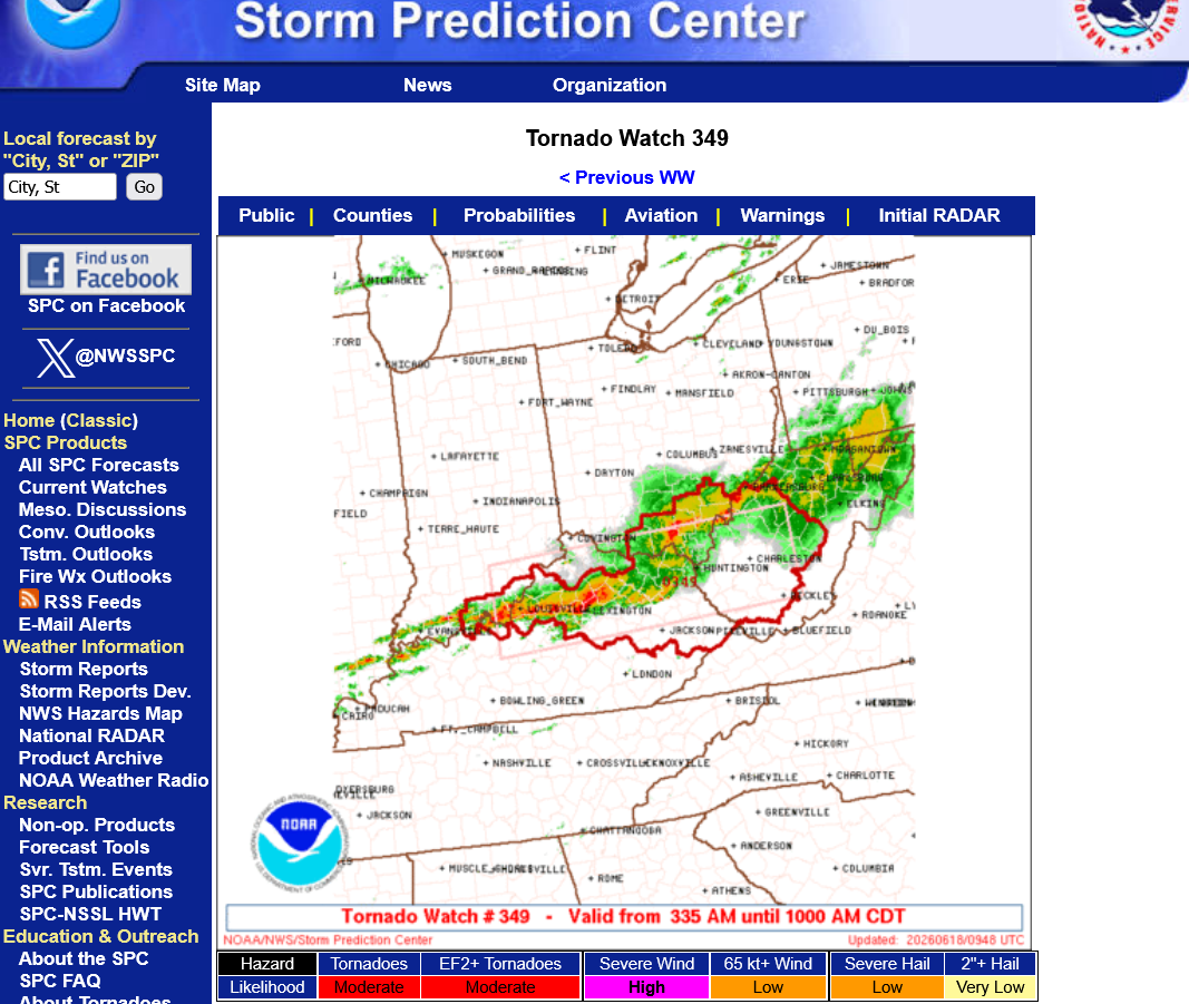
The weakening east sections have maintained enough strength for another tornado watch just over an hour ago that's still in effect until 10am CDT( 11am EDT).
The time stamps on MarketForum are in EDT.
https://www.spc.noaa.gov/products/watch/ww0349.html
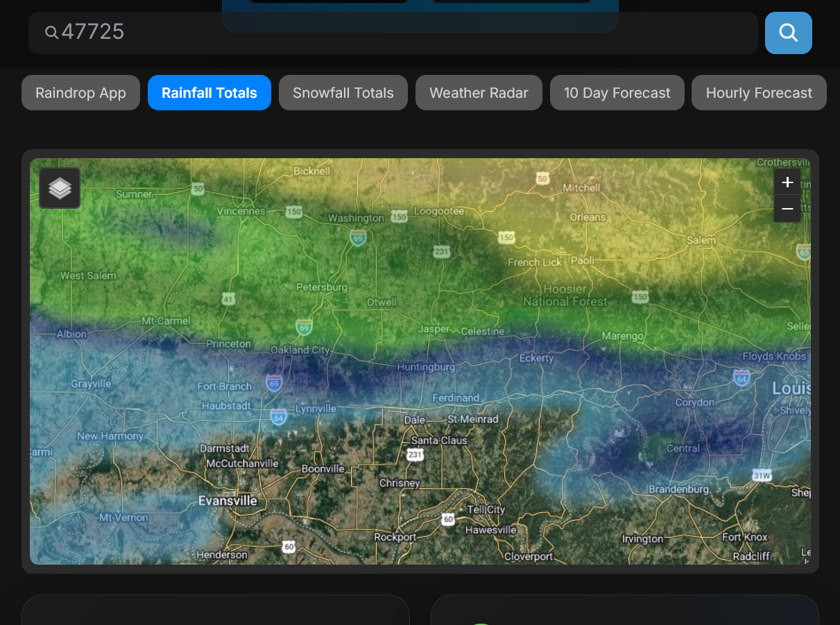
To see how much rain fell at your house the last 24 hours or any other place in the country, go here. Scroll to any place in the country or put your zip code in.
It's updates within minutes of the rainfall. I think it uses NWS automated rain gauges that are are numerous in every county.
It shows .22" from the rain we got just minutes ago at our house, while my rain gauge at our house measured .28. It's usually very close.
6am update: It now shows .31 of very welcome rain but we would love more like 3 inches here!
https://www.raindrop.farm/rainfall-totals/zipcode
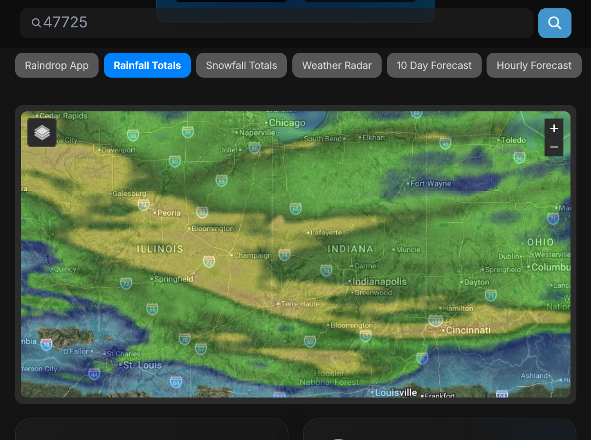
Here's a closer look at how the rains dried up in southwest IN overnight. Evansville, IN is near the southwest corner of the screen.
++++++++++
Get all the comprehensive weather here:
We can see how the severe weather numbers, especially the tornado counted jumped much higher after the NWS did their damage surveys for this event.
https://www.spc.noaa.gov/climo/reports/260617_rpts.html

Damage Surveys
 Weather Map