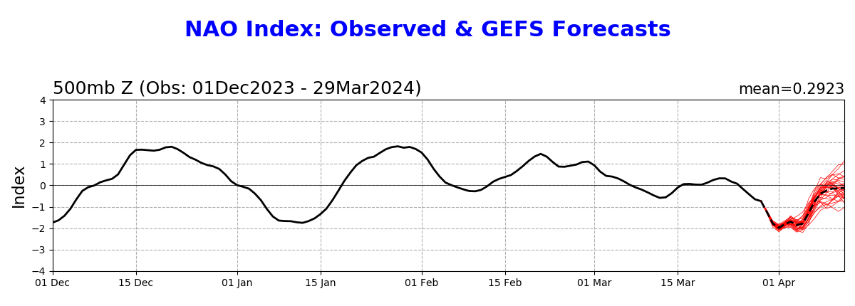
- The 3/29 0Z GEFS run’s mean NAO prediction (see image below) of ~-1.75 for 3/31 is ~tied for the daily record low NAO for all of March (records go back to 1950)! The current March record is -1.75 (3/22/1980). It will also easily beat the current record low for March 31 of -1.3 (1975).
- This run is predicting the lowest NAO to be ~-1.95 to -2.00 (on 4/1). Should that verify closely, it would be a record low NAO (back to 1950) for the entire period covering Feb 15th through April 7th! It will also obliterate the current record low for April 1 of -1.2 (1975).
- This run implies there will be daily record low NAOs March 31-April 2nd and possible daily record lows April 3rd-5th.
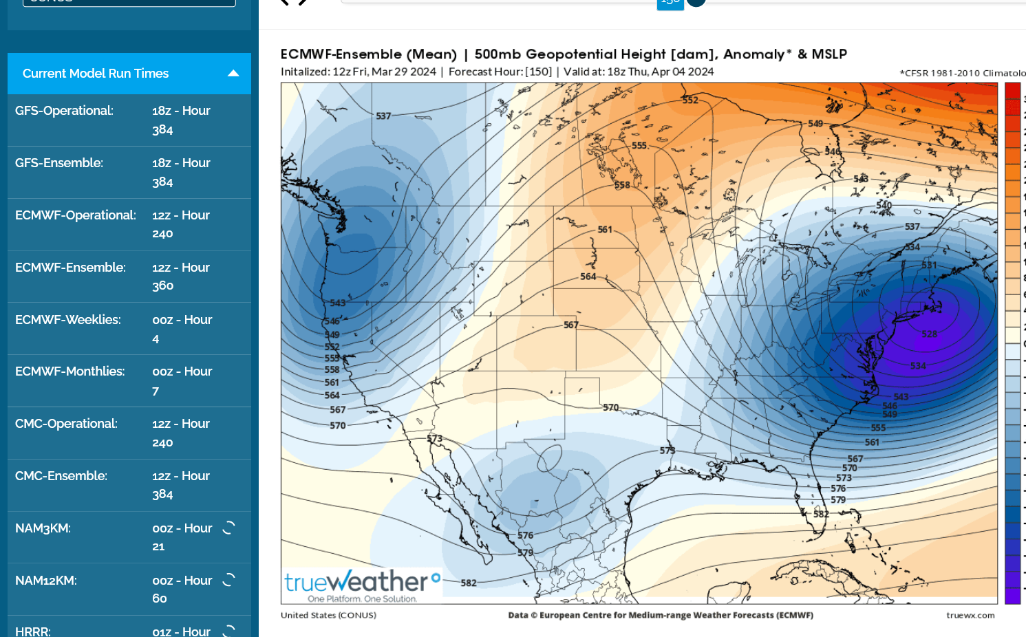
- Related to this, the model consensus has a very strong nor’easter for ~April 4th.
- I don’t know if this is related much to the very strong stratospheric wind reversal that started Mar 4th.
That's one heck of a Nor'easter, Larry!
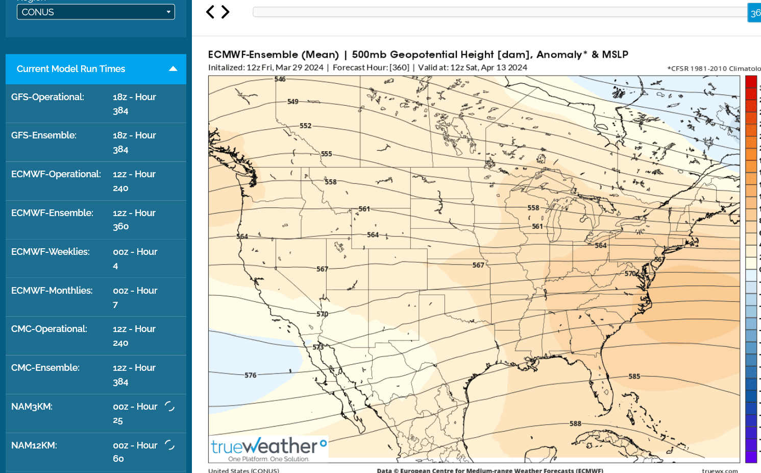
Huge pattern change after this to very mild zonal flow;
Warmer and warmer as expected......and a bit wet too but not excessive rain.
https://www.cpc.ncep.noaa.gov/products/predictions/814day/index.php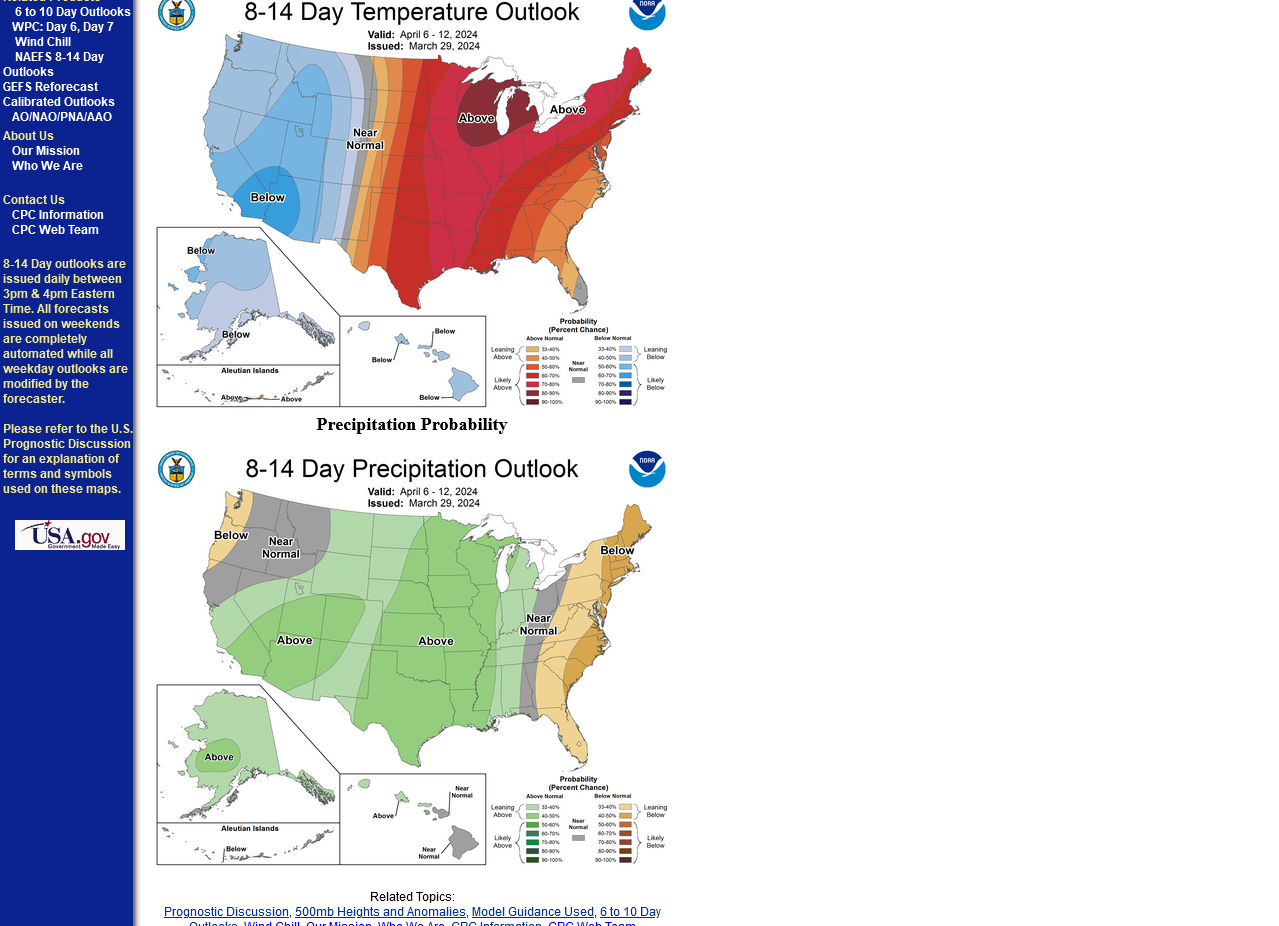
Indeed, it looks to be one heck of a nor’easter in/near the NE US near and just after the middle part of this week. The last few UKMET and CMC runs have had accumulating snow as far south as Long Island due to a further south track than what most other models have had recently. I wouldn’t discount the chance for that far south a track due to the very strong -NAO but we’ll see. There wont be an Arctic airmass in place in advance of the storm unlike was the case 4/8/1982.
Extremely impressive, Larry! Thanks for tuning us into this huge event.
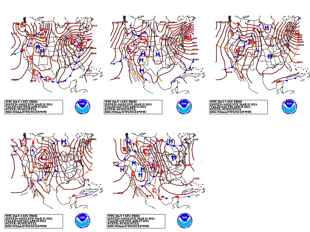
Surface Weather maps for days 3-7 below:
https://www.wpc.ncep.noaa.gov/medr/medr.shtml
As we get closer, we can see the NWS forecast here:
1. Weather map now.
2. In 24 hours and
3. In 48 hours.
https://www.wpc.ncep.noaa.gov/#


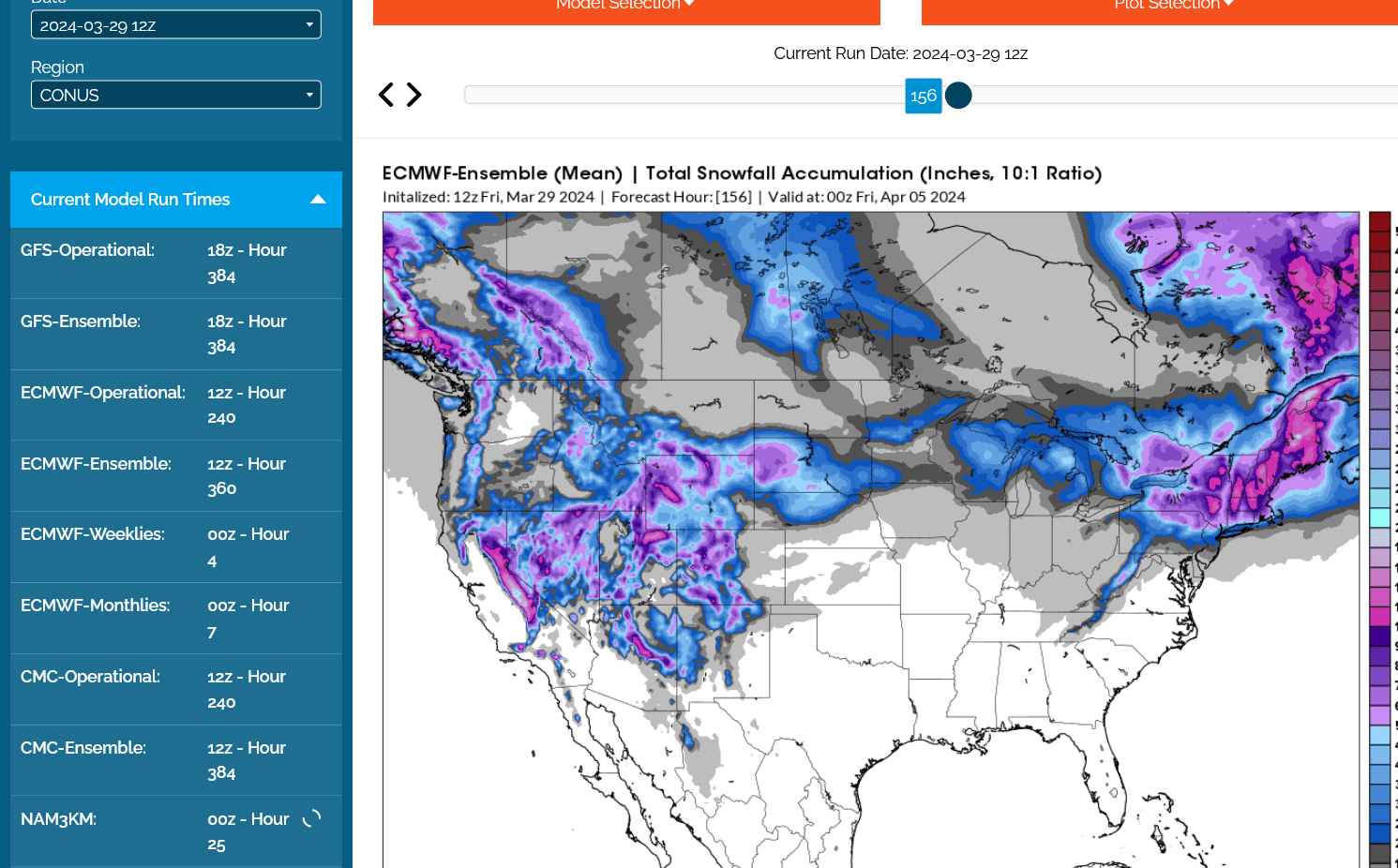
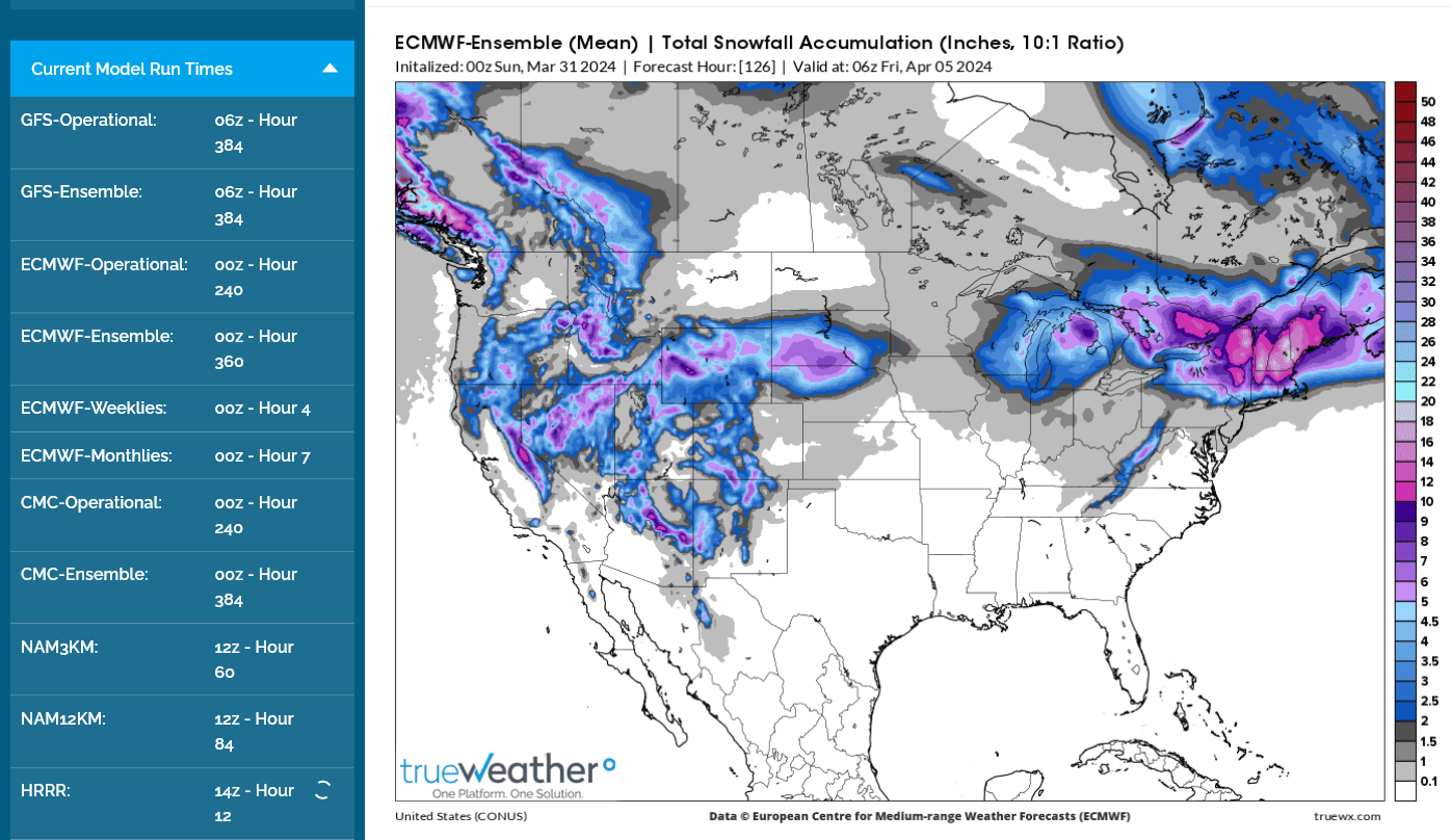
Last 0z European model total snow forecast:
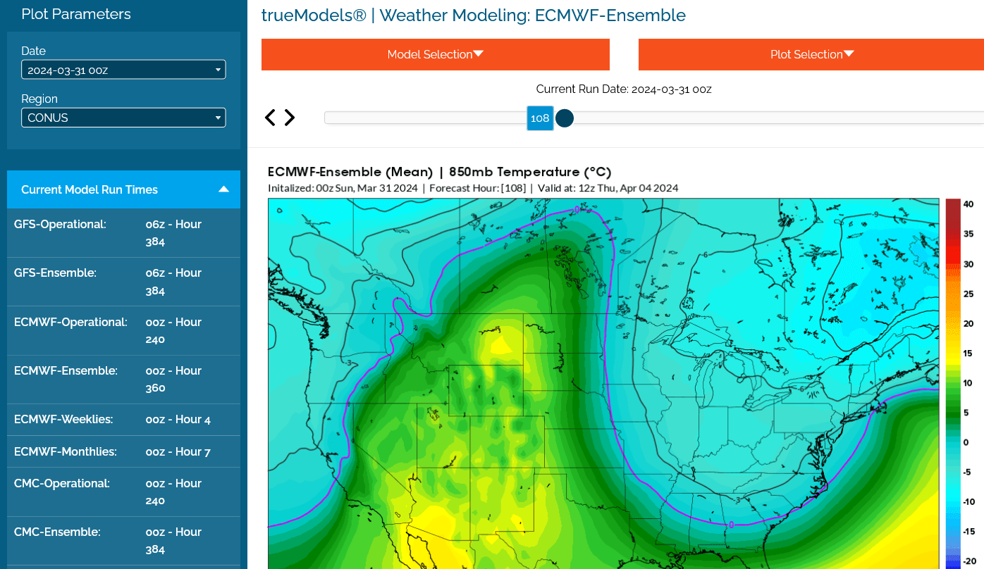
850 mb temperature. Like you said, not Arctic air but cold ENOUGH for snow, at well below 0 Deg. C
More weather here: