This is the start of a thread that will be updated the rest of the week, when I have time. January will be a very snowy month in the eastern 2/3rds of the country with more weather threads like this one.
+++++++++++++++++
Main weather thread here: https://www.marketforum.com/forum/topic/83844/
+++++++++++++++++++++++
We're getting ready for a chess tournament on Saturday. The risk for snow is extremely low on Friday, so we WILL have chess that day at McCutchanville and be able to set up for the tournament on Saturday.
On school days, a snow event means hazardous travel for buses loaded with children......and they cancel/close schools. On Saturday, that should not be the case. And we should be set to go on Friday evening.
++++++++++++++++++++
There has been a trend on the last couple of model runs for the northern fringe of this southern stream storm to pull in just enough cold air to generate accumulating snow, as far northwest as Indiana on Saturday, 1-6-24.
As it tracks northward, snow chances and amounts WILL increase. By the time the system hits Ohio, accumulating snow is LIKELY on Saturday with several inches in Southeast OH.
Farther east, in PA, WV/VA, amounts could top 10 inches(then NY/NJ area on Sunday).
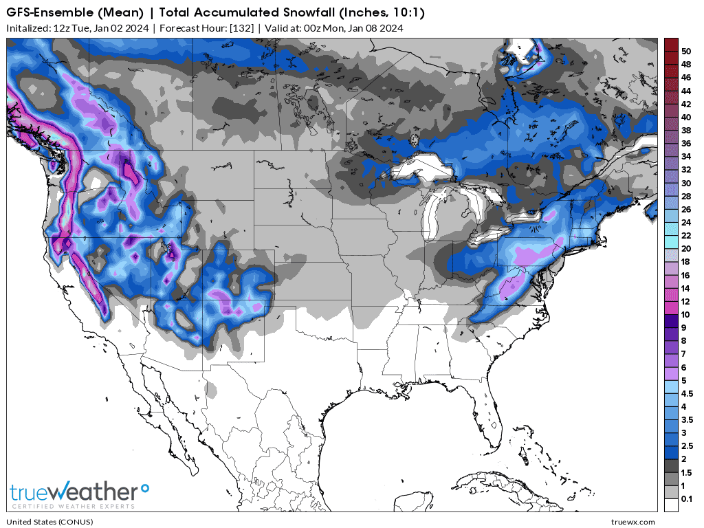
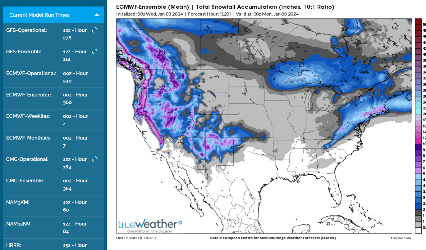
This is the latest 12z GEFS snow forecast(for all the solutions averaged to 1 product). This includes snow on Sunday, farther east.
However, there are several (SIGNIFICANT minority=30%+) solutions that have accumulating snows in Indiana on Saturday.
The NWS will update these products a couple of times/day numerous hours AFTER the updated models are out.
http://www.wpc.ncep.noaa.gov/wwd/winter_wx.shtml
Snowfall Probability Forecasts
The following charts depict the probability of snowfall reaching or exceeding the specified amount.
|
| Specific accumulation thresholds for Days 1-3: | All accumulation thresholds for: | |
| ≥ 1 inch | ≥ 8 inches | Day 1 |
| ≥ 2 inches | ≥ 12 inches | Day 2 |
| ≥ 4 inches | ≥ 18 inches | Day 3 |
| ≥ 6 inches | ||
| Day 1 | Day 2 | Day 3 |
≥ 4 inches | ≥ 4 inches | ≥ 4 inches |
≥ 8 inches | ≥ 8 inches | ≥ 8 inches |
≥ 12 inches | ≥ 12 inches | ≥ 12 inches |
24-, 48-, and 72-Hour Snowfall Percentile Accumulation Forecasts for Days 1-3
Day 4-7 Outlook
|
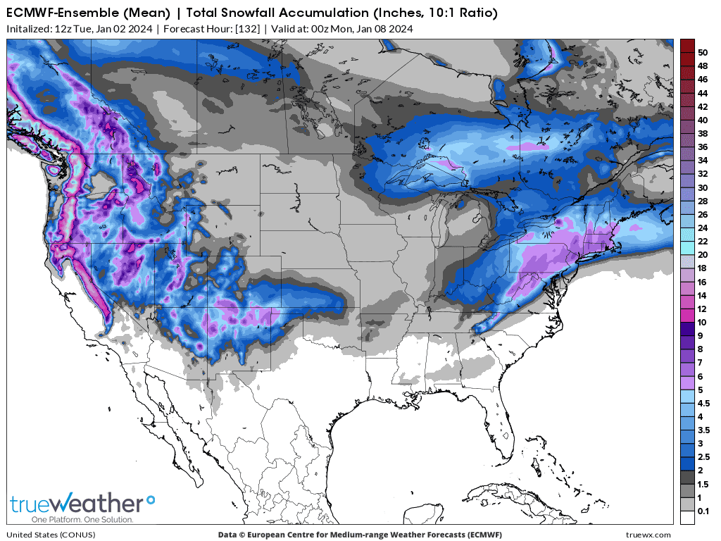
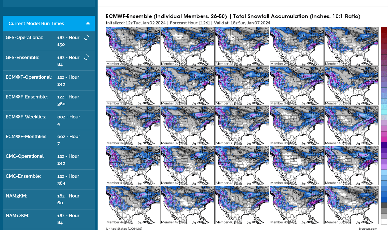
The European model has similar solutions. The thing to keep in mind here is that although the AVERAGE/MEAN of all the solutions has the best track record historically, with a snowfall event like this and MOST of the solutions ON THE FRINGE of the snow-shield NOT having this solution, the average does not have as much predictability.
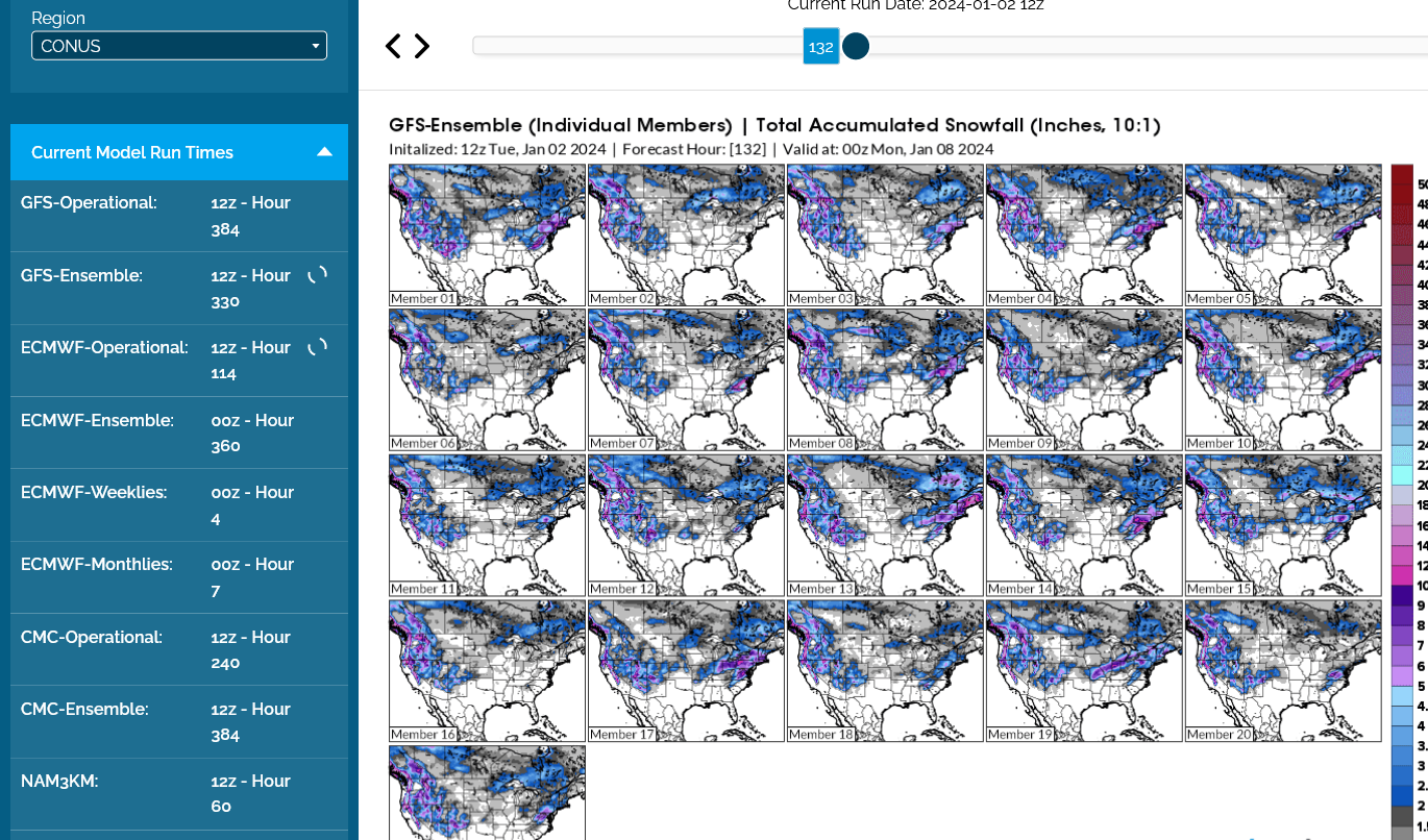
Here's what I mean, using individual members 26-50 below. The majority have almost no snow in Indiana. However, a significant minority have a BIG snow. Average them all together and we get the product above .......Most of them DON'T look like the average/mean of all the solutions above. That causes the mean solution to have less predictive skill compared to if the majority of individual solutions matched up with it.
One could interpret that by saying there's a ~30% chance of MORE snow than the forecast (potentially MUCH more) and 40% chance of less snow than the forecast, possibly nothing and a 30% chance of nailing the predicted snow amounts with the mean map above.
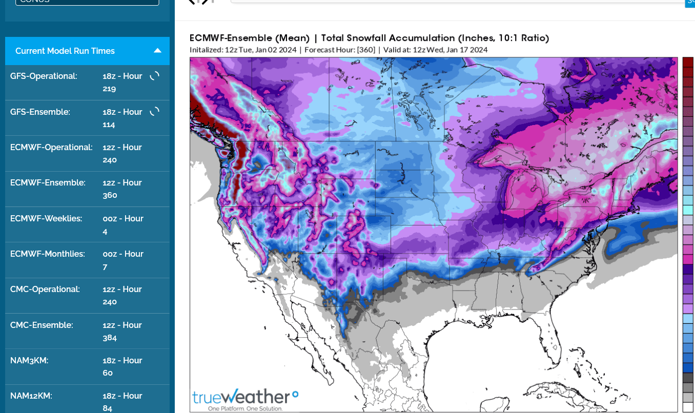
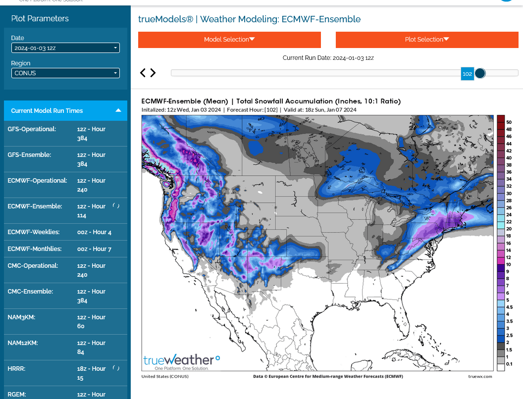
One thing that we can state with very high confidence in this type of pattern is that there will be a great deal of snow the next 2 weeks!!
This is the 2 week total which combines snow from numerous systems traveling in air cold enough for snow.
This map may not be great for nailing exact totals during the period for individual spots because the tracks of individual systems in week 2 can't be predicted accurately. However, being off on the track, only means the heavy snow will get dumped/shifted to the north or south by XXX miles. It's still coming!!!
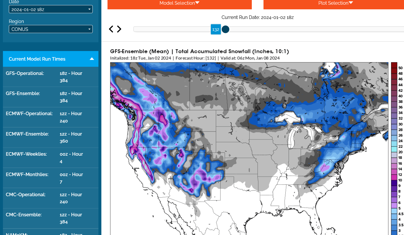
This just out 18z run of the GEFS has LESS snow for Indiana with this upcoming Winter Storm. So chances have dropped to LESS THAN 20% of accumulating snow on Saturday.
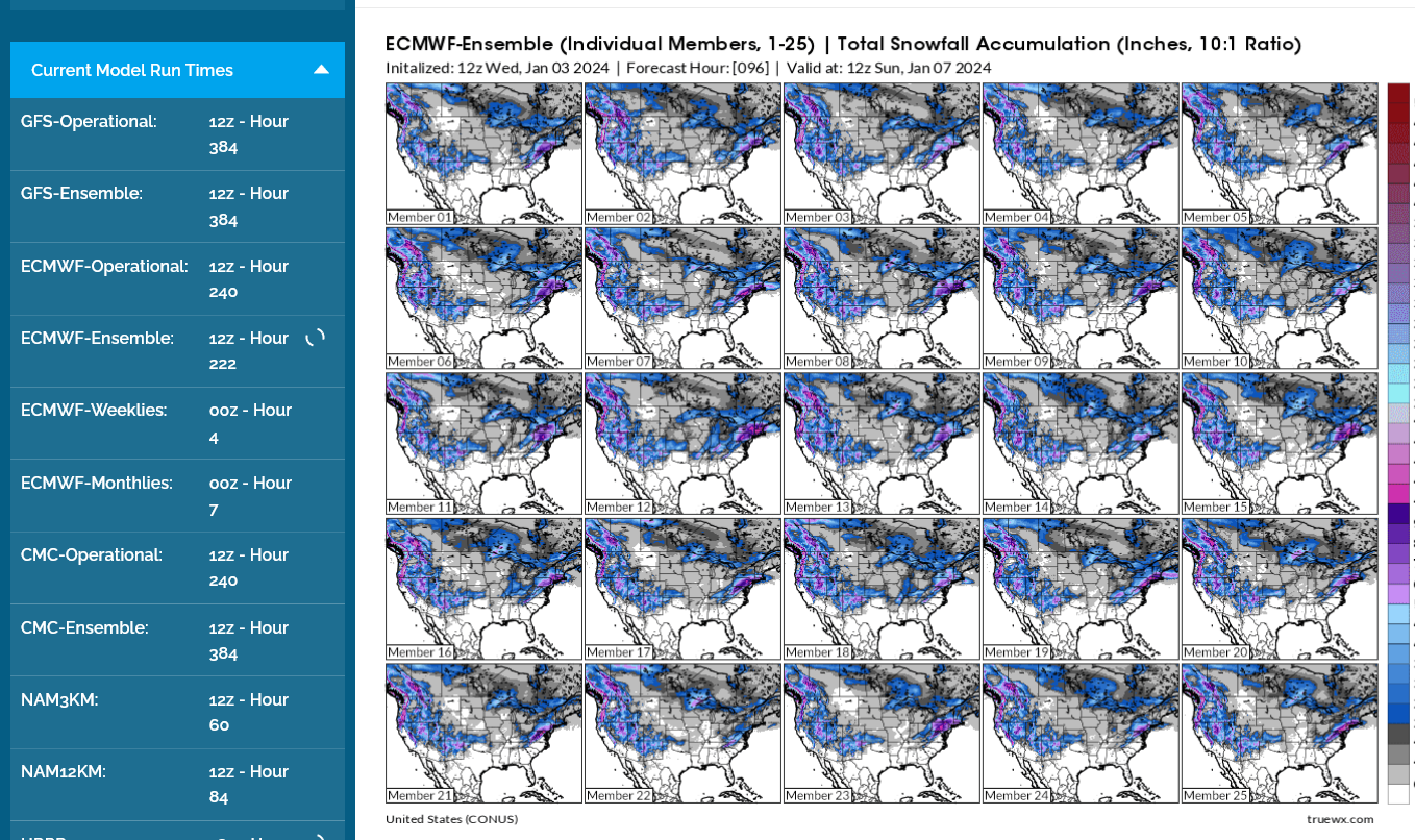
These are individual members 26-50 of the last European model for total snow thru the weekend. Accumulating snow more than 2 inches in Indiana is only predicted by mostly OUTLIERS.
The average/mean of all the solutions, depicted by the 2nd map, shows the 1 inch, darker gray around the north and east edges of IN.
We'll be focusing our attention on the MAJOR Winter storm early next week.
That one will be dumping well upwards of 6 inches, north and west of a line from sw KS to Kansas City to Chicago!
Indiana should be on the eastern side of the storm with enough milder southerly flow to keep the precip as rain.
Surface Weather maps for days 3-7 below:
https://www.wpc.ncep.noaa.gov/medr/medr.shtml

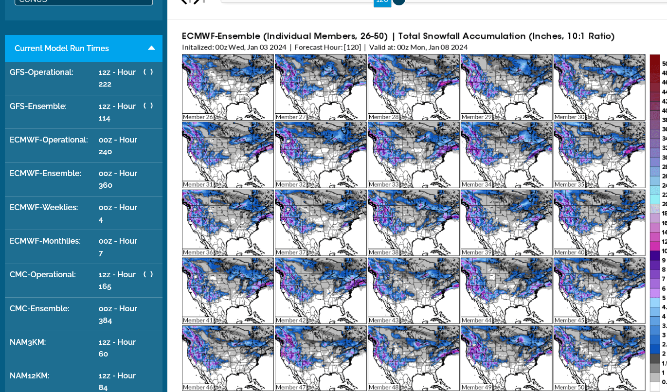
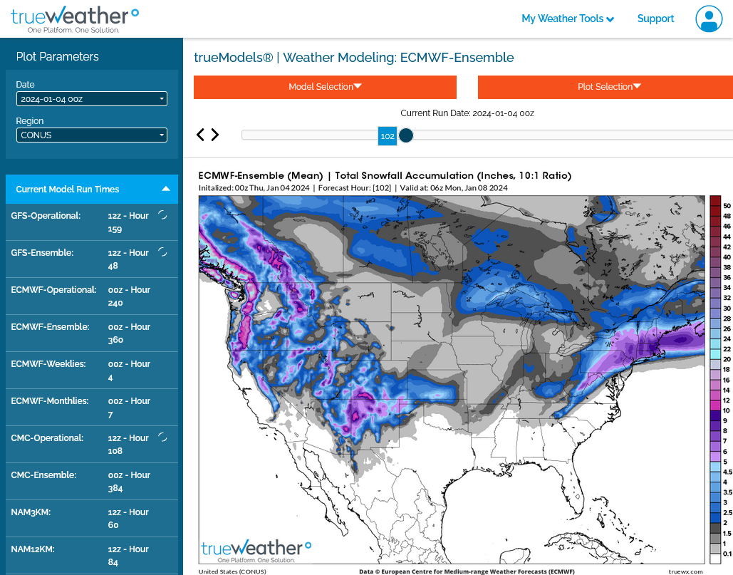
Back to the weekend Winter Storm. The just out European model is a bit more bullish for snow amounts in IN on Saturday.
A couple of outliers go as high as 4 inches.
The overnight European model continues to be the most bullish with snow on Saturday with the mean showing 2 inches possible in small parts of IN.
This is mainly the result of the vast majority with LESS than 2 inches but several outliers that like 4-5 inches. .........that with this pattern are very possible.
sharpened my snow shovel blade. gave it a shot of WD 4. Saw tankers sucking sea water for pre app.
Southern Maine lol
So who got the snow?
Not me - central coastal N J - miserable cold light rain.
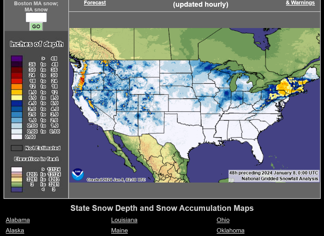
Here's the total snowfall from this storm for you!
https://www.weatherstreet.com/weather-forecast/Snow-Depth-US.htm