Previous Tropics thread:
December cotton was up +4c earlier, almost the daily limit of +5c because of the threat to the Gulf of Mexico THEN to cotton production in the Gulf States/Texas and Southeast in the very late part of next week.
Should cotton close limit up, the next trading session features an expanded limit of +7c(it might be 6c but I'll try to confirm)
UPDATE: 4c IS the limit. We are locked limit up after the 12z GFS came out bullish on Hurricane Hermine.
https://fillyourplate.org/blog/usda-releases-new-maps-identifying-major-crop-producing-areas-cotton/
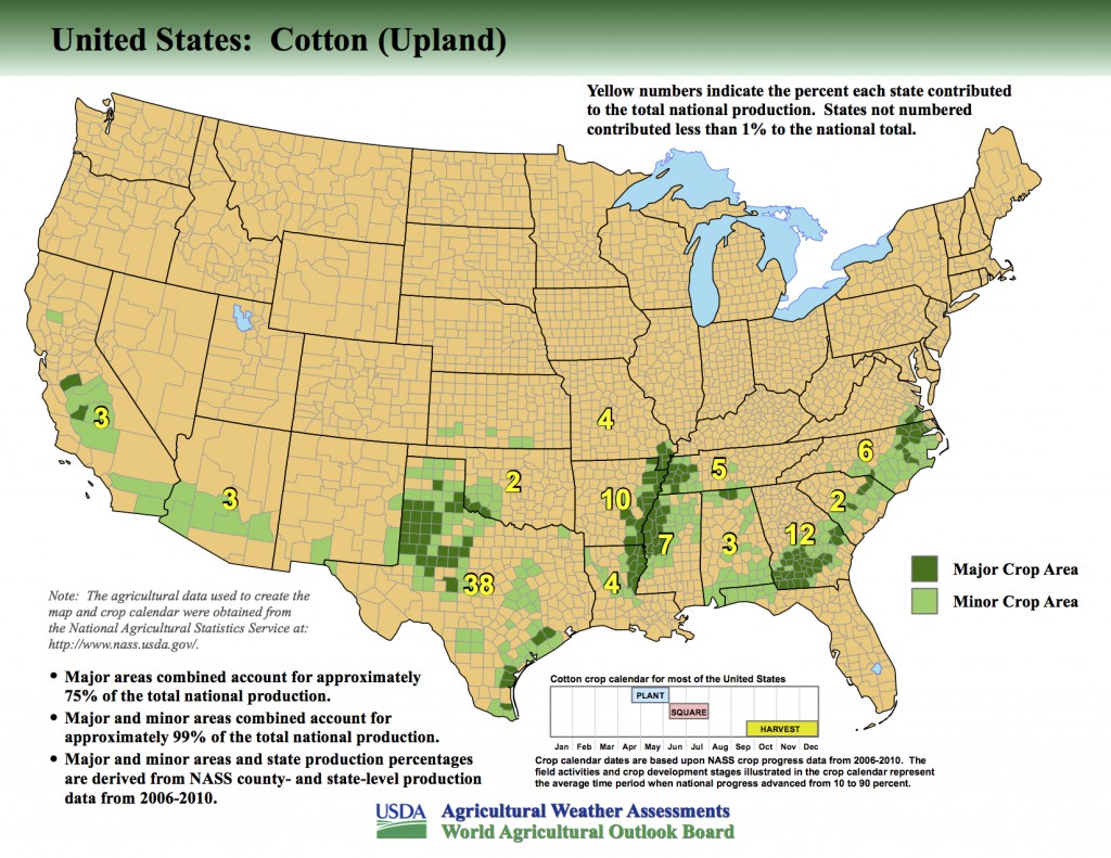
Cotton most vulnerable has open bolls, which is 59%.
That's why later season hurricanes can do more damage to cotton than early season hurricanes.
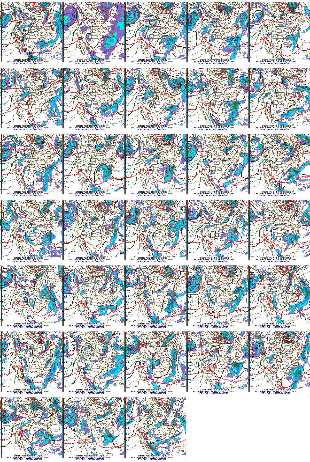
These were the last solutions from the last GFS ensemble model 0z run for late next Wednesday, 9-28-22.
Go to the link to see them better.
http://www.meteo.psu.edu/fxg1/ENSPRS_0z/f180.html
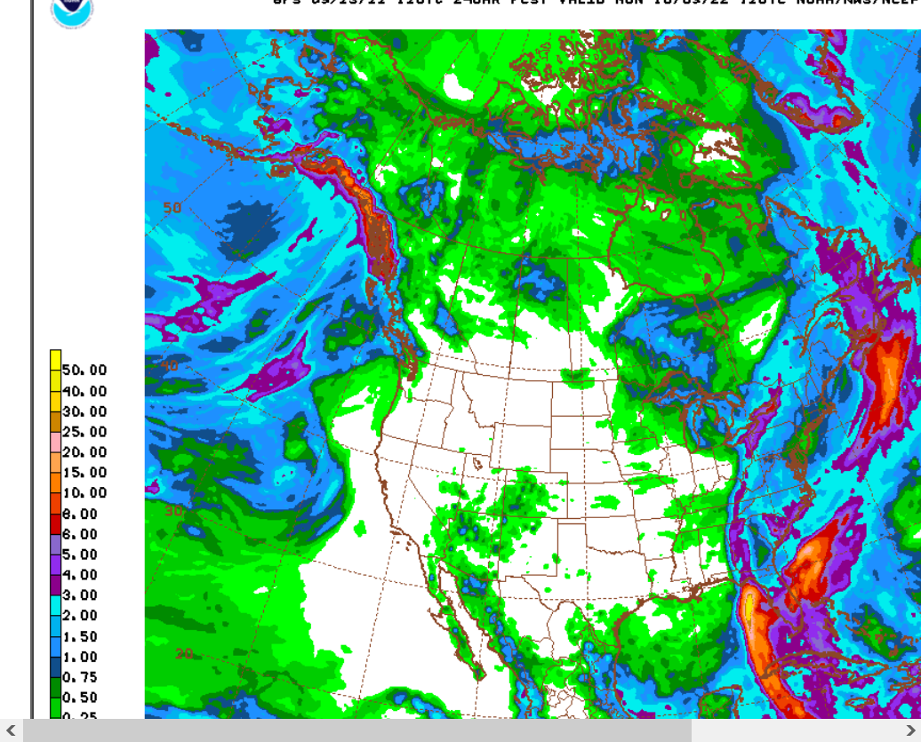
Water temperatures in the Gulf of Mexico are plenty warm.
Note the huge area of cool anomalies in the tropical Pacific. This is the almost record long La Nina(in it's 3rd year) which is causing the drought in the US as well as the global warming pause(which actually started 6 years).
Top map is temp anomalies.
2nd map is temps in Deg. C.
80 Deg. F = 26.7 Deg. C = Minimal hurricane temp.
29 Deg. C = 84.2 Deg. F = current water temp
30+ Deg. C = 86. Deg. F = current water temp in warm pockets
https://www.ospo.noaa.gov/Products/ocean/sst/anomaly/index.html

https://www.ospo.noaa.gov/data/sst/contour/gulfmex.c.gif


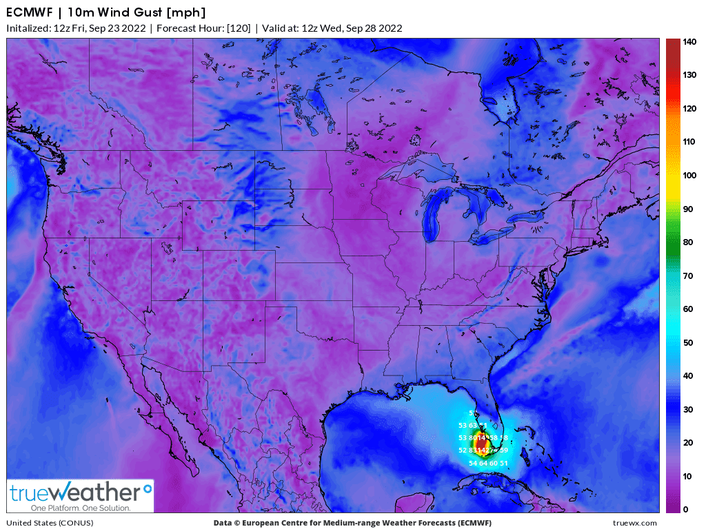
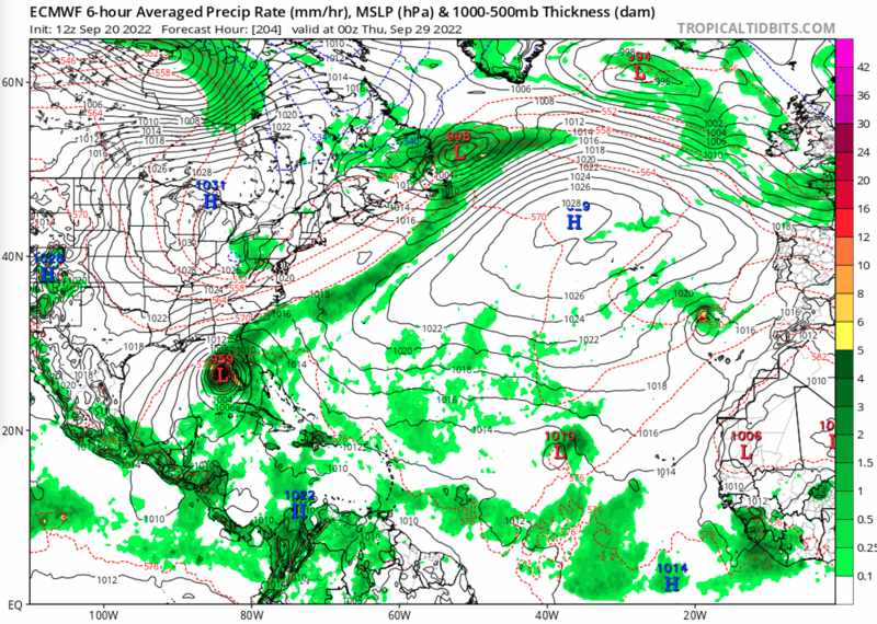
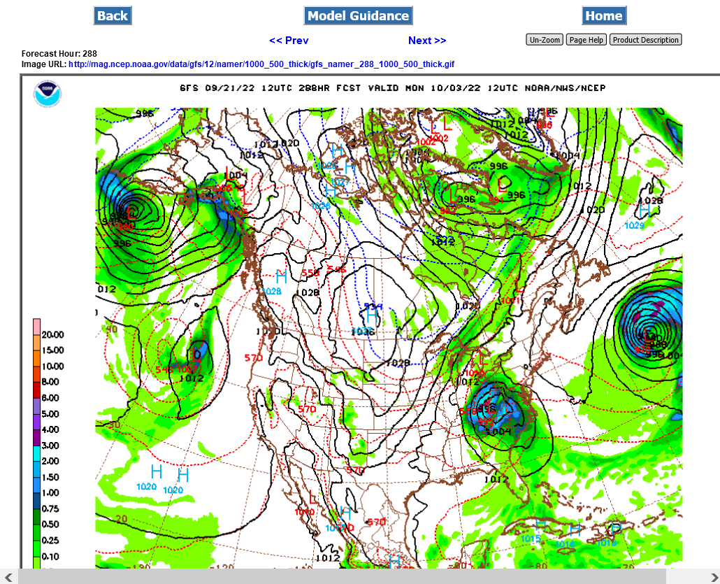
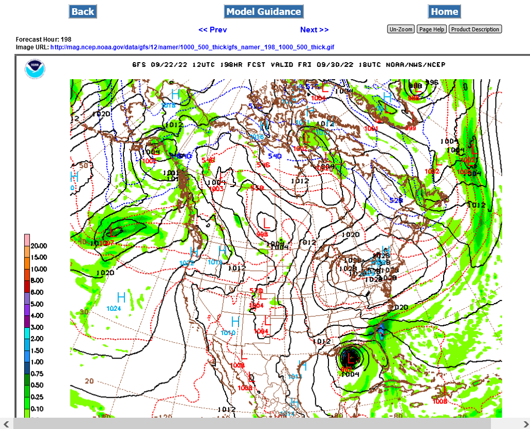
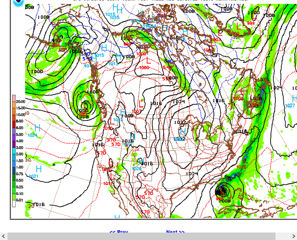
metmike: Just one of the models below(European) for late next Wednesday. Model skill for hurricane predicting at this time frame is LOW:
The ECMWF which at the moment is relatively close to consensus with the GFS, but suggests a west coast Florida Peninsula landfall currently:
UPDATE: 4c IS the limit for cotton. We are locked limit up after the 12z GFS came out bullish on Hurricane Hermine.
Days 10-11-12 below
https://mag.ncep.noaa.gov/Image.php
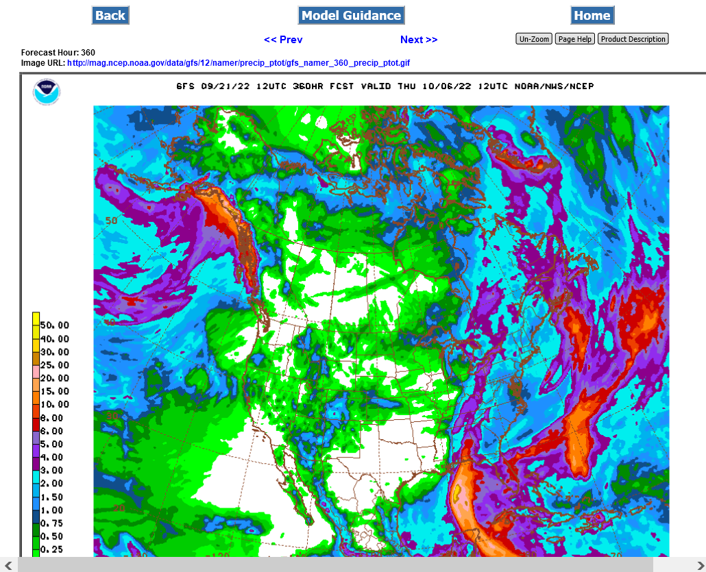
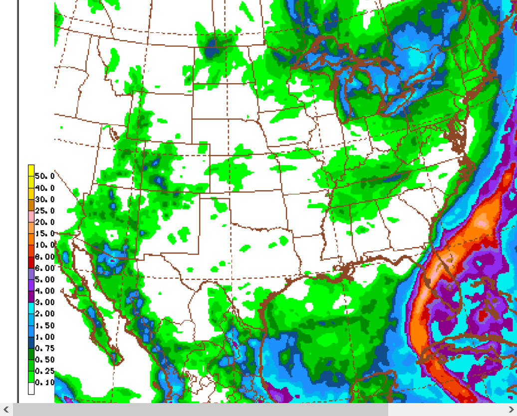
Total rains. They will be UNDER forecasted in a hurricane like this.
CT selling off/spiking down to almost +3 on the day. GFS ensembles not as bullish.
extremely volatile and spiky.
If I were still trading commodities, I would have looked at cotton and possibly even OJ for a wx play. But alas with my lost interest, I even forgot about Invest 98L affecting either one. I've become detached from something I was doing for two decades. Besides losing interest in NG, my free time to do any of this is too limited now.
By the way, assuming 98L will become a named storm, it may not become Hermine due to the wave coming off Africa possibly getting the name Hermine first.
Larry,
You make a good point. We shouldn't assume much of what i appeared to be assuming about this tropical system.
Make no mistake about it though, that was a good decision to make a thread for what has a very good chance to end up the storm of the entire season for the CONUS. This could end up a monster.
Thanks Larry!
Especially for helping me to remember all the many things that can happen to cause Hermine to NOT be a major hurricane threatening the US next week.
Larry,
Thanks for reminding me that OJ is a target for this potential hurricane and OJ has been going higher this week as a result. Had not been following OJ as closely from.........just forgetting!
OJ is up almost 10c from the lows on early on Monday morning.
After an extreme spike on the open, Monday, OJ has been on a steady climb without the extreme volatility you might expect.
Must be a steady stream of light buying (some short covering) and nobody wanting to sell ahead of a potential hurricane strike next week.
The farther west solution(away from FL) of the just out 12z GFS has OJ back down close to unch for the day.
Cotton is a tad lower, after yesterdays HUGE gains, being locked limit up, +4c for awhile.
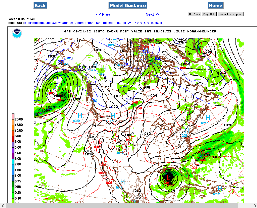
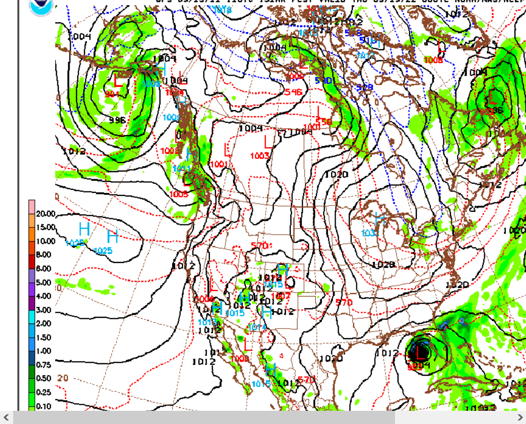
This was the just updated GFS for 8 days from now. It continues much farther west than the European model(which has been targeting Florida).
https://mag.ncep.noaa.gov/model-guidance-model-area.php
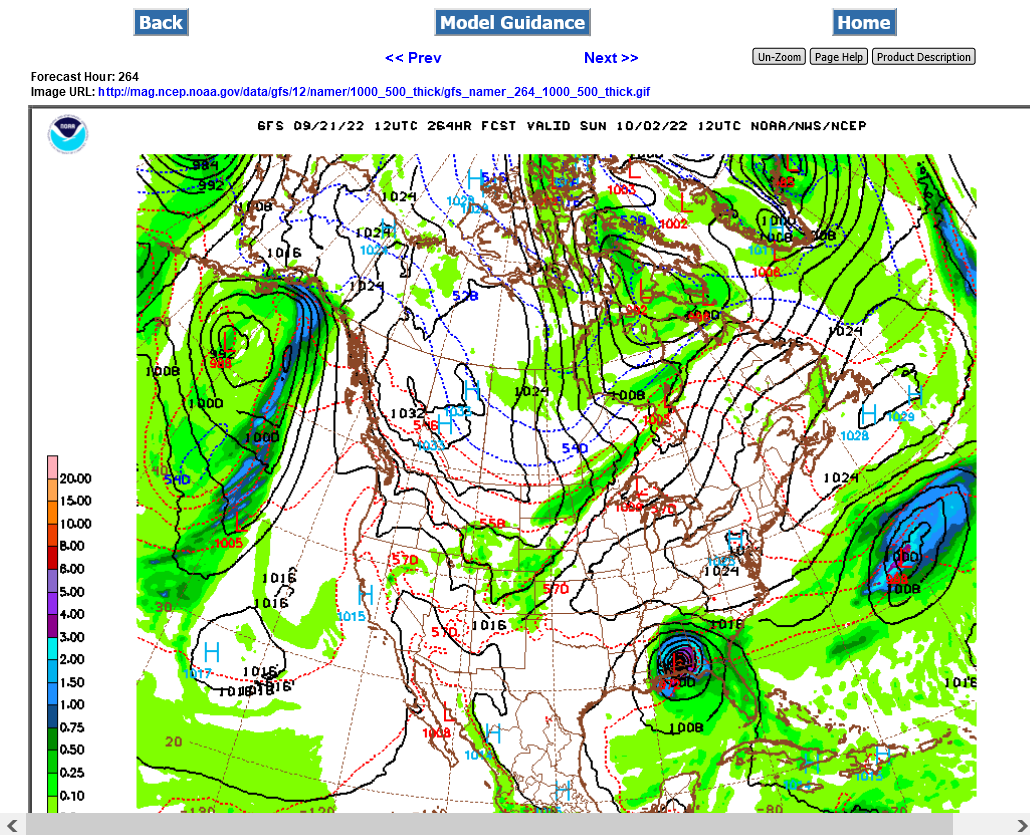
The last 12z European model just out is much farther EAST than before and hits far S.Florida.
This is a 10 meter wind gust forecast map for late next Wednesday. Incredibly different track compared to the 12z GFS.
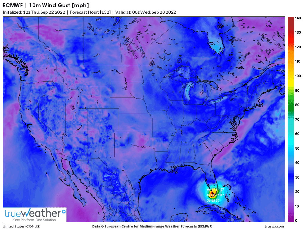
Wide spread on models. From the Central GOM to southeast of FL.
https://wgxa.tv/news/local/tropical-wave-likely-to-become-hermine-next-named-storm

GFS operational model has come almost all the way over to the European model's much farther east track here on the 0z run coming out right now.
1. GFS now tracks it across South/Central. Florida, instead of the Central GOM. The first map below is next Wednesday.
2. Total accumulated rain. The very small band of light brown in the epicenter of EastCentral FL represents the 25"+ rain band.
3. Models can't forecast a hurricane track accurately this far out or rain amounts but the much farther west track is getting less likely.
The change mentioned above, late yesterday evening has caused cotton to be almost limit down, -4c at times early this morning, as well as the energies to be sharply lower as Hermine is no longer as big of a threat to the structures in the W.GOM and along the coast(refineries) or most of cotton country, although there's still the chance of it clipping the far Southeast.
We should note that some of the GFS Ensemble members still like the farther west track.
https://www.nhc.noaa.gov/text/refresh/MIATCDAT4+shtml/230924.shtml?

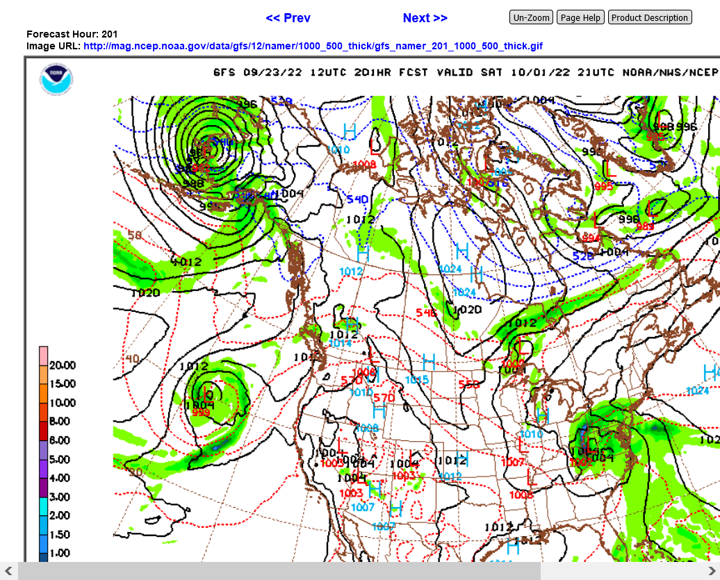
12z GFS just out is back to the left a bit. FL peninsula Gulf Coast then up the East Coast.
Total rains below.
12z European model nails OJ which was +2c+ again today for +12c from the lows.
Late morning, total volume was still under 1,000 contracts for the front month, November and bids/offers were in the low single digits.