Markets are closed but the weather happens 168 hours a week.
National Radar Loop:
MUCH more action than in recent weeks............rain forecasts are verifying better.
https://radar.weather.gov/Conus/index_loop.php

Picture worth 1,000 words. Past 24 hour rains:
![]()
It's been very dry in parts of the Cornbelt, especially IN/IL the past 60 days. Upcoming rains will continue to hit the driest spots!
You can go to this link to see rain totals from recent time periods:
https://water.weather.gov/precip/
Go to precipitation, then scroll down to pick a time frame. Hit states to get the borders to see locations better. Under products, you can hit %normal.
You can see how big the dry pockets.........are shrinking are right now. Since the crop ratings are near the best ever 78% GD/EX corn and 75% beans, clearly this dryness has not effected the condition of the overall crop yet.
Crop ratings will likely drop a bit next Monday........from the dry places that don't get rains(which may come next week) but will maintain after that.
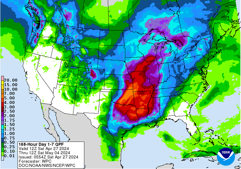
Rains the next 7 days, graph of totals. The I states get bombed(where it counts). mcfarm's farms have better chances............not much change from Thursday or Friday.
Day 1:
http://www.wpc.ncep.noaa.gov/qpf/fill_94qwbg.gif?1526306199054
Day 2:
http://www.wpc.ncep.noaa.gov/qpf/fill_98qwbg.gif?1528293750112
Day 3:
http://www.wpc.ncep.noaa.gov/qpf/fill_99qwbg.gif?1528293842764
Days 4-5:
http://www.wpc.ncep.noaa.gov/qpf/95ep48iwbg_fill.gif?1526306162
Days 6-7:
http://www.wpc.ncep.noaa.gov/qpf/97ep48iwbg_fill.gif?1526306162
Total accumulation
http://www.wpc.ncep.noaa.gov/qpf/p168i.gif?1526397762

mcfarm's weather forecast from the NWS
oday
Showers and thunderstorms likely, mainly after 4pm. Partly sunny, with a high near 88. South southwest wind around 8 mph. Chance of precipitation is 60%. New rainfall amounts between a tenth and quarter of an inch, except higher amounts possible in thunderstorms.
Tonight
A 40 percent chance of showers and thunderstorms. Mostly cloudy, with a low around 67. Southeast wind around 6 mph.
Sunday
A 50 percent chance of showers and thunderstorms. Mostly cloudy, with a high near 86. South wind 5 to 8 mph becoming west southwest in the afternoon. New rainfall amounts between a tenth and quarter of an inch, except higher amounts possible in thunderstorms.
Sunday Night
A 40 percent chance of showers and thunderstorms. Mostly cloudy, with a low around 68. Southwest wind around 6 mph.
Monday
A 40 percent chance of showers and thunderstorms. Partly sunny, with a high near 86. Southeast wind around 6 mph becoming west in the afternoon.
Monday Night
A 40 percent chance of showers and thunderstorms. Mostly cloudy, with a low around 69.
Tuesday
Showers and thunderstorms likely, mainly after 2pm. Partly sunny, with a high near 88. Chance of precipitation is 60%.
Tuesday Night
Showers and thunderstorms likely before 8pm. Partly cloudy, with a low around 63. Chance of precipitation is 60%.
Wednesday
Mostly sunny, with a high near 84.
Wednesday Night
A 20 percent chance of showers and thunderstorms after 2am. Partly cloudy, with a low around 64.
Thursday
A 40 percent chance of showers and thunderstorms. Partly sunny, with a high near 84.
Thursday Night
A 30 percent chance of showers and thunderstorms. Partly cloudy, with a low around 66.
Friday
A 10 percent chance of showers and thunderstorms. Partly sunny, with a high near 84.
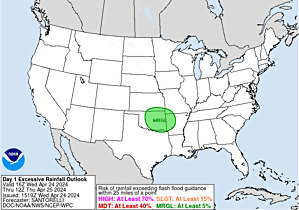
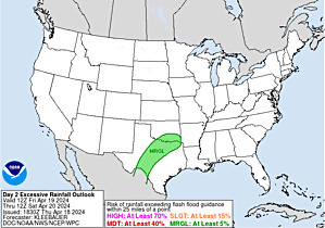
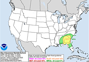
Excessive rain potential the next days:
http://www.wpc.ncep.noaa.gov/qpf/excess_rain.shtml
Current Day 1 Forecast Valid 15Z 06/09/18 - 12Z 06/10/18 |
Day 1 Threat Area in Text Format
| Day 2 and Day 3 Forecasts |
Current Day 2 Forecast Valid 12Z 06/10/18 - 12Z 06/11/18 |
Day 2 Threat Area in Text Format
Current Day 3 Forecast Valid 12Z 06/11/18 - 12Z 06/12/18 |
Severe Storm Risk the few days:
http://www.spc.noaa.gov/products/outlook/
Current Day 1 Outlook | Forecaster: Thompson/Broyles Issued: 09/1251Z Valid: 09/1300Z - 10/1200Z Forecast Risk of Severe Storms: Slight Risk |
Current Day 2 Outlook | Forecaster: Dial Issued: 09/0524Z Valid: 10/1200Z - 11/1200Z Forecast Risk of Severe Storms: Slight Risk |
Current Day 3 Outlook | Forecaster: Dial Issued: 09/0726Z Valid: 11/1200Z - 12/1200Z Forecast Risk of Severe Storms: Slight Risk |
Current Day 4-8 Outlook | Forecaster: Dial Issued: 09/0839Z Valid: 12/1200Z - 16/1200Z Note: A severe weather area depicted in the Day 4-8 period indicates a 15%, 30% or higher probability for severe thunderstorms (e.g. a 15%, 30% chance that a severe th |
Western corn belt suckn tity and a lot warmer temps than Eastern side.
BUT rain is rain and trade watches that
My driveway actually got damp today! Not wet.....damp! But the day is not over yet.
More action in the ECB than in a very long time here just after Noon.
Is that a blob of thunderstorms aimed at mcfarms place?
Must be a drought mirage (-:
https://radar.weather.gov/Conus/centgrtlakes_loop.php

Get ready to sing in the rain mcfarm:
https://radar.weather.gov/radar.php?rid=ind&product=N0R&overlay=11101111&loop=no
Yes Mike I have been checking that blob all nite and morning as it marches from C Iowa right to my western door........and now it it falling apart......not a surprise at this point....be lucky if it sprinkles with some wind at this point...catch the latest radar
Yes, I did notice that mcfarm and took my singing in the rain video down for the time but there appears to be activity behind it and more in your area for several days.
https://radar.weather.gov/radar.php?rid=ind&product=N0R&overlay=11101111&loop=no remember this system came intact nearly 400 miles.....until it reached the next county west , Hendricks, at which time the most intense part, red. took a sudden move to the ne......that is hard to explain other than large cities interfering with the fronts and the weather SE side residents receive...this happens time after time, esp during extended dry spells
Sorry it died on you like that mcfarm. I watched it like you and the NWS upped their chances to 90%. If you don't get a good rain, we'll have to call it getting mcfarmed(instead of Harley'd)
I was bummed too but here we go again.
This time with a rapidly developing batch to your southwest..........that looks like it might just miss you to the south but could start moving in your direction.
Looking pretty good for Cutworm later today.
Let me study this thing for a few minutes. Going to get nailed here in the swest.
When I got back from Detroit last weekend, there was 5.8 inches of rain in the rain gauge from 2 weeks.
Mostly from the tropical system.

If the northern part of this huge batch of storms can stay along I-70, we can still have you singing in the rain shortly but it looks to pass south of you this time........close though and those are the ones that hurt..........when it rains around you and you miss it.
mcfarm,
Regarding the storms dying as they approached the big city. Am thinking that more likely they just traveled over a long stretch of bone dry ground and the moisture inflow from the south into the storms was not enough to over come this as they dried up.
The old expression, "drought begets drought" applies here.
Dew points ahead of these storms were only in the 60's. By June standards, that's pretty low. Typically, with the weather pattern similar to this we would have dew points well into the 70's. Very often, at this time of year if the ground is moist and you are getting some evapotranspiration from the rapidly growing corn plants it will contribute around 5 to as much as 10 degrees worth of dew point to the lower levels. That is mostly absent right now.
That can mean the difference between sustaining storms that were out there today and them dying as they hit the much drier air in Indiana(dew points in the 60's on bone dry soils)
My usual source for dew point contours is no longer available but I found this one below. Typically in June, under these conditions, we might see 70+ dew points from the GOM well into the Midwest, with a few embedded 75+ dewpoints providing moisture for these storms.
They are mostly in the 60's right now. Only a couple of isolated pockets at or just above 70.
Even along the Gulf Coast, many of the dew points are in the upper 60's. Looking ahead, even with a very promising weather pattern it just doesn't look like the typical juicy Gulf moisture ever gets injected in.
For sure there will be alot of rains in alot of places, including your farms hopefully but not with the confidence as if we had dew points well into the 70's to work with

7pm update. The rains in S.Indiana also dried up for the reasoning above and we ended up with .23 in my backyard north of Evansville, with the NWS getting just .18 out of storms that looked like they would dump MUCH more. There were scattered higher amounts.
The Indianapolis total was .05 and I'm guessing you got almost nothing mcfarm.