
It's a great May 30th!!! Do something to make somebody feel loved today! Then, after observing the positive results, make a good habit out of it!
Scroll down and enjoy the latest comprehensive weather to the max...... occurring because of the natural physical laws in our atmosphere.
Blocking Heat ridge in the Southeast is breaking down .....not as hot late this week onward but still pretty hot.
Stormy weather has ended for the Midwest from the long lived blocking pattern but it's not completely dry.
The models in the extended time frame are not as dry today.
Here are the latest hazards across the country.
Purple/Pink/blue on land is cold/Winter weather. Brown is wind, Green is flooding. Gray is fog. Reddish is a red flag advisory.
Go to the link below, then hit the location/county on the map for details.
https://www.spc.noaa.gov/ Go to "hazards"


Wind map Press down on this on the left with your cursor!


Current Jet Stream

| Low Temperatures Tomorrow Morning |

High heat in the South/Southeast/East is getting suppressed on Thursday. Really warming up the next couple of days in the N.Plains as the new pattern already shows signs of the big changes ahead.
Temperature colors on the maps below still need to be adjusted down to cooler shades.


Highs for days 3-7:
Major pattern change!!!
N.Plains warms up, Northeast cools down. Still very warm to hot in the South but not as hot in the Southeast.


Temperature pattern change. Red very warm anomalies from the Northwest to N.Plains., Chilly blue anomalies shift to Northeast.......but nothing extreme.
Not as hot in the Southeast but still pretty hot in the South.
https://www.wpc.ncep.noaa.gov/medr/medr_mean.shtml
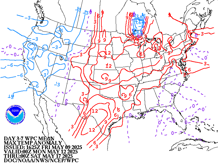
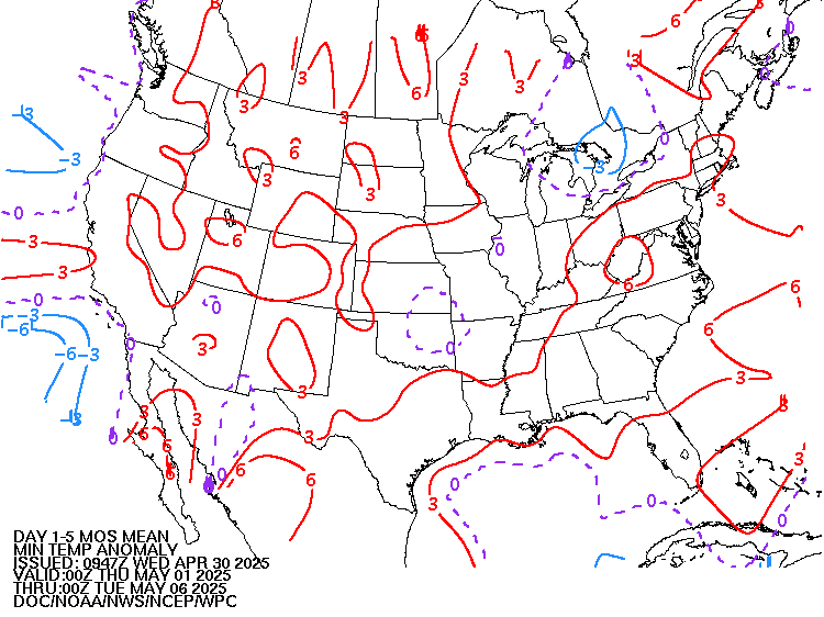
Weather maps for days 3-7 below
Blistering heat in the Southeast moderates.
Huge pattern change! Strong, progressive, cold front now sweeping southeast......and eventually getting into the Southeast and modifying the intense heat. Reinforcing progressive cold fronts to follow. Chilly in the Northeast.
Front/system coming in next week will slow down enough and affect the very wet areas with more unwanted rains to be a problem.

Last 24 hour precip top map
Last 7 day precip below that
https://www.wunderground.com/maps/precipitation/daily


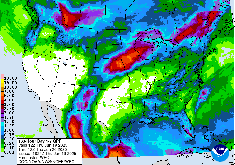
Liquid equivalent precip forecasts for the next 7 days are below.
More progressive pattern as the blocking heat ridge in the Southeast breaks down. The excessive rains and severe weather threat is over.
However, reinforcing cold fronts will have scattered lighter rains, then potentially a moderate rain event around the middle of next week. This will bring some unwanted rains to waterlogged areas, even as things dry out a bit overall the next 5 days.
Day 1 below:
http://www.wpc.ncep.noaa.gov/qpf/fill_94qwbg.gif?1526306199054

Day 2 below:
http://www.wpc.ncep.noaa.gov/qpf/fill_98qwbg.gif?1528293750112

Day 3 below
http://www.wpc.ncep.noaa.gov/qpf/fill_99qwbg.gif?1528293842764

Days 4-5 below:
http://www.wpc.ncep.noaa.gov/qpf/95ep48iwbg_fill.gif?1526306162

Days 6-7 below:
http://www.wpc.ncep.noaa.gov/qpf/97ep48iwbg_fill.gif?1526306162

7 Day Total precipitation below:
http://www.wpc.ncep.noaa.govcdx /qpf/p168i.gif?1530796126
Main Excessive Rainfall threat has ended!
Mesoscale Precipitation Discussions
Current Day 1 Forecast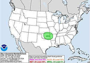 Valid 12Z 04/22/19 - 12Z 04/23/19 |
Day 1 Threat Area in Text Format
| Day 2 and Day 3 Forecasts |
Current Day 2 Forecast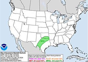 Valid 12Z 04/23/19 - 12Z 04/24/19 |
Day 2 Threat Area in Text Format
Current Day 3 Forecast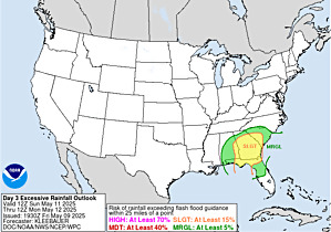 |
Severe Storm risk-a few storms storms East Coast and sw.TX possible but the severe weather outbreaks are over!!!
Current Dew Points
Higher moisture getting nudged southeast with slightly less moisture but not real dry air.

Latest radar loop
http://www.nws.noaa.gov/radar_tab.php


| (3400x1700 pixels - 2.2mb) Go to: Most Recent Image |

Go to: Most Recent Image
You can go to this link to see precipitation totals from recent time periods:
https://water.weather.gov/precip/
Go to precipitation, then scroll down to pick a time frame. Hit states to get the borders to see locations better. Under products, you can hit "observed" or "Percent of normal"
+++++++++++++++++++++++++++++++++++++++++++++++
Precipitation compared to average for the last 7, 14, 30 and 60 days.
The Cornbelt has had way too much rain. We will be drying out(but not completely dry) for the next several days in some places adding in some heat.
Usually not updated for previous day until late the next day.
https://www.atmos.illinois.edu/~snodgrss/Ag_Wx.html


Surprise, surprise, surprise!! Currently, there is 0% of the Cornbelt/Midwest with drought. There is no place even slightly dry there. It has been dry(and very warm/hot) in the Southeast though which has some drought. The Southeast drought has really increased since last week!!!!
The map below is updated on Thursdays.
The market will be keying on precip forecasts for planting concerns for the next couple of weeks.
https://droughtmonitor.unl.edu/

The top map is the Canadian ensemble average, the maps below are the individual members that make up the average at the end of week 2.
+++++++++++++++++++++++++++++++++++++++++
Each member is like the parent, Canadian model operational model.......with a slight tweek/variation in parameters. Since we know the equations to represent the physics of the atmosphere in the models are not perfect, its useful to vary some of the equations that are uncertain(can make a difference) to see if it effects the outcome and how.
The average of all these variations(ensembles) often yields a better tool for forecasting. It's always more consistent. The individual operational model, like each individual ensemble member can vary greatly from run to run.........and represent an extreme end of the spectrum at times. The ensemble average of all the members, because it averages the extremes.............from opposite ends of the spectrum.........changes much less from run to run.
End of week 2....................0z ensembles:
Analysis starting from a week ago, ending with today:
Last week+ of analysis, starting with the day farthest in the past. This is an end of week 2 forecast!
Last Wednesday: Vast majority have the heat ridge in the Southeast, with hot/and dry over the Southern 1/3 of the country. Deep trough or upper level low along the West Coast and strong jet stream aimed towards the middle of the country, over the top of the ridge acting to trigger active weather.
Thursday: Around half of the members keep the huge heat ridge going in the Southeast. Half break it down. They will be one of the keys to determine where the strong Pacific jet stream coming in will travel. Potential for a lot of rain when it encounters warm humid air being pumped in by the heat ridge.
Friday: Majority keep the heat ridge going in the Southeast. Very strong jet stream coming from the Pacific.
Saturday: Canadian ensembles shift the Southeast heat ridge farther to the west. Still a strong jet stream across the country, with possibly more zonal, progressive (but active) flow if the blocking heat ridge is displaced from its long lived home in the Southeast.
Sunday: Some solutions keep the long lasting heat ridge in the Southeast alive...........others, obliterate it.
Monday: Watching to see what happens to the heat ridge in the Southeast. ......and location of the powerful jet stream coming out of the Pacific which will be modulated by the upper level trough along the West Coast and downstream upper level ridge.
Tuesday: Same as Monday. In fact, hard to tell any difference in the ensemble average.
Wednesday: Southeast ridge continues to go away/shift west and be replaced by weak troughing in the new pattern. Much, much cooler in the Southeast. Midsection may still be active with a decent jet stream and numerous systems. .
Thursday: Good agreement on a deep upper level low/trough along or just off the West but wide spread downstream on the upper level ridge and path of the strong jet stream in between them.
Friday: Another day with good/strong agreement on the trough around the West Coast. Strong stream from the Pacific will be coming in under this. Where it's aimed downstream will depend on any upper level ridging or no ridging. The long lived Southeast heat ridge still looks to die in week 2(possibly shifting westward to the W.Gulf to N.Mex/S.TX).
Saturday: Still a trough along the West Coast. Strong flow from the Pacific dipping into the trough and being aimed across the US. Will it be a strong, active jet stream coming going west to east in zonal fashion? Or will the flow pattern buckle at some point and become amplified and extreme beyond 2 weeks?
Sunday: Good agreement on very deep trough/low along to just off the West Coast. What will happen downstream? Strong, active zonal flow or amplification of high pressure and heat?
Monday: Very strong agreement on the extremely deep trough/low along the West Coast. Today, this leads to strong ridge building/amplification downstream (as the jet stream buckles) with a heat ridge, anywhere from the Plains to points farther east....maybe in the center of the country. This would SHUT DOWN the rains and turn up the heat for the Cornbelt. If the large scale features are positioned differently,...trough farther east in the Rockies/Plains, it could be the complete opposite.
Tuesday: Similar to yesterday. Trough West, ridge building in the center of the country.
Wednesday: The mean is characterized by a more zonal flow look today but that's just averaging out some extremes. Still the Upper Level low along the West Coast, to the Gulf of Alaska and potential ridge amplification downstream, favored spot is Southcentral US to the W.Gulf states. This a slight shift in the main features and this could go from mostly dry to wet again.
Thursday: Trough to cut off low along the West Coast is deeper today and very impressive. What will happen downstream? Ridge building or more ammo to start up another stormy weather pattern? Not as dry looking as the previous few days.
360h GZ 500 forecast valid on Jun 14, 2019 00 UTC
0Z GFS Ensembles at 2 weeks:
Analysis, starting with the oldest, ending with the most recent:
Last Thursday: Much different than the Canadian model above and tremendous differences/spread for individual members, so great uncertainty. Best agreement is for the upper level ridge in the Southeast to be replaced by weak troughing.
Friday: Pattern change from what we have now with heat ridge in the Southeast broken down but too much spread on how what it will be to take a serious gander.........other than to think that it will be more progressive than the recent pattern.
Saturday: Several members want to greatly deepen an upper level low in SW Canada and possibly buckle the jet stream with an upper level ridge pumped up downstream, which could be any where from the Midwest to points east and south. Just as many have something different.
Sunday: Uncertainty but the recent pattern of a heat ridge in the Southeast and excessive rains around the periphery is not one of the solutions.
Monday: Similar pattern to the Canadian model but large scale features are shifted west/northwest. The deep upper level low is from SW Canada to the Gulf of Alaska and downstream upper level high/ridge is from the Rockies to Plains. This also allows for some troughing, even farther downstream along the East Coast and cooler temps there.
Tuesday: Deep trough to cutoff low anywhere from the West Coast to the Gulf of Alaska with amplifying upper level ridge down stream(Plains?) late in week 2.
Wednesday: Same as yesterday but with more members featuring a trough in the East/Northeast. No question, a dry pattern with the Gulf cut off and no ridging in the Southeast. Warmest temps in the Plains to West.
Thursday: All sorts of solutions from a heat ridge to a cut off upper level low in the Upper Midwest/Great Lakes.

GFS Ensemble mean(average of all the individual solutions above). The first map is a mid/upper level map. The 2nd one is a temperatures map at around 1 mile above the surface. These are anomalies(difference compared to average). The daily analysis starts with the oldest and ends with the latest.
Last Tuesday: A weak NEGATIVE anomaly in the far Southeast,tells us the long lived heat ridge will be going bye bye!!!! Now, we have an extensive positive anomaly along the Canadian border in the new pattern...........which will be drier with the heat ridge not steering Gulf air north and blocking progression. Don't see the negative anomaly along the West Coast here but its there on the Canadian model.
Wednesday: Weak NEGATIVE anomaly in the East is even more confirmation that the long lived heat ridge will be dead. Very cool in the East. Positive anomaly in the Plains to West. This is a major pattern change.
Thursday: Very weak negative anomaly very far Southeast/Florida. Positive anomaly Northeast Canada.
Friday: Exactly like Thursday but much uncertainty though it looks progressive.
Saturday: The greatest positive anomalies are at the higher latitudes but most of the US looks to have slightly above 500 mb height anomalies, which means warm temperatures.
Sunday: Same as Saturday
Monday: NOT the same as the last 2 days. Growing Positive anomaly in the N.Rockies is noteworthy as it represents the current, favored locations for a building upper level ridge. Along with a modest negative anomaly in the Gulf of Mexico, this is the recipe for a DRY pattern, with the GOM shut down. There would be some heat close the ridge and on this model the heat is most likely farther west, than on the Canadian model solution above. This is almost the complete opposite of the recent pattern that has dominated in May.
Tuesday: Significant positive anomaly N.Plains!
Wednesday: Big positive anomaly in the N.Plains again and now, a modest negative anomaly in the Northeast, along with a slight negative anomaly off the West Coast. This is suggestive of a trough/ridge/trough couplet. Warm under the ridge and likely dry. Amplification could take on an Omega Block signature but that speculating. There still could be some moisture and energy from the West Coast trough which gets aimed towards the Plains.
Thursday: Positive anomaly in the N.Plains has weakened. Negative anomaly along the West Coast. Great uncertainty but not as dry overall vs the last few days.
Latest, updated graph/forecast for AO and NAO here, including an explanation of how to interpret them.
Previous analysis, with the latest day at the bottom for late week 2 period.
Last Saturday: Still negative AO with the high latitudes not changing a great deal but NAO increases a bit. Mid latitudes could be changing, with potential for more warming from the south in a manner that these indices are not designed to capture well(since they are NORTHERN stream flow indicators). PNA a tad positive.
Sunday: AO and NAO increasing to almost 0 near the end of week 2(after being solidly negative for a couple of weeks)...........suggesting a pattern change that takes out the northern stream influence that has been around for quite some time. PNA near 0.
Monday: AO and NAO increasing. PNA decreasing. Pattern change?
Tuesday: AO and NAO increasing but stay a bit negative. PNA plunging to negative.
Wednesday: AO increases back to near 0. NAO, PNA slightly negative. Nothing strong to key on as indicators.
Thursday: AO, NAO, PNA all slightly negative.
Friday: AO increases to near 0. NAO and PNA slightly negative.
Saturday: The same as yesterday. It's getting to the warm season when these indices are not much help anyway.
Sunday: A0 up to 0, NAO and PNA a bit negative.
Monday: All slightly negative. Could have a pattern change later in week(not because of these indices though)
Tuesday: AO, NAO, PNA all a tad negative. Nothing to see here.
Wednesday: A tad negative. The PNA has a wide spread at the end of week 2, some strongly negative.
Thursday. Slight negative for NAO/AO, near 0 PNA.
Friday. Slight negative for NAO/AO and near 0 PNA again.
Saturday: Same. Suggests zonal flow.
Monday: AO around 0. NAO increasing late and PNA dropping below zero late. Indications of the pattern change, with major amplification as the strong jet stream buckles. We will see a deep trough somewhere from off the West Coast to the Gulf of Alaska to slightly east and a down stream upper level ridge, somewhere from the Rockies to points east.
Tuesday: All 3 indices a bit negative.
Wednesday: AO a tad negative. NAO and PNA near 0.
Thursday: AO, NAO and PNA slightly negative and not telling us anything.
National Weather Service 6-10 day, 8-14 day outlooks.
Tuesday: We're finally seeing changes being called for over the last week, with below normal precip expanding in the northern 1/3rd, with the new heat building from the West to the N.Plains associated with and upper level ridge(cool Northeast).
Wednesday. Look for the changes to continue as a result of the long advertised week 2 pattern change..............which will be the opposite of the recent one. Warmth shifts West along with a cooling trend in the Northeast, to possibly the Great Lakes. Much drier than recent forecasts in the 11-14 day period, however, a new system early in the 6-10 day period has added rains for a couple of days. You will note that in the update.
Thursday: Unsure now except that the Northeast looks the driest. More rains added in the extended today vs yesterday, especially in the south.
Temperature Probability | |
Precipitation Probability | |
| the 8-14 day outlooks ArchivesAnalogsLines-Only FormatGIS Data | |
Temperature Probability | |
 | |
Noon maps! :) Something must have happened, corn popped after 12. Must be getting wetter in the forecasts.
Yes Jim, good observation.
The GFS mainly shifted the rains a bit farther north into some of the waterlogged areas that looked like they might not get much next week.
This shift actually started with the previous run, 6 hours earlier which lent strength to the grains after 5am.
The 18z GFS was the wettest yet and gave us the spike higher on the open earlier tonight.
The key time frame right now is the 6-10 day period.
A southern stream weather system loaded with moisture is schedule to last several days and dump several inches of rain.
How far north will it go is the huge ???
If its stays south of the Ohio River its bearish and extends the dry period for the wettest spots. If it goes as far north as Chicago, it real bullish as many of the water logged areas won't have time to dry out the next 6 days before it hits and 3 more inches of rain, delays things yet another week and we are talking mid June before planting.........which puts the kabash on corn.
I'm thinking that beans will still get planted into late June.