ENSO: Recent Evolution,
Current Status and Predictions
A transition from El Niño to ENSO-neutral is likely by April-June 2024 (83%
chance), with increasing odds of La Niña developing in June-August 2024 (62%
chance).
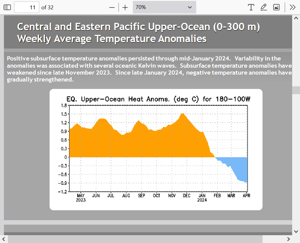
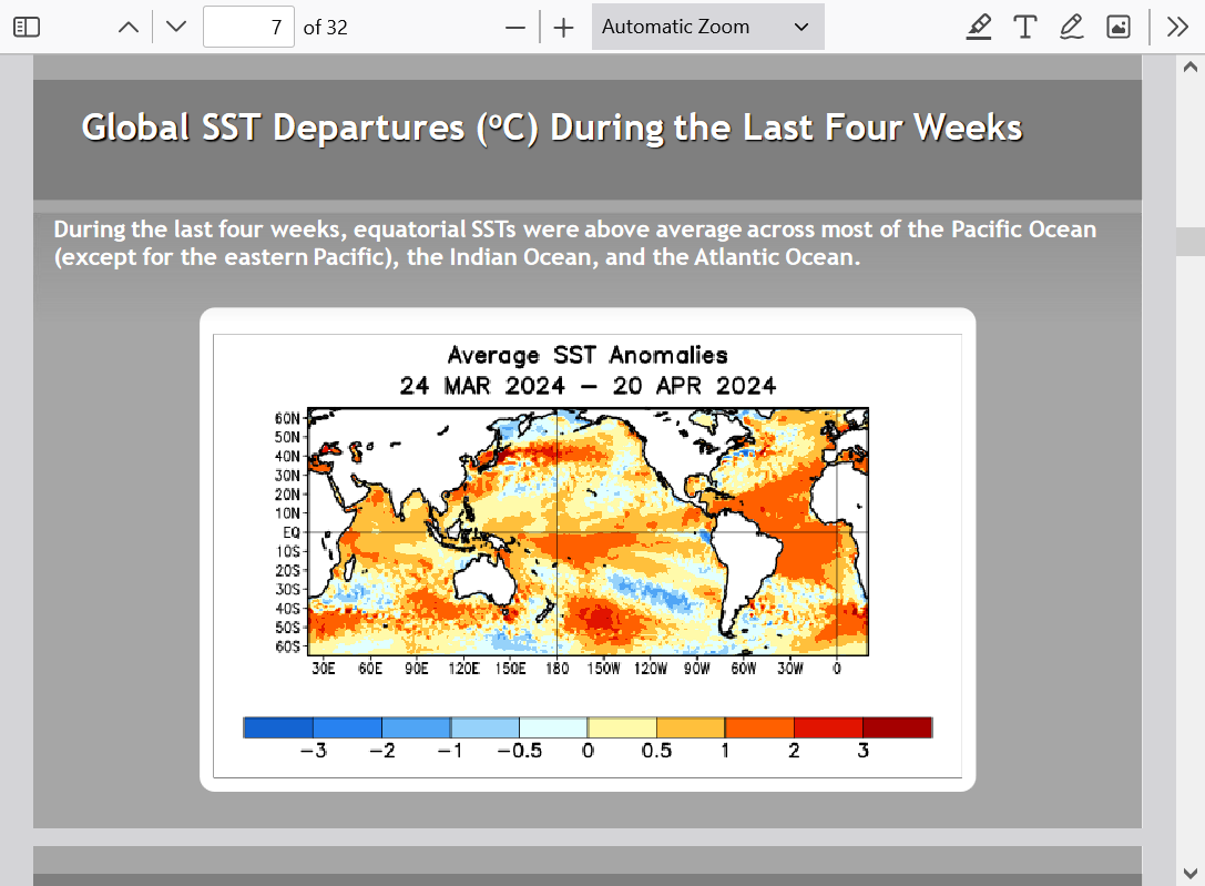
Nino region 1+2, farthest to the east, is the first to shift to cooler temp anomalies from cooler sub surface water rising to the surface there first. 
We can see the tiny area of cooler blue, just off the coast of South America, along and just south of the equator. Off the coast Ecuador.

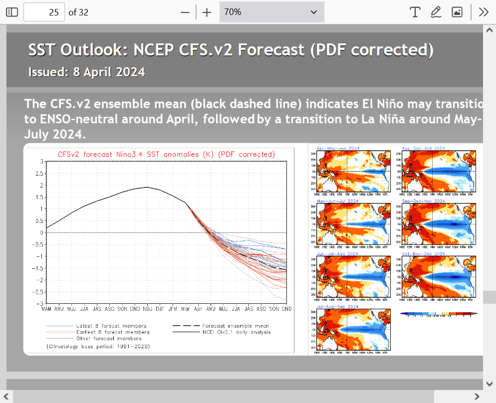
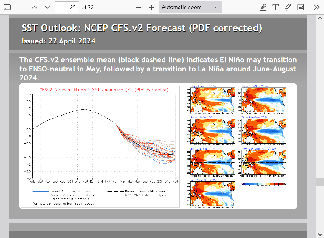
The subsurface water profile ensures La Nina coming quickly and robustly:
All the models pass quickly thru neutral to La Nina over the next several months.
Same link as the other data above:
Historically, El Nino's have resulted in better growing weather in the Cornbelt and La Nina's worse weather:
The discussion related to La Nina coming on strong this Summer was here and has not changed:
https://www.marketforum.com/forum/topic/101854/#101858
Here's the latest ENSO discussion. La Nina appears to be coming on fast and strong!
The Eastern, Tropical Pacific is cooling but still some plenty warm waters in the tropical Atlantic below. Watch out hurricane season when combining that with a La Nino(that helps suppress upper level Atlantic wind shear that rips apart hurricanes)
Cooling fast in some places below
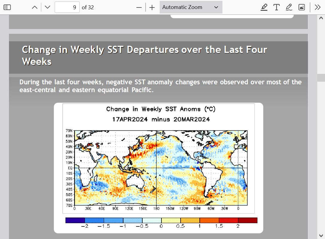
Heat content in the Central/East is plunging very fast.
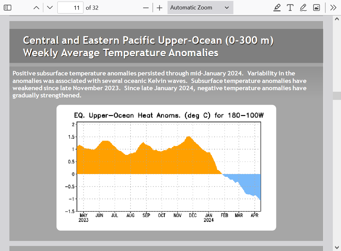
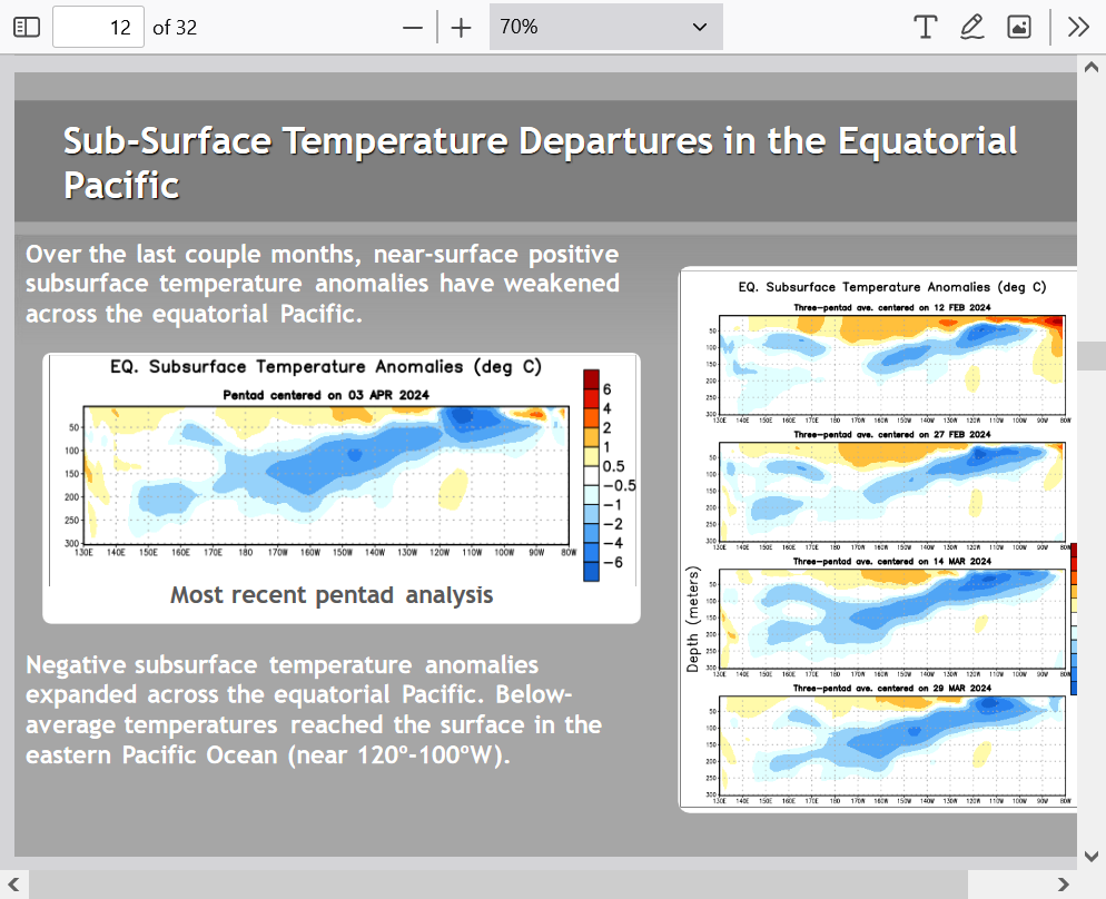
Very impressive sub-surface cool anomalies with this cooler water rising to the surface early in a developing La Nina. 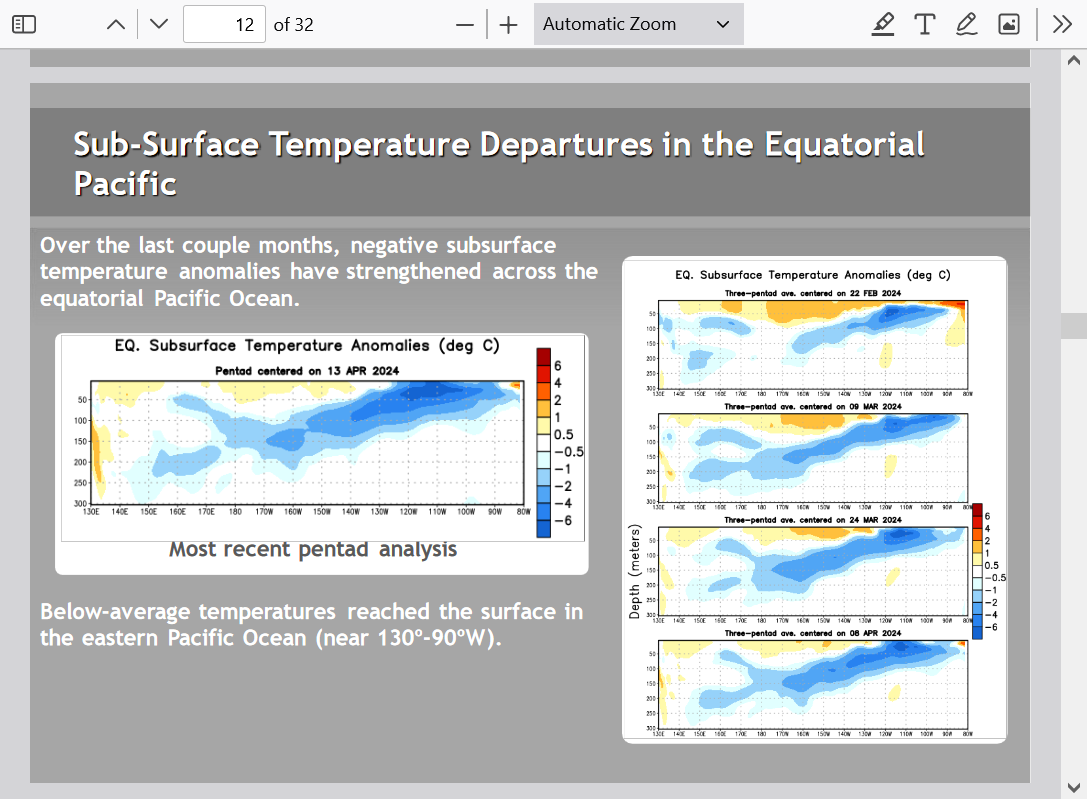
Here's one of the models with the maps to the right. Rapid transition to a La Nina this Summer. Historically, that's not a good thing for our growing season. It can also mean heat and CDDs for natural gas. Also increases chances for more active tropical Atlantic basin activity. El Nino's cause more upper level wind sheer downstream in the Atlantic. This damages the best wind profile needed for ideal hurricane dynamics.
This last ENSO update continues consistent with previous updates and we still expect a rapid transition from the previous El Nino to a La Nina this Summer. Maybe a strong La Nina by later this year.
This increases the odds of an active hurricane season and for hot/dry weather in the Cornbelt this Summer.
Discussion on this Summer's weather:
https://www.marketforum.com/forum/topic/101854/#102658
https://www.marketforum.com/forum/topic/101854/#101858
https://www.marketforum.com/forum/topic/101854/#101859
https://www.marketforum.com/forum/topic/101854/#101860