Weather models
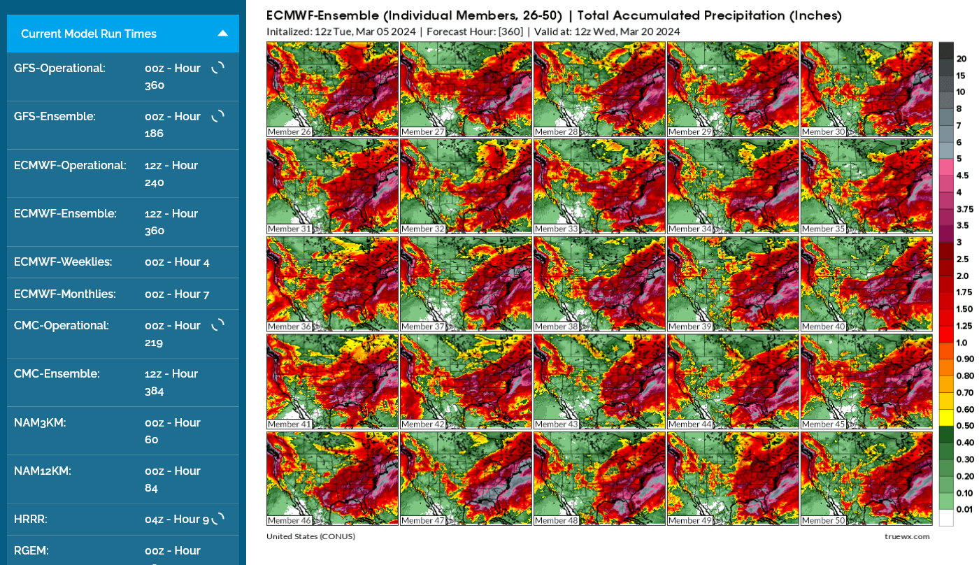
European model ensemble solutions for members 26-50 total rains thru 360 hours
Current Jet Stream
https://mag.ncep.noaa.gov/Image.php
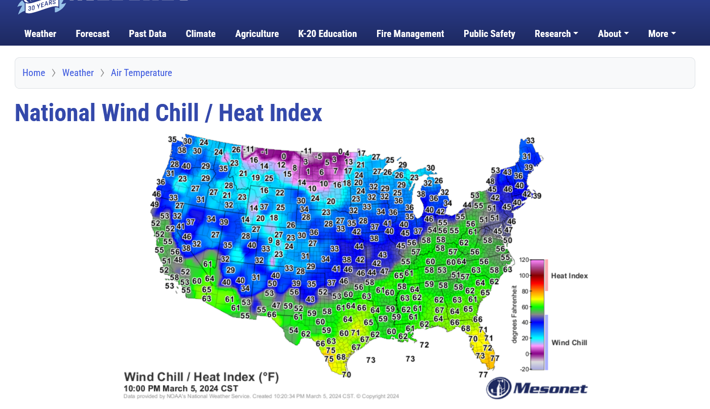
10pm Tuesday Temperatures
++++++++++++++++++++++++++++++++++
WINTER WEATHER
january 10th Jet Stream
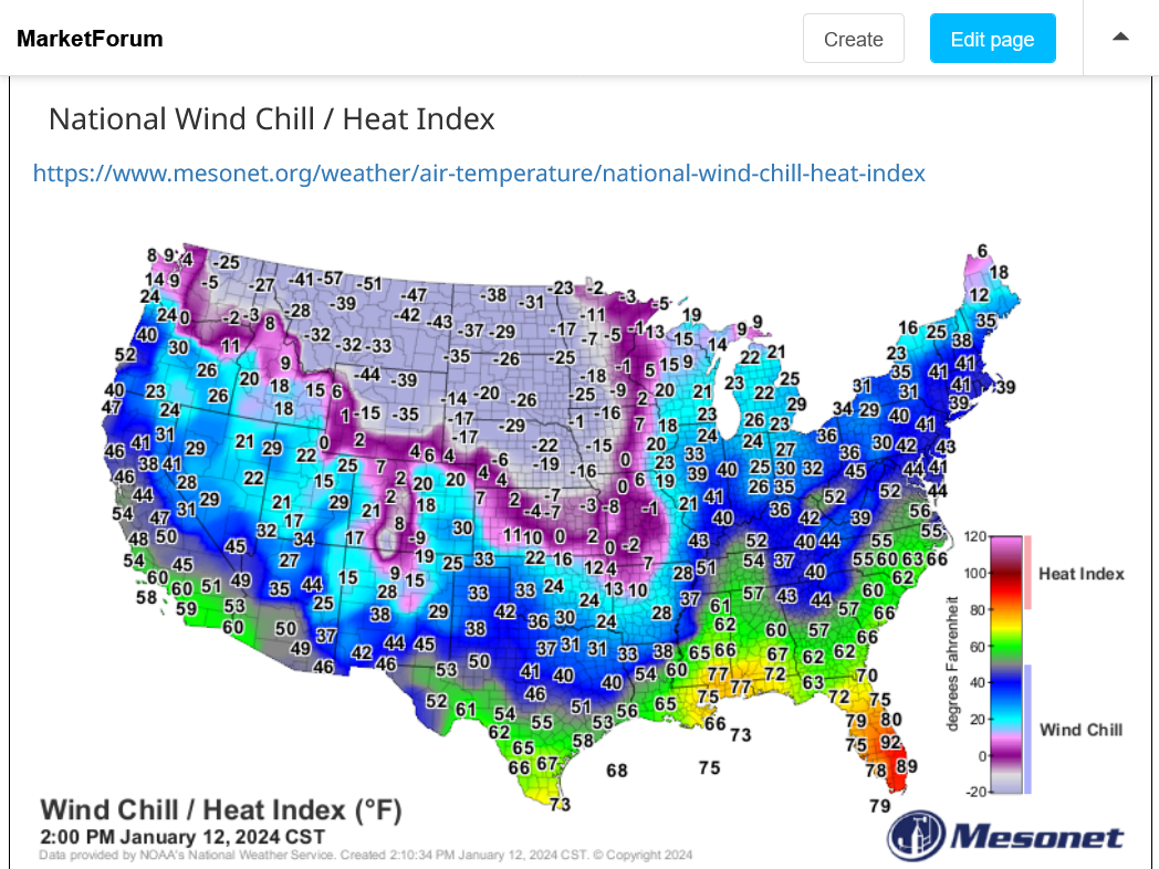
Ahead of the cold front January 12, 2024
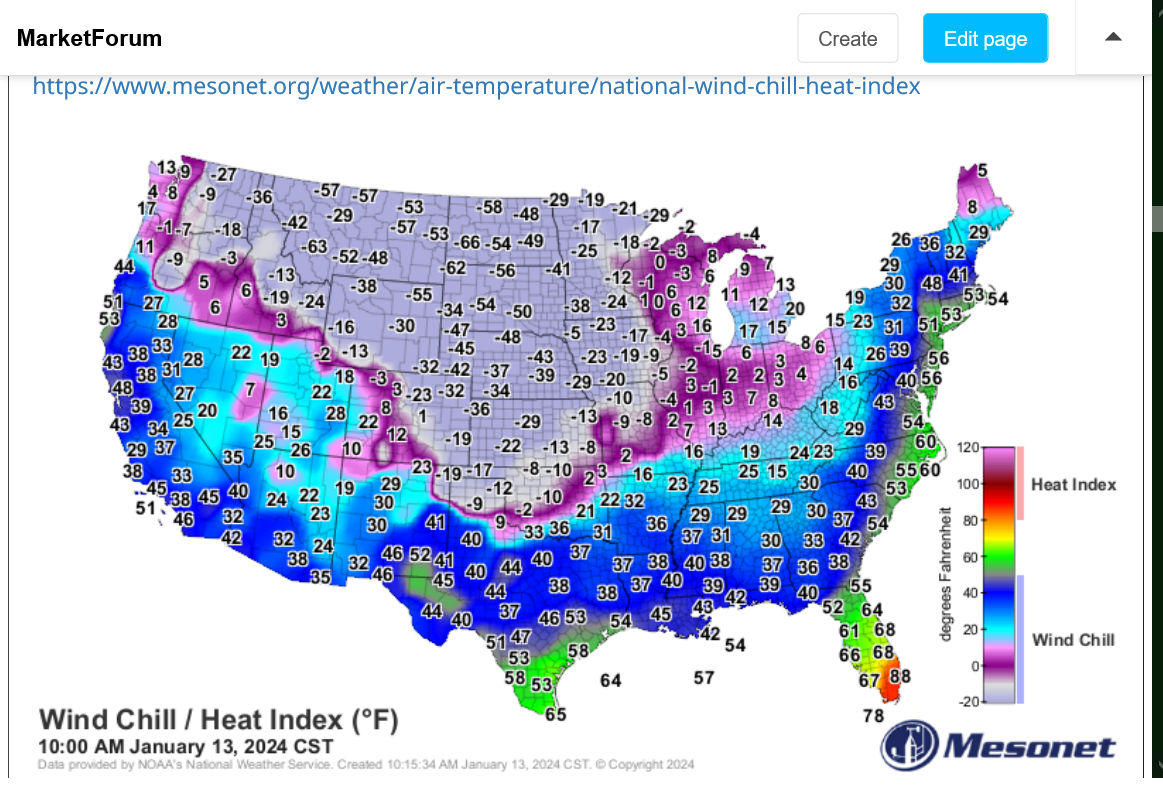
Behind the cold front January 13, 2024
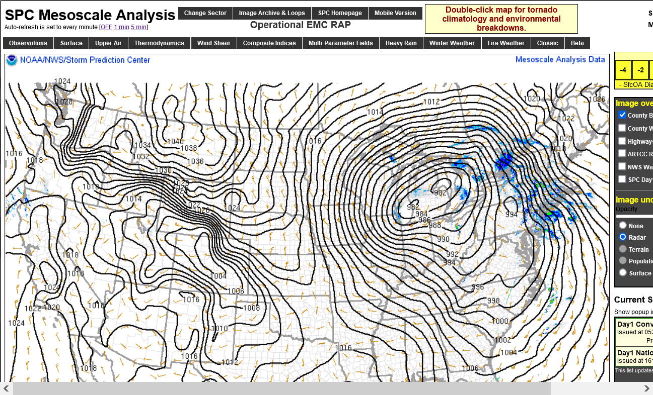
Surface pressure pattern after the cold front passed. January 13, 2024
+++++++++++++++++++++++++++++++++++
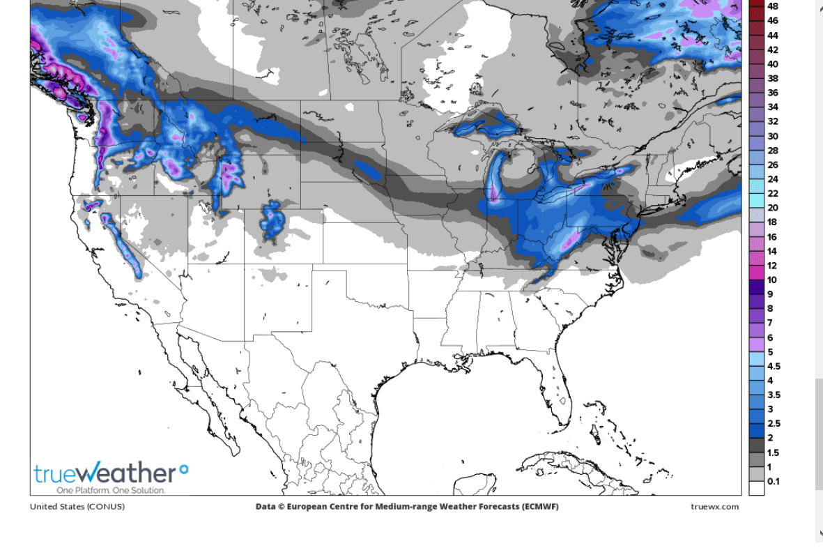
Forecast for January 18/19 snow event that canceled school on Friday January 19, 2024
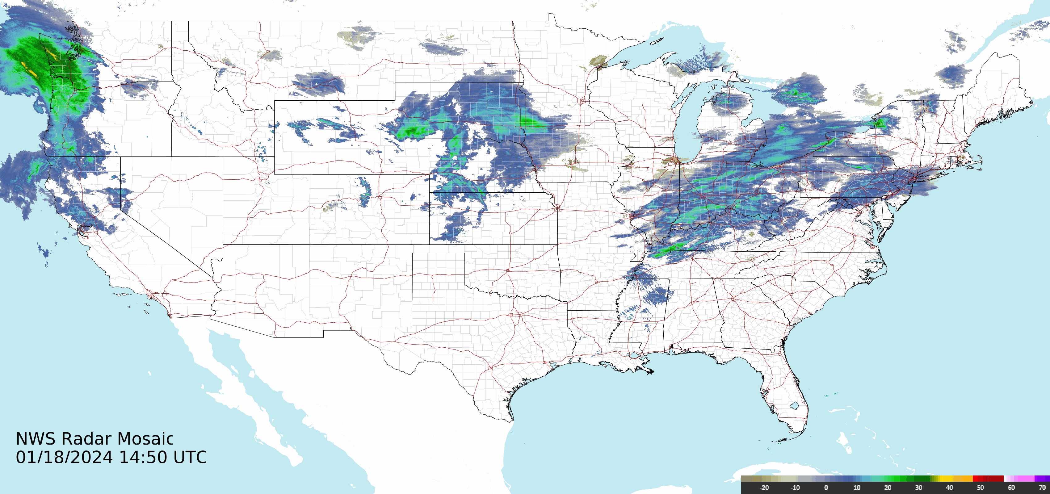
Thursday, January 18, 2024 radar..........snow sublimated on the way down.
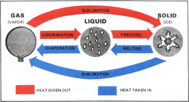
Sublimation is when frozen water/snow converts directly to a gas/vapor, bypassing the liquid state.
It happens only when the temperature is BELOW FREEZING and is greatest when the air is VERY DRY.
CHANGE OF STATE
https://www.aviationweather.ws/027_Change_of_State.php
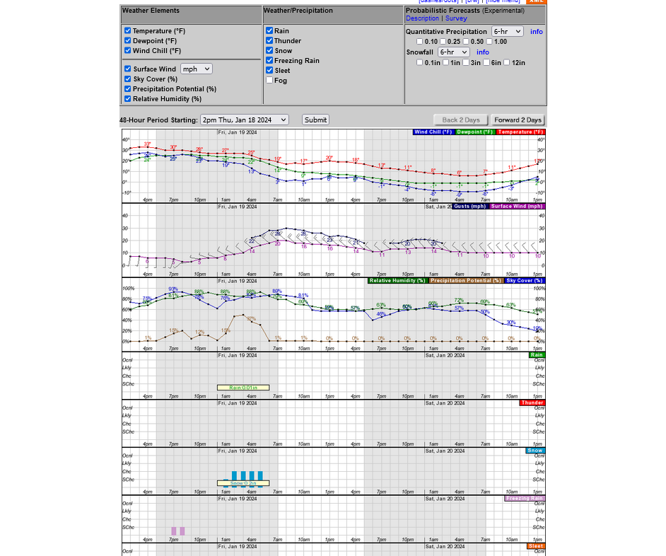
Forecast for Friday January 19, 2024 No snow in Evansville????
++++++++++++
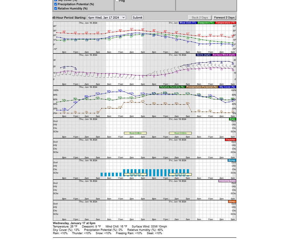
The weather graph for Evansville below for late Thursday/Friday. Not much snow. STRONG WINDS!
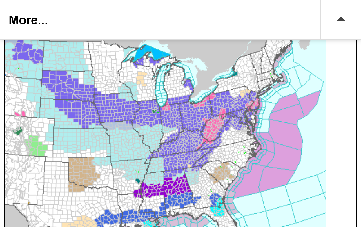
Late January 18/early January 19 Winter watches/warnings
3:24 to 3:42 am images below with heavier snow band about to hit.
Very early Friday Morning 1-19-24. A band of snow dumps 1 inch quickly-with strong winds and no school!

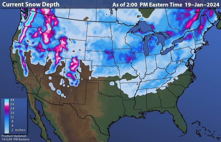
National Snow January 19, 2024
4 stories from the worst snow storms in Evansville history | Webb
1917/18 Winter
that winter dumped 67 inches of snow on Evansville – 41 in January alone.
Lots of stories about this blizzard in January.
24 inches of snow buried Evansville just before Christmas that year.
I measured 24 inches from 2 different waves, spaced around 12 hours apart.
Horrible. Miserable. Hellish.
All those words could describe the 2009 ice storm – as well as a few others my editors won’t let me print.
Five inches of snow fell in late January that year, but that was nothing compared to 1.25 inches of ice that encased power lines and turned the streets into post-apocalyptic hockey rinks.
+++++++++++
I remember going out in the middle of the night towards the end of it and just hearing constant crashing sounds in the distance and every once in awhile close by........tree limbs and other ice loaded structures falling to the ground, breaking from the weight of the ice. It was surreal.
We had it bad but we saw where it was even worse.
Our family went to Florida over Spring Break that year in March. Driving south thru much of Kentucky, on both sides of the highway, instead of many thousands of trees, each with dozens of limbs that would normally be starting to bud out and soon be producing leaves for the upcoming growing season, we saw nothing but GIANT TOOTHPICKS as I called them.
The ice was even thicker and heavier in W.Kentucky during that ice storm. It really looked more like what you would expect to see with trees after a violent tornado and continued for dozens of miles along the highway.
Most of the limbs on the majority of the trees had broken off from the weight of the ice during the January ice storm. It really was the saddest drive of my life to see so much destruction, many tens of thousands of completely destroyed trees from 1 extreme weather event and that was just along 1 highway

+++++++++++++++++++++++++++++++++++++++
SEVERE WEATHER!
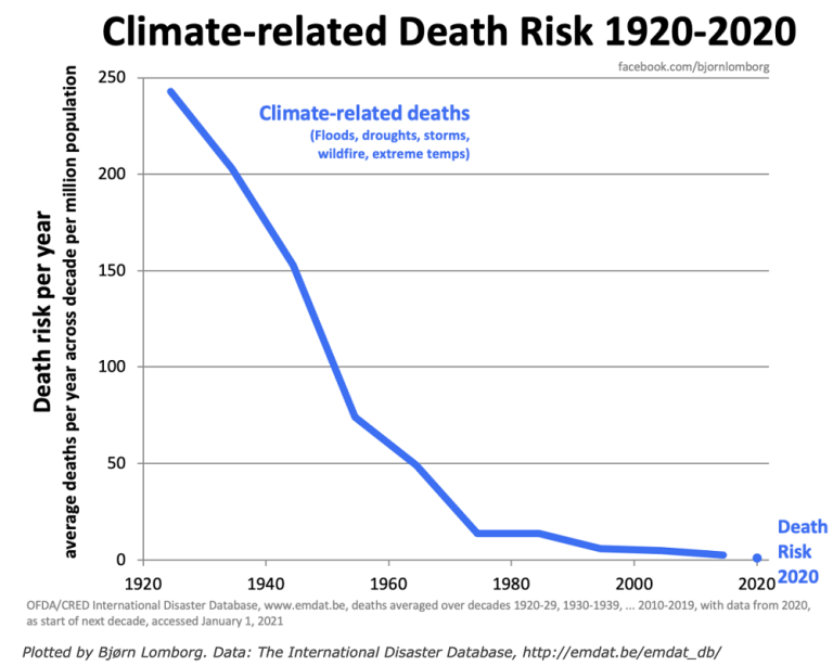
Deaths from extreme weather events plunged because of technology/warnings the last century
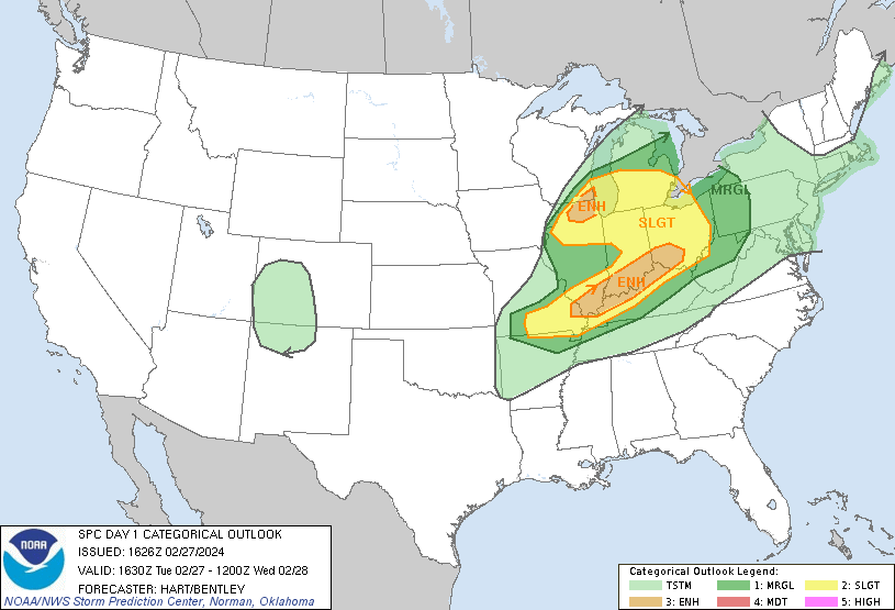
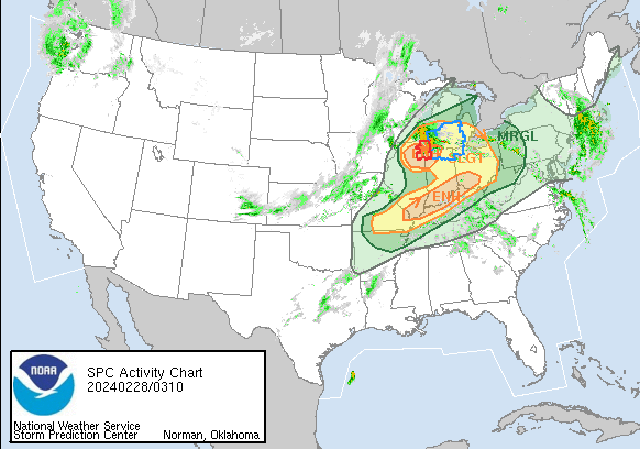
Severe weather threat 1 week ago in Evansville below:
Enhanced risk area late Tuesday into early Wednesday(2-27/2-28). Severe Storm Forecast Center
https://www.spc.noaa.gov/products/outlook/day1otlk.html
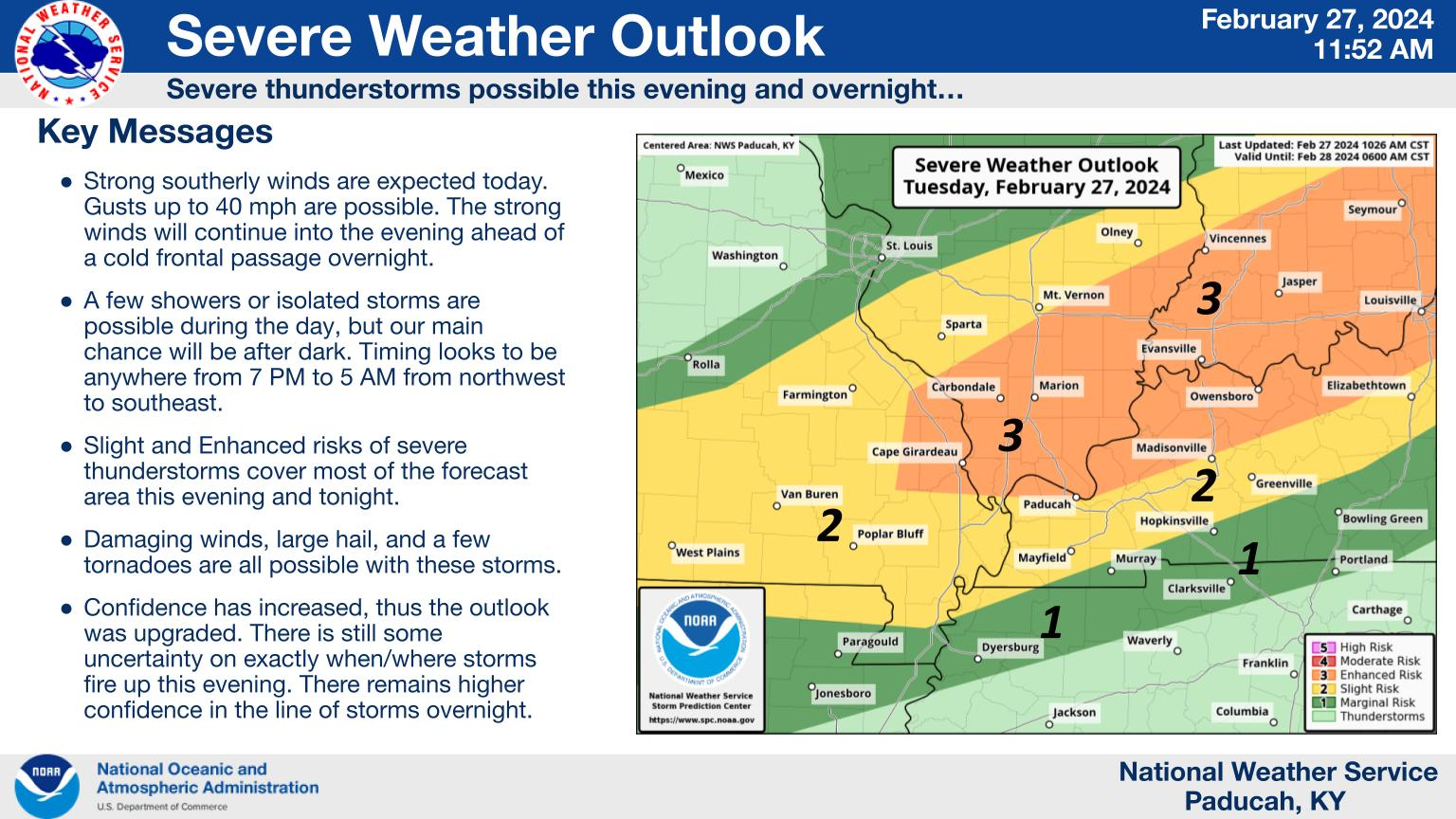
Local NWS from Paducah area of responsibility, including southern Indiana:
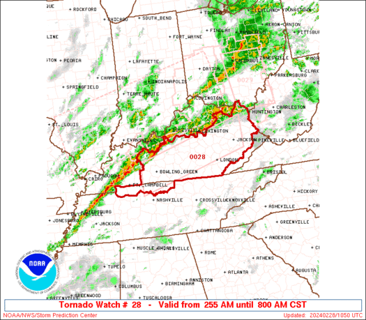
Severe Storm Forecast Center gives us a heads up late Tuesday that a tornado watch is coming in the next 2 hours.
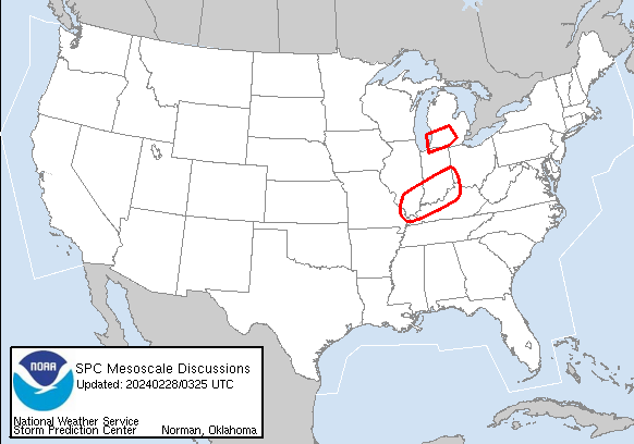
https://www.spc.noaa.gov/products/md/md0167.html
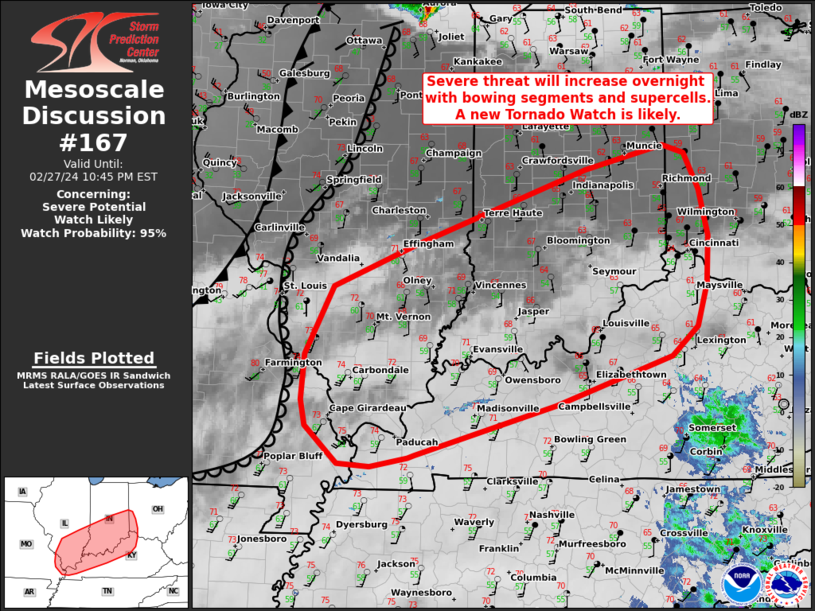
The tornado watch is issued below in the red rectangle, right over enhanced area.
80%+ of tornadoes WILL NOT HURT YOU IN YOUR HOUSE.
The top strongest 5% and especially top 2% are the killers. Those are extraordinarily rare and not likely this time.
https://en.wikipedia.org/wiki/Tornado_intensity
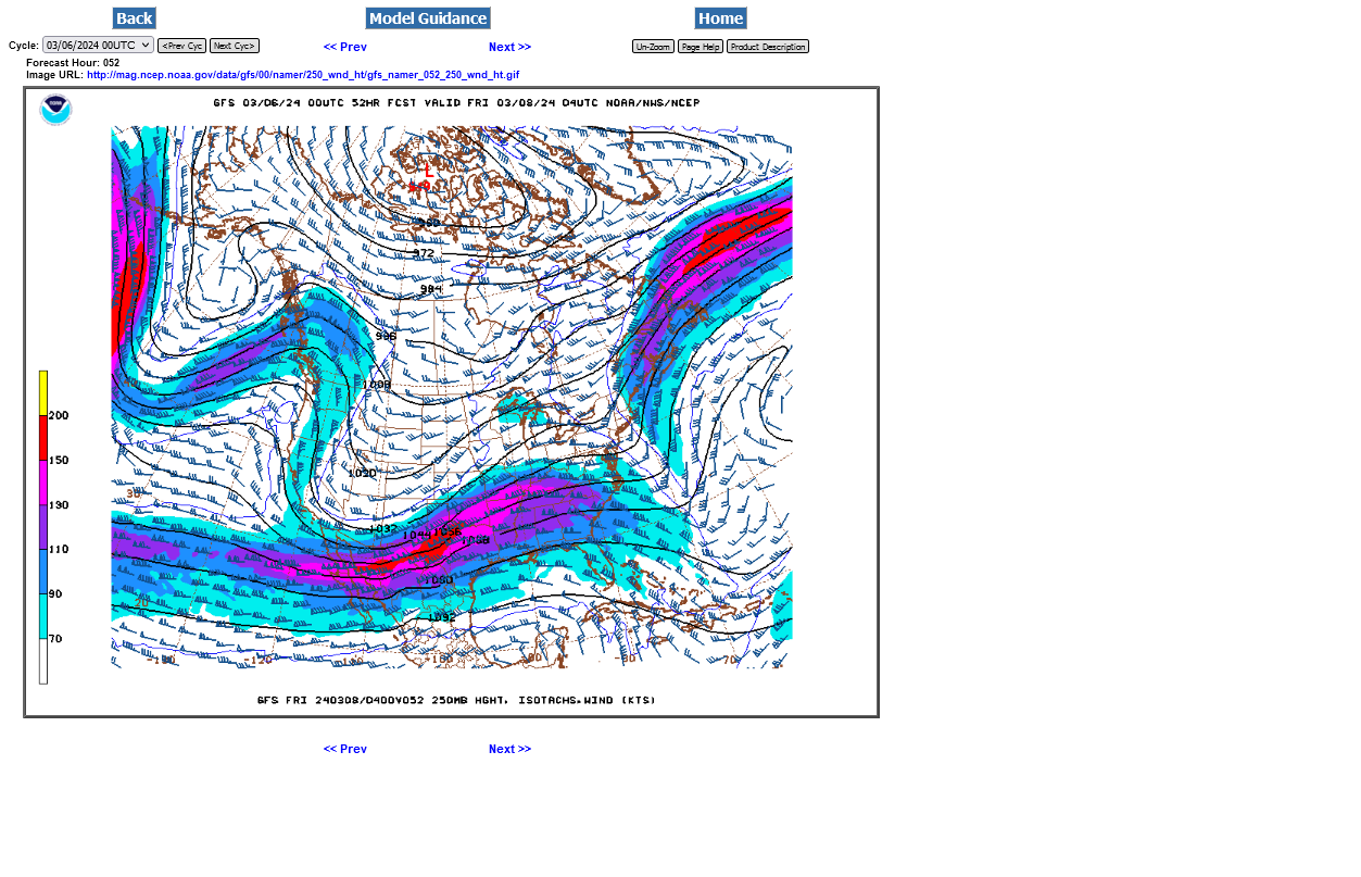
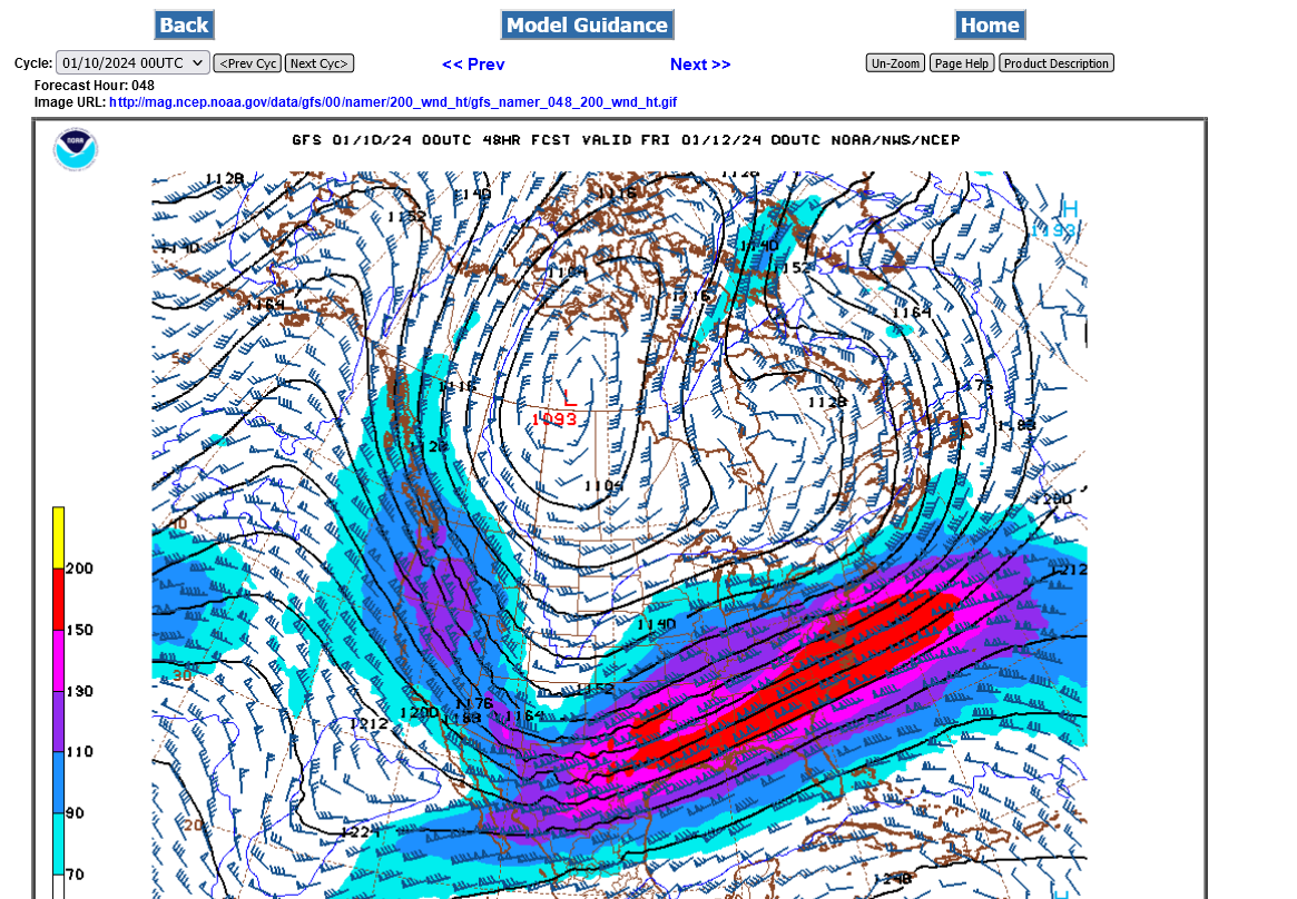
A key element with STRONG and VIOLENT tornadoes is a powerful jet stream.
The sliver of yellow is at the top of the color bar and represents 200 KNOTS/hour at the 250 mb level on the GFS model.
This is around 230+ mph!
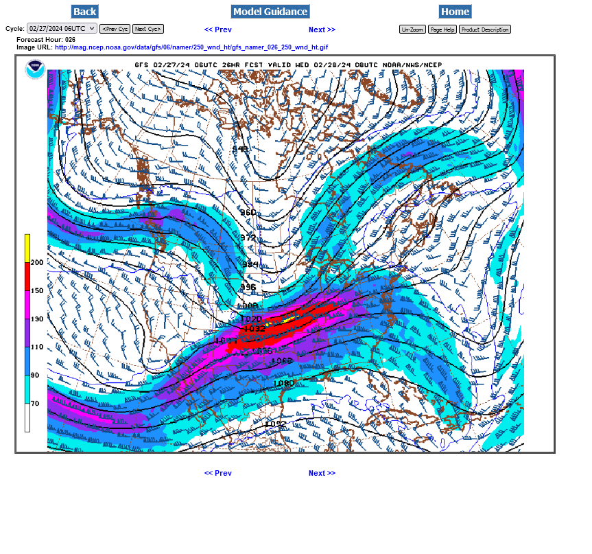
How high up is 250 mb??? Around 34,000 feet, which is around 6.5 miles above the ground.
https://www.boqueteweather.com/millibars_altitude.htm
| Level | Standard Height | |
| 1000 MB | 364 ft | 111 m |
| 925 MB | 2498 ft | 762 m |
| 850 MB | 4781 ft | 1458 m |
| 700 MB | 9882 ft | 3013 m |
| 500 MB | 18289 ft | 5576 m |
| 400 MB | 23574 ft | 7187 m |
| 300 MB | 30065 ft | 9166 m |
| 250 MB | 33999 ft | 10366 m |
| 200 MB | 38662 ft | 11787 m |
| [Boqueteweather.com] | ||
| Copyright © 2007 Boqueteweather.com | ||
++++++++++++++++++
https://www.maximum-inc.com/learning-center/what-is-knot-speed/
++++++++++++++++++
https://www.thoughtco.com/measuring-wind-speed-in-knots-3444011
| Unit of Measure | |
|---|---|
| Surface winds | mph |
| Tornadoes | mph |
| Hurricanes | kts (mph in public forecasts) |
| Station Plots (on weather maps) | kts |
| Marine forecasts | kts |
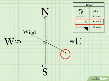
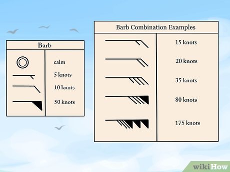
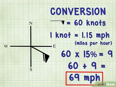
https://www.wikihow.com/Read-Wind-Barbs
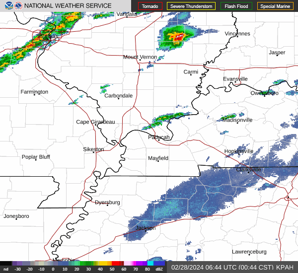
At 1am a potentially dangerous line of storms forms southwest of Evansville.
At 4am that line has expanded to a squall line as it pushes just southeast of Evansville in Kentucky.
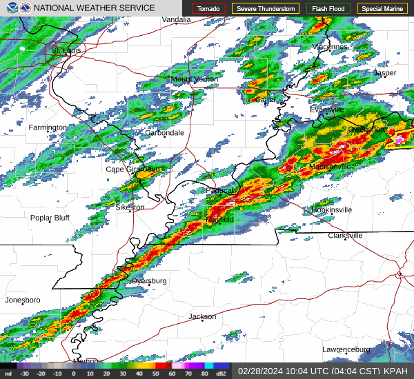
The Severe Storm Forecast Center issues a NEW tornado watch box for KY for people in the path of those storms.
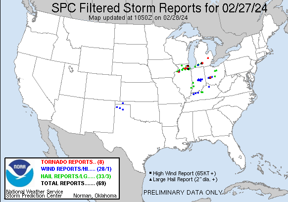
These were the high wind, hail and tornado reports. It's been much worse!
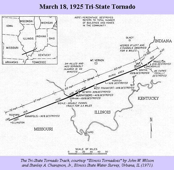
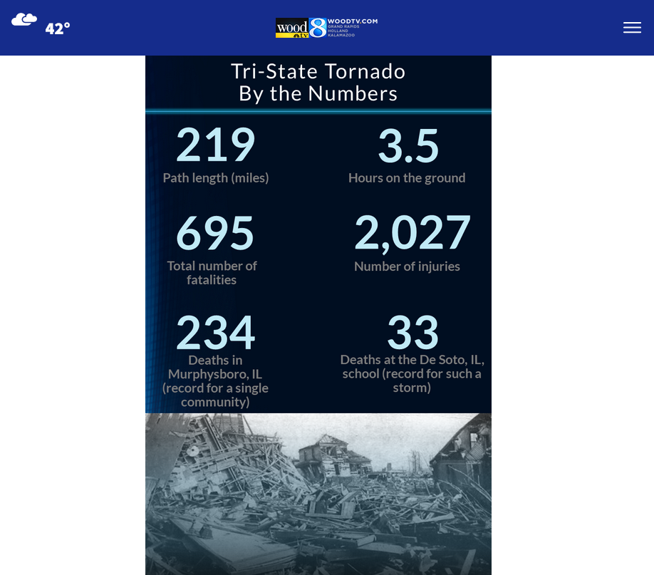
The Great TriState Tornado March 18, 1925
Hurricane Gloria, September 1985