Southern and Eastern Cornbelt drying out(MO/IL/IN/OH) the next week...........though not completely dry everywhere. New rains emerging later this week, still look like they did yesterday but more than they did last week.
Forecast for rains below:
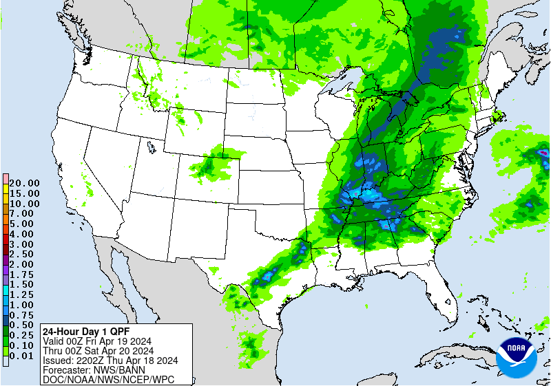
Day 1:
http://www.wpc.ncep.noaa.gov/qpf/fill_94qwbg.gif?1526306199054
 |
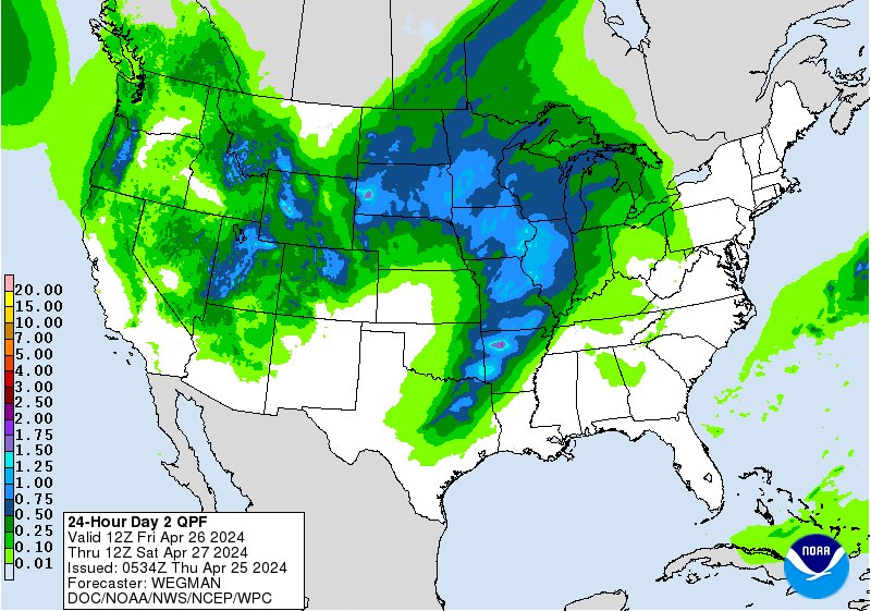
Day 2:
http://www.wpc.ncep.noaa.gov/qpf/fill_98qwbg.gif?1528293750112
 |
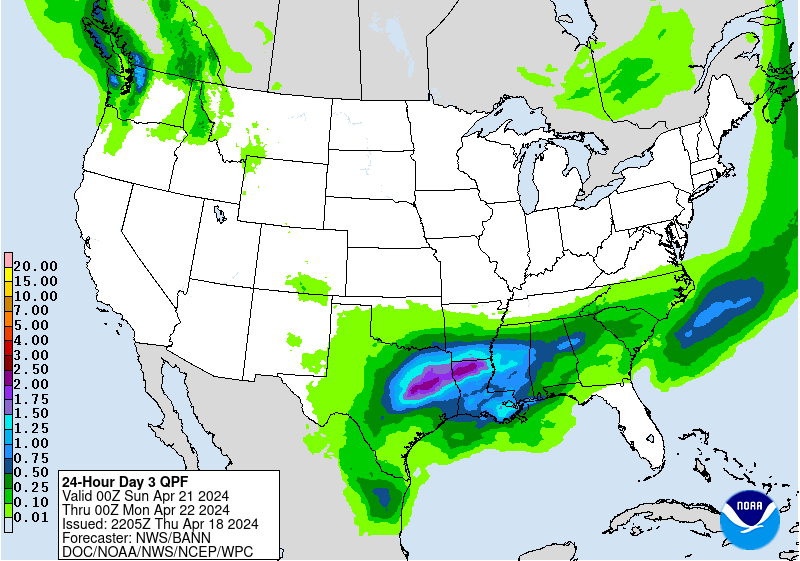
Day 3:
http://www.wpc.ncep.noaa.gov/qpf/fill_99qwbg.gif?1528293842764
 |
Days 4-5:
http://www.wpc.ncep.noaa.gov/qpf/95ep48iwbg_fill.gif?1526306162
Days 6-7:
http://www.wpc.ncep.noaa.gov/qpf/97ep48iwbg_fill.gif?1526306162
Days 4-5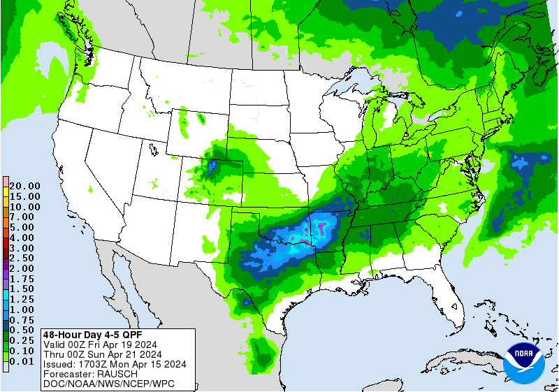 Valid 12z 07/11/18 - 12z 07/13/18 [contours only] | Days 6-7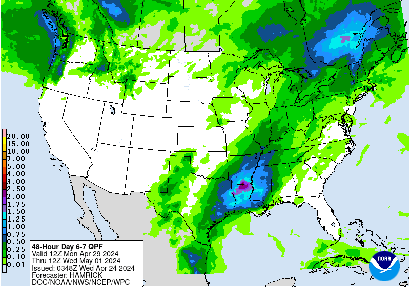 Valid 12z 07/13/18 - 12z 07/15/18 [contours only] |
http://www.wpc.ncep.noaa.govcdx /qpf/p168i.gif?1530796126

Severe Storm Risk. Main jet stream shifted. Press your cursor on the map for full screen.
https://www.spc.noaa.gov/products/outlook/
Current Day 1 Outlook | Forecaster: Hart/Kerr Issued: 18/1240Z Valid: 18/1300Z - 19/1200Z Forecast Risk of Severe Storms: Slight Risk |
Current Day 2 Outlook | Forecaster: Bunting Issued: 18/0600Z Valid: 19/1200Z - 20/1200Z Forecast Risk of Severe Storms: Marginal Risk |
Current Day 3 Outlook | Forecaster: Bunting Issued: 18/0731Z Valid: 20/1200Z - 21/1200Z Forecast Risk of Severe Storms: Marginal Risk |
Current Day 4-8 Outlook |
Not much Excessive Rainfall threat.
Current Day 1 Forecast Valid 12Z 07/05/18 - 12Z 07/06/18 |
Day 1 Threat Area in Text Format
| Day 2 and Day 3 Forecasts |
Current Day 2 Forecast |
High Temperatures today and Tuesday........hottest West.


Dry air, especially Northeast making it comfortable............dew points starting to increase northward to Ohio River Valley.

Heat and high humidity .....feels like temperature!

Highs days 3-7 shows Hot in Midwest.......cooling late Upper Midwest.


How do these temperatures compare to average at this time of year. Above average in the hottest time of year!:
High temperature departures:

Low Temperature Departures:

Rains the past 24 hours. Minnesota!
![]()
You can go to this link to see rain totals from recent time periods:
https://water.weather.gov/precip/
Go to precipitation, then scroll down to pick a time frame. Hit states to get the borders to see locations better. Under products, you can hit "observed" or "Percent of normal"
A significant feature to the forecast this morning is the longer range, week 3 and week 4 forecast that seems to be getting some attention.......MUCH cooler today:

Precip below:

Canadian ensembles back up the heat ridge in week 2 with a deepening trough in the Northeast. This has been a consistent theme for numerous days for this model with fewer and fewer members having the heat ridge farther east.
384h GZ 500 forecast valid on Jul 25, 2018 00 UTC


GFS ensembles almost all have the same thing..dome Southwest to S.Plains....upper level trough Northeast:

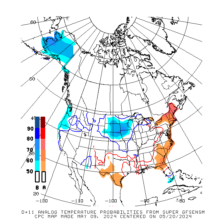
The analog temperature guidance for the 8-14 day period is VERY cool compared to its output from the last month:
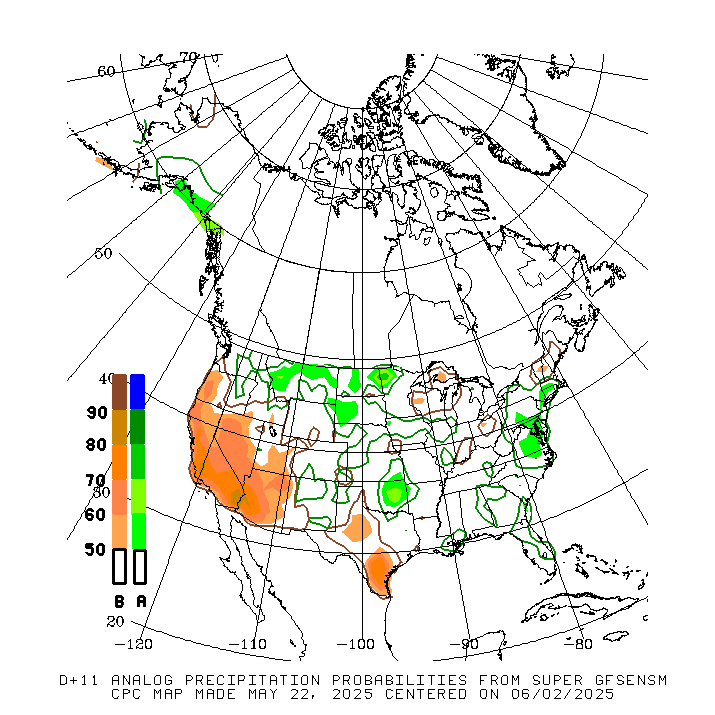
Here is the precip
Last 12Z GFS continuing the trend of the dome backing up...........way up to the Southwest on this run and a very deep/cool upper level trough for the eastern half of the country on this run:
gfs_namer_384_200_wnd_ht | gfs_namer_384_500_vort_ht |
gfs_namer_384_1000_500_thick | gfs_namer_384_850_temp_ht |
I will be on Relevant Radio this afternoon on the Drew Mariani show, from 4:00-4:30pm Central, talking about climate change.
The reason that they want me on is because of this comment from Pope Francis:
Pope warns climate change turning Earth into desert, garbage
https://apnews.com/2dc33645a7e140ffa63e9f5f3b8d2504
And this one:
Al Gore: Pope Francis a ‘moral force’ for solving climate crisis
https://www.vaticannews.va/en/world/news/2018-07/al-gore-pope-francis-climate-crisis.html
You can listen here live:
https://relevantradio.com/wp-content/media/rrplayer.php
I'll try to have the link to the taped/archives late today or tomorrow.
The latest NWS forecast, like the last 2 days now, continues to be the most bearish its been in over 2 weeks...less heat in the Midwest and tons of rain.
Last week and the week before featured hot/dry on ever extended forecast going back for 2 weeks.
Temperature Probability 6-10 day |
Precipitation Probability |
Temperature Probability 8-14 day |
Precipitation Probability |
Extreme weather days 3-7:


![[contours only]](http://www.wpc.ncep.noaa.gov/qpf/95ep48iwbg.gif?1531058516)
![[contours only]](http://www.wpc.ncep.noaa.gov/qpf/97ep48iwbg.gif?1531058516)