A sneak preview of the NWS week 2 forecast. There are numerous guidance products and they all have the same general trend(cooler) I will show a couple here that don't perfectly capture the anamolies of them all put together.
You should assume that the Midwest will be cooler than in recent week 2 forecasts.
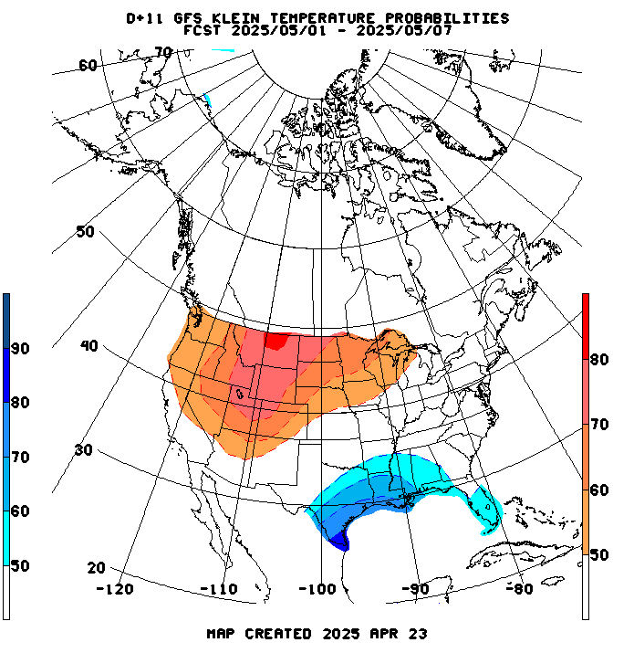
The GFS ensembles are extremely cool......likely too cool, especially using the guidance tool(Klein) below but I will show it so that you can see what represents the extreme end of cool possibilities for week 2:
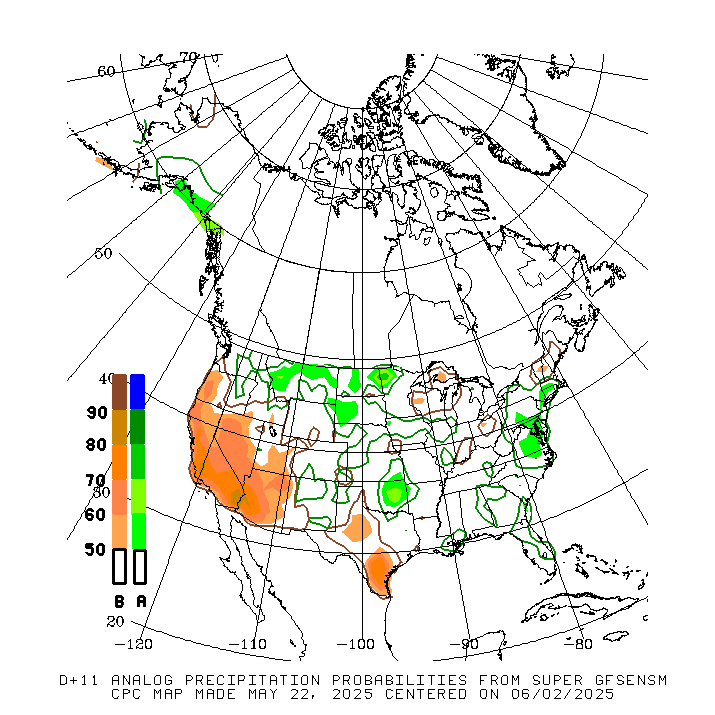
Precip continues to be ABOVE, except in the northern tier that may be dominated by cool and dry Canadian high pressure systems:
CFS week 3 and 4 forecast brings the heat ridge back from the S.Plains to the Ohio Valley and the North East.
Also along the West Coast..................and we all know that a week 3-4 forecast can be taken to the bank..........yeah, bankRUPT.
Am wondering if I should continue with weather at this time frame............oh well, it can be entertaining.
Temps below.

Rains dry up under the heat ridge S.Plains to Ohio Valley, ok elsewhere.

And the automated NWS forecast product for Sunday came out much warmer for the week 2 period than what was shown in the guidance above/earlier. The pattern for that period is uncertain enough so that just about anything is possible:
| 8 to 14 Day Outlooks | |
| Valid: June 18 to 24, 2018 Updated: 10 Jun 2018 | |
| Click below for information about how to read 8-14 day outlook maps Temperature Precipitation | |
| Click below for archives of past outlooks (data & graphics), historical analogs to todays forecast, and other formats of the 8-14 day outlooks ArchivesAnalogsLines-Only FormatGIS Data | |
Temperature Probability | |
Precipitation Probability | |
The Canadian model ensembles have anything from a deep trough to a heat ridge in some of the same places.
My pick?
I don't know.
If you were paying me, that would be the wrong answer.......but my week 2 forecast confidence is extraordinarily low.
324h GZ 500 forecast valid on Jun 24, 2018 00UTC


