Started a new thread updated with todays weather and mcfarms post this morning vs last nights old title.
By mcfarm - May 9, 2018, 9:36 a.m.
just got some comments from growers up the that wet area. Many in northern Iowa, S South Dakota, and S Minn. have not planted an acre. They got hammered again last nite and more on the way. Just west of there growers cannot buy a rain. This is huge corn area that usually grows very big yields. Meanwhile down in S central Illinois one grower reports corn is up with outstanding start to his year
Thanks mcfarm,
Has been a year of extremes for planting but that is not completely unusual.
Glad that the ECB did not get picked on again this year.
I remember your frustration last year, well into June when it stayed wet in many places of IN and there was a rain magnet over your area.
Last nights weather system hitting the wettest areas, now pushing east, across Lake Michigan and extending well south into #2 corn producer IL...........where much of the corn is planted.
Severe Storm Forecast Center has a risk of severe weather with some of these storms.
As the front stalls and energy feeds in from the west, with the next system, the risk of severe storms will shift back west tomorrow and Friday.
http://www.spc.noaa.gov/products/outlook/

Current Day 2 Outlook | Forecaster: Broyles Issued: 09/0556Z Valid: 10/1200Z - 11/1200Z |
Current Day 3 Outlook | Forecaster: Broyles Issued: 09/0729Z Valid: 11/1200Z - 12/1200Z |
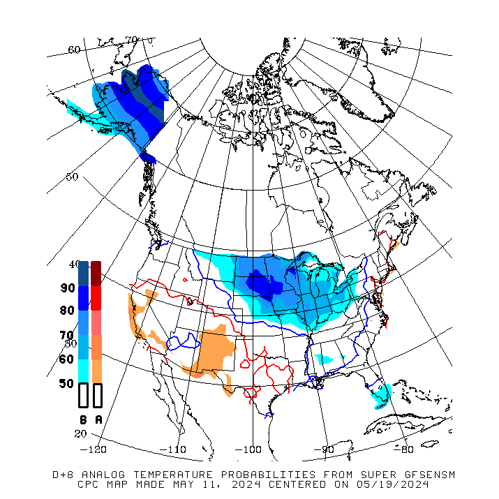
Based on the NWS guidance for making extended forecasts, I think they will be wet with high confidence and warm again this afternoon.........but the warm will be more to the east and Plains will be cooling off.
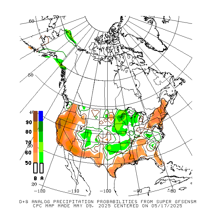
Part of the previous post was cut off by the graphic. My confidence in the extended forecasts being wet is HIGH.
Confidence in heat in the Southeast is high also(with the heat ridge pumping in moisture for all the rains to the west), with cooling coming in from the west, working east.
One can make a case for the Plains and even the far Upper Midwest to be morphing into the cooler than average temperature category by late in week 2.
The latest GFS is still pretty wet in most places like before but has the heaviest rains in the southeast belt.........where planting has already made decent progress.
Less rain in the Upper Midwest that is way behind right now but still too much rain(though it does have a week+ period with no rain there)
Keep in mind that this is just 1 operational model run for accumulated rains for the next 16 days and the next one will look different:

Some recent runs of the GFS have been trying to develop a strong tropical storm to hurricane in the Gulf beyond 10 days. That would be crazy this early in the season.
Day 12 of the just out 18z GFS:
gfs_namer_288_200_wnd_ht | gfs_namer_288_500_vort_ht |
gfs_namer_288_1000_500_thick | gfs_namer_288_850_temp_ht |
Still shows a lot of rain coming the next 2 weeks. The light pinks are 6 inches. ........the model to model, run to run changes in the amounts and placement widely vary.
Good thing you are way ahead on your planting this year mcfarm.
