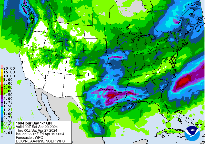
Rain will define the weather pattern this week from the N/C Plains, across the Midwest.
http://www.wpc.ncep.noaa.gov/qpf/day3.shtml
Several weather systems will bring rounds of showers and a few t-storms.
The first one hits the N.Plains Tuesday and pushes southeast across the Midwest Wed/Thu.
A bigger system follows that with heavier rains late in the week. Things get interesting then. A building upper level ridge in the Southeast will really start pumping in moisture and cause the front from the first system to stall and come back as a warm front.
Perturbations in the jet stream tracking from the Pacific into the Plains/Midwest will trigger waves of thunderstorms. Because of the heat ridge building in the southeast, the environment will become favorable for heavy rains and thunderstorm clusters to repeat in some of the same areas that see earlier rains.
This will occur close to the nearly stationary front which will be located around northern MO/southern IA but might shift farther north or south from that position...............too far out to know.
Number 1 corn producer Iowa is likely to get the most rain this week, with widespread totals close to 2 inches possible.
http://www.wpc.ncep.noaa.gov/qpf/p168i.gif?1525657881
This will slow planting down, especially in the northern and northeastern parts of IA.
Here very early Monday, the patternis looking more progressive which will limit rain totals vs Sunday's models and forecast.