
It's January 6th....... Just another day? Do something special for somebody today. Seriously, don't just think about it for a moment......do it now.
Scroll down and enjoy the latest comprehensive weather to the max. Mild weather pattern continues for a bit longer....then cooling down, especially Northeast.
Here are the latest hazards across the country.
Purple/Pink/blue on land is cold/Winter weather. Brown is wind, Green is flooding. Gray is fog. Reddish is a red flag advisory.
Go to the link below, then hit the location/county on the map for details.
https://www.spc.noaa.gov/ Go to "hazards"

Winter Weather
https://www.wpc.ncep.noaa.gov/wwd/winter_wx.shtml
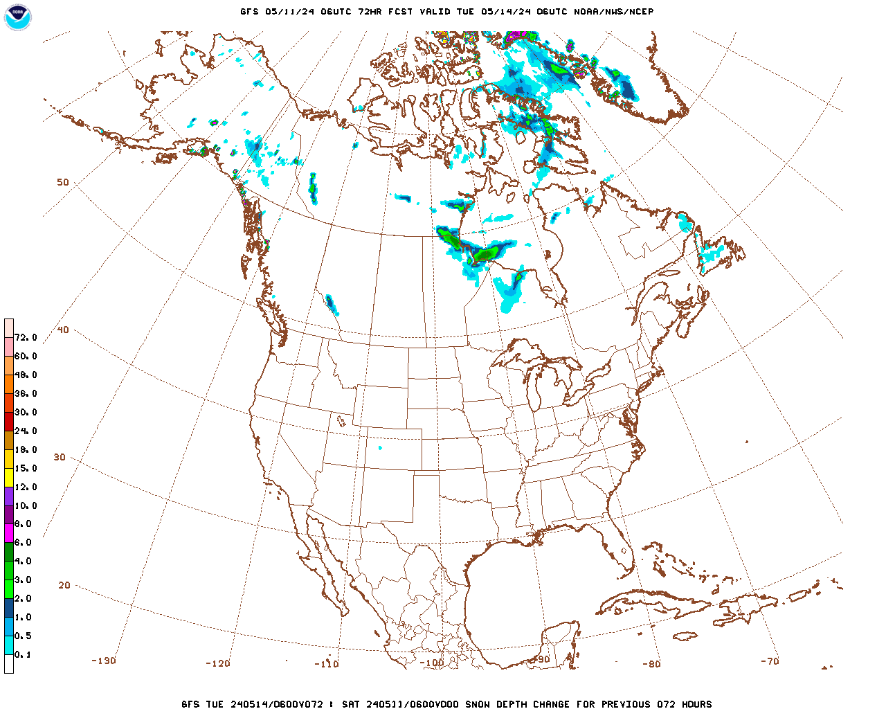
Snowfall the next 3 days:
| Low Temperatures Tomorrow Morning |

High Temperatures today and tomorrow.
Extraordinarlity MILD for this time of year-early January.


Highs for days 3-7:
Turning colder, especially northern tier but not too bad by January standards.


How do these days 3-7 temperatures compare to average at this time of year?
Above to much above average reds shift westward, cold blues expand east.
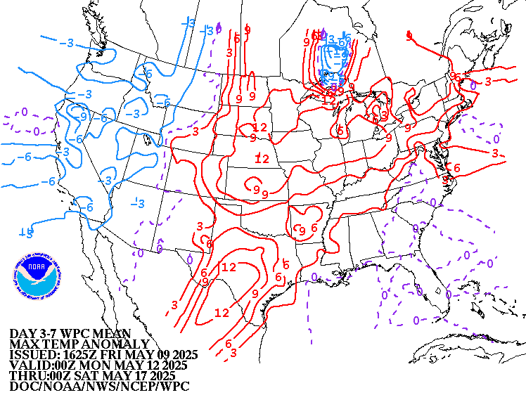

Weather maps for days 3-7 below:
Mild Pacific origin air early this week gives way to colder Canadian air with reinforcements.
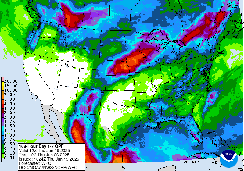
The latest liquid equivalent precip forecasts for this week are below.
West Coast gets bombed.
Day 1 below:
http://www.wpc.ncep.noaa.gov/qpf/fill_94qwbg.gif?1526306199054

Day 2 below:
http://www.wpc.ncep.noaa.gov/qpf/fill_98qwbg.gif?1528293750112

Day 3 below
http://www.wpc.ncep.noaa.gov/qpf/fill_99qwbg.gif?1528293842764

Days 4-5 below:
http://www.wpc.ncep.noaa.gov/qpf/95ep48iwbg_fill.gif?1526306162

Days 6-7 below:
http://www.wpc.ncep.noaa.gov/qpf/97ep48iwbg_fill.gif?1526306162

7 Day Total precipitation below:
http://www.wpc.ncep.noaa.govcdx /qpf/p168i.gif?1530796126
Current Dew Points
A little moisture in the South.

Latest radar loop
http://www.nws.noaa.gov/radar_tab.php

| Full resolution version loop (3400x1700 pixels - 2.2mb) |

Go to: Most Recent Image
Precipitation the past 24 hours
![]()
You can go to this link to see precipitation totals from recent time periods:
https://water.weather.gov/precip/
Go to precipitation, then scroll down to pick a time frame. Hit states to get the borders to see locations better. Under products, you can hit "observed" or "Percent of normal"
+++++++++++++++++++++++++++++++++++++++++++++++
Soil moisture anomaly:
Still wet on this particular metric in an enormous area.

+++++++++++++++++++++++++++++++++++++
Precipitation compared to average for the last 7, 14, 30 and 60 days.
Usually not updated for previous day until late the next day.
https://www.atmos.illinois.edu/~snodgrss/Ag_Wx.html


The top map is the Canadian ensemble average, the maps below are the individual members that make up the average
End of week 2....................12Z ensembles from SUNDAY:
Analysis:
Friday: Pretty cold Midwest/East but not as cold as the previous run. Ridge West/Trough East couplet. Several members allow the polar vortex to shift far enough south for frigid air to settle in.
Very uncertain..........the European ensembles are not this cold and the Canadian ensembles have been too cold for the last month.
Saturday/Today: Similar to yesterday but not quite as cold or as much cross polar flow.
Sunday: MUCH milder than previous solutions. Mild members now outnumber cold ones. Still great uncertainty as week 2 progresses. Enough cross polar flow and bitter cold lurking just north of the US border so that any cold fronts with a decent southward push could be quite potent.
++++++++++++++++++++++++++++++++++++++++++++++++++++++++++++++
Each member is like the parent, Canadian model operational model.......with a slight tweek/variation in parameters. Since we know the equations to represent the physics of the atmosphere in the models are not perfect, its useful to vary some of the equations that are uncertain(can make a difference) to see if it effects the outcome and how.
The average of all these variations(ensembles) often yields a better tool for forecasting. It's always more consistent. The individual operational model, like each individual ensemble member can vary greatly from run to run.........and represent an extreme end of the spectrum at times. The ensemble average of all the members, because it averages the extremes.............from opposite ends of the spectrum.........changes much less from run to run.
384h GZ 500 forecast valid on Jan 22, 2019 12 UTC
0Z GFS Ensembles at 2 weeks:
Friday: Huge disparity between cold and mild, wet/snow and dry.
Best agreement is for above precip in the East.
Saturday: Cold focused on the Northeast. Still the Ridge west, trough Northeast couplet.
Sunday: Coldest of the models(European ensemble was pretty mild). Ridge West, trough East extends pretty far north, to the higher latitudes. This will bring frigid air south across Canada. The most likely point of deep penetration into the US, will be in the Northeast.

Latest, updated graph/forecast for AO and NAO here, including an explanation of how to interpret them.
Previous analysis, with the latest day at the bottom:
Friday: AO is negative with some members very negative.....huge disparity/uncertainty. This favors frigid air moving from high latitudes to mid latitudes. NAO and PNA are close to zero.
Saturday: AO strongly negative as week 2 goes on, favors cold. NAO leaning slightly negative, PNA slightly positive favor cold in the Northeast(Midwest)
Sunday: AO still negative and changeable/uncertain but without the extreme negative solutions of previous days......still favors cold delivery south from high latitudes. NAO around zero and PNA slightly positive. Tipping odds for cold in the Northeast.
The link below, now has the PNA index added at the bottom:
National Weather Service 6-10 day, 8-14 day outlooks.
Warmer than Friday, especially in the north/center of the country.
Temperature Probability | |
Precipitation Probability | |
| the 8-14 day outlooks ArchivesAnalogsLines-Only FormatGIS Data | |
Temperature Probability | |
 | |
Previous Posts
By metmike - Jan. 4, 2019, 1:06 p.m.
The new European model 30 day outlook came out yesterday.(its updated on Mon and Thu, late afternoons).
Still has some major cold hitting in several waves later this month into early February. It's had this solution for a couple of weeks now and the forecast has busted.
Maps below start on January 16th and continue every 24 hours thru Feb. 3rd.
++++++++++++++++++++++++++++++++++++++++
By WxFollower - Jan. 4, 2019, 8:27 p.m.
Mike,
Welcome back! Did you happen to notice how much the US has cooled on the GFS for the period 1/9-15 just since yesterday’s 12Z run? It has been impressive and likely a big reason NG got stronger through the day despite the quite bearish EIA. Check this out as this is a relative rarity:
12Z Thu run: 137 HDD -41 vs norm
0Z Fri run: 144
6Z Fri 165
12z fri 173
18Z Fri 180 +2 vs norm
I should add that the GFS is warm biased. But it isn’t the warm bias being negated as the big story. All of the models have been getting significantly colder for this period since yesterday.
Why do I think this is happening? My guess is the combo of a consensus projected weak MJO phase 8 starting 1/9 (including going into the under 1.0 amp phase 8 favorable for cold (inside circle) through 1/15) and a -2 AO predicted by GEFS.
The cooling adjustments look like they may not be nearly complete. Let’s see if this period keeps getting even colder in future GFS runs. Come Sun night, this period could even be much colder on the 18Z GFS than it is on today’s 18Z.
Thanks Larry,
Looks like the models have reversed back to MUCH warmer during the first half of the week 2 period vs Friday. The GFS/ensembles still like the idea of cold in the Northeast after that(very unreliable period) but the European model ensembles keep it mild.
Canadian ensembles are not nearly as cold either.
Natural gas lower tonight.
Agree on NG lower opening.
Mike and I were correct. NG opened down and sharply at that. No money on it for me though as I’ve been in my usual flat position.